

Eastern Pacific alive with activity as 2 growing threats build behind weakening Tropical Depression Amanda
Invest 91E was designated on Friday, and another area to watch lingers behind it. These systems could become tropical depressions by weekend's end.
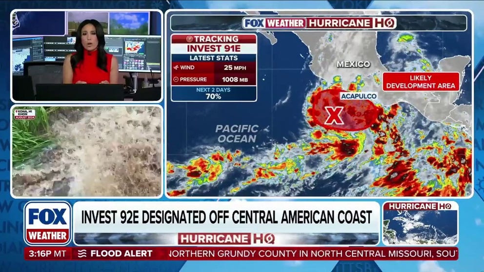
Eastern Pacific Heating Up: Multiple Tropical Threats Brewing
The Eastern Pacific is wasting no time as hurricane season gets underway. With Tropical Depression Amanda weakening over the open ocean and multiple disturbances showing signs of development near Mexico and Central America, forecasters are closely monitoring a basin that could see additional tropical cyclones form in the coming days. FOX Weather Meteorologist Marissa Torres breaks down the latest forecast data, development odds and what the early burst of activity could signal for the rest of the season.
The Eastern Pacific is already busy with tropical activity less than a month into hurricane season, as the National Hurricane Center continues monitoring two areas to watch hot on the heels of the first named storm of the season.
While Amanda has weakened to a tropical depression, the Eastern Pacific isn't slowing down. Forecasters are tracking two additional areas of interest that could become the basin's next tropical cyclones.
Tropical Depression Amanda is moving west at 5 mph with winds at 35 mph and is forecast to continue to gradually weaken into a remnant low by Sunday, according to the National Hurricane Center (NHC).
WHAT'S THE DIFFERENCE BETWEEN A TROPICAL DEPRESSION, TROPICAL STORM, AND HURRICANE?
A tropical storm is a tropical cyclone that has maximum sustained winds between 39 and 73 mph.

(FOX Weather)
Amanda is forecast to have no direct impacts on land and remain out at sea.
HOW ARE HURRICANES RATED? THE SAFFIR-SIMPSON HURRICANE WIND SCALE EXPLAINED
On Friday, the National Hurricane Center designated Invest 91E near Acapulco, Mexico.
The NHC has given this system a high chance of development over the next week.

(FOX Weather)
This system is likely to become a tropical depression late into the weekend or early into next week.
For now, the NHC said it's likely to move northward near the coast of Mexico.
7 FACTS TO KNOW ABOUT HURRICANES
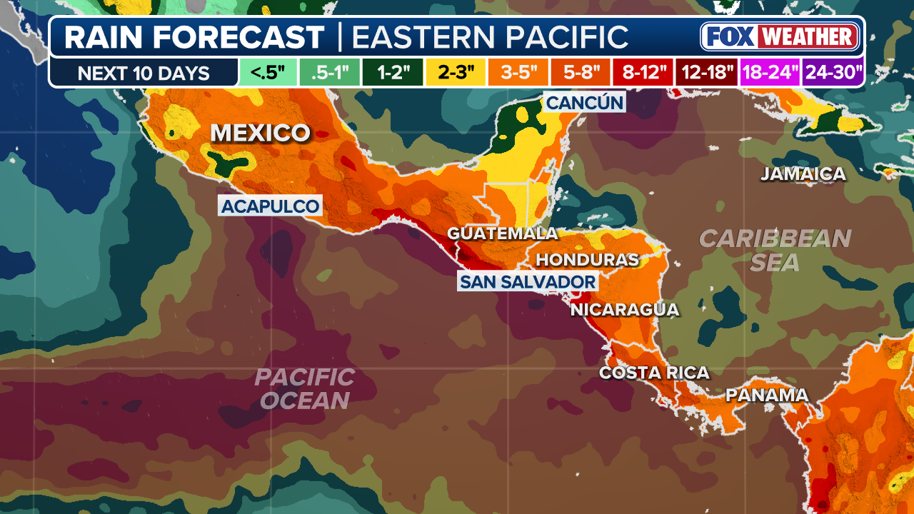
The FOX Forecast Center said Invest 91E could bring significant rain to Mexico if it continues near the coast.
(FOX Weather)
On Saturday, the NHC declared a second area to watch as Invest 92E.
Invest 92E also has high chances of development over the next seven days.

(FOX Weather)
The NHC said if Invest 92E remains offshore, it could become a tropical depression by late weekend or into early next week.
Heavy rainfall is likely across Nicaragua, El Salvador and Guatemala with this system.
Sea surface temperatures near Mexico and farther west into the open Pacific are currently running about 2 to 3 degrees above average — favorable conditions for tropical formation.

(FOX Weather)
These temperatures are consistent with a developing super El Niño climate pattern that is expected to play a dominant role this hurricane season, likely increasing tropical activity in the Eastern Pacific, while simultaneously suppressing tropical development in the Atlantic.
The Eastern Pacific averages around 15 named storms, 8 hurricanes and 4 major hurricanes each season.