Damaging Northwest floods visible from space
The Nooksack River flooded in mid-November after several inches of rain fell in the region, breaking all-time rain records.
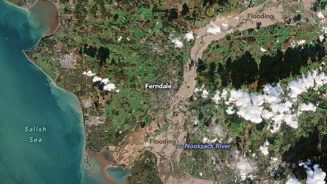
A swollen Nooksack River floods parts of Whatcom County as seen on Nov. 16, 2021.
(European Space Agency’s Copernicus Sentinel-2 via NASA)
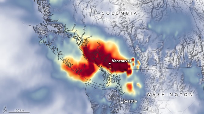
SUMAS, Wash. -- The severe flooding that devastated communities along the British Columbia-Washington border earlier this month was so widespread it was easily spotted by satellite imagery.
The Nooksack River flooded in mid-November after several inches of rain fell in the region, including nearly 7 inches in Hope, B.C. in one day and almost 5 inches of rain in the Bellingham area over two days, breaking all-time rain records.
(NASA)
Surging floodwaters poured into the Washington towns of Sumas, Lynden, Everson, Hamilton and parts of Ferndale. Some 500 people were forced to evacuate in Washington while across the border in Abbotsford, deep floodwaters wiped out roads and railways, essentially cutting Vancouver off from inland areas, NASA said.
Western Washington flood damage 'devastating'
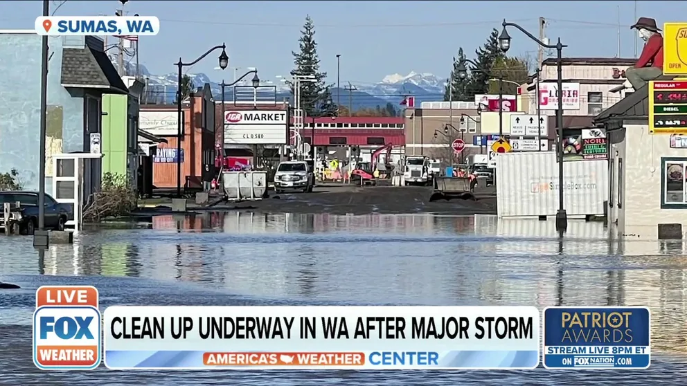
Officials estimate 75 percent of homes in Sumas, Washington have water damage.
Thousands of animals died in the floods despite heroic efforts from farmers and volunteers to rescue as many stranded animals as possible.
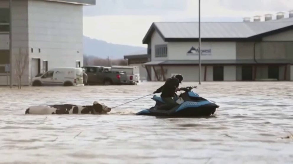
Cows rescued from flooded farmlands in British Columbia
Farmers and community members used sea-doos and boats to help rescue hundreds of cows from flooded farmlands in Abbotsford, British Columbia.
The floodwaters receded in the days after, but rivers ran high again just this week as additional atmospheric rivers continued their relentless march into the Pacific Northwest.
LEARN: What is an Atmospheric River?
Seattle, Bellingham and Forks were all setting records for wettest Novembers -- and autumns in general. Bellingham tied a record for five days in November measuring at least an inch of rain, and set an all-time monthly rainfall record with 13.27 inches and counting.
For those who suffered damage in the floods earlier in the month, the continued rainfall is adding insult to injury.
"There are people out here still cleaning their homes and now more weather is moving in," said Sumas resident Laura Anker. The restaurant she works for and the neighboring business both suffered significant damage in the flood. "It's going to be months before they can get up and going."