Power slowly returning to Coloradans after late spring storm dumps 2 feet of snow
Late-May snow is rare in Denver, but it is not unprecedented
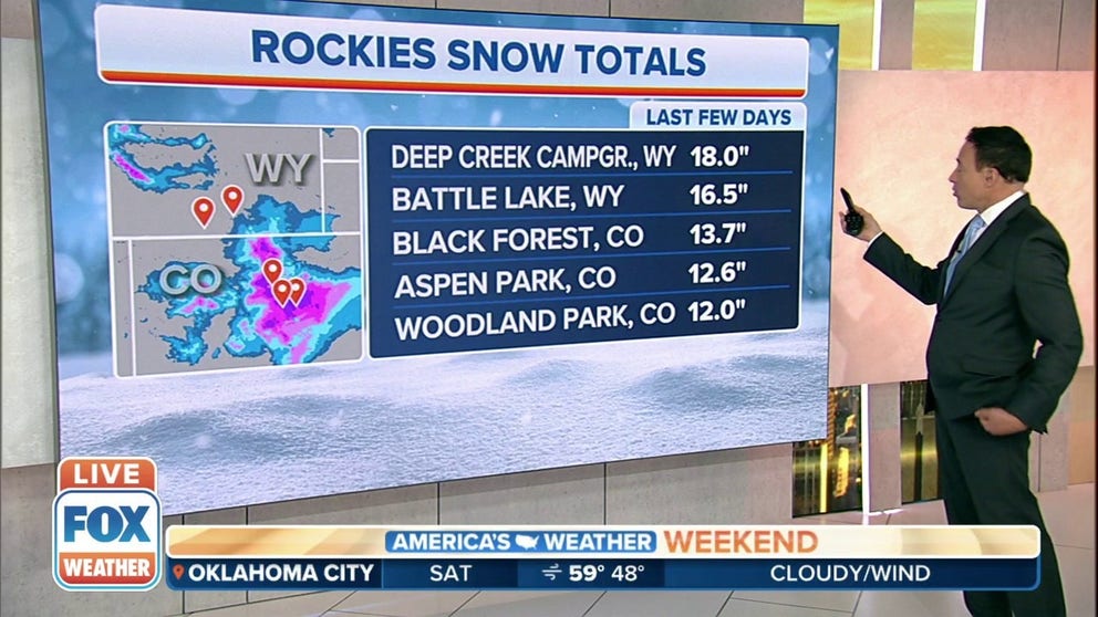
Over a foot of snow falls in parts of Wyoming, Colorado
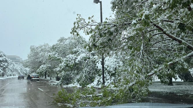
A late-season snowstorm is impacting the Front Range. This heavy, wet snow is leading to widespread travel impacts along the urban corridor and significant impacts to mountain travel. Power outages and downed trees have been reported as spring leaf out has already occurred.
DENVER – A temperature drop of nearly 60 degrees in the Centennial State means rare sights from a late-spring storm that promises to cover the ground in parts of the state with snow.
The National Weather Service said Saturday Floyd Hill, about 25 miles west of Denver, saw two feet of snow.
As of Saturday morning, more than 100,000 were without power, according to PowerOutage.US but electric companies were making quick work of restoration efforts.
The weight of the snow weighed down trees, even forcing some to tumble and snap across the Denver metro area.
Denver, CO
The frozen precipitation began falling across large parts of the state by Friday afternoon.
HOW TO WATCH FOX WEATHER ON TV
As the snow began to fall Friday, photos from areas with higher elevations showed considerably more snow on the ground but a very similar sight with grassy areas tending to accumulate more of the frozen precipitation than roadways.
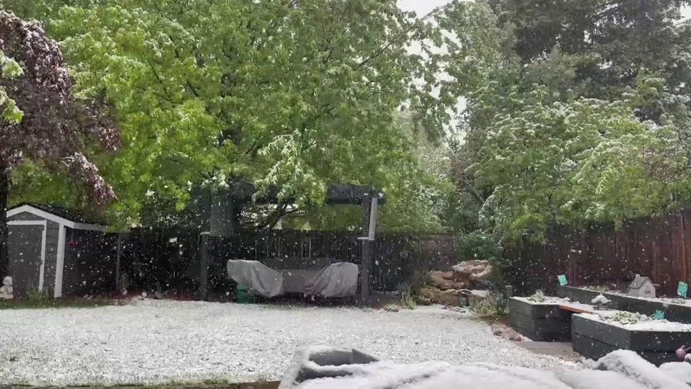
Snow coats ground in Littleton, Colorado
FOX Weather’s Craig Herrera films snow coating the ground in Littleton, Colorado during a late-season winter storm.
National Weather Service meteorologists said because the state has been so warm, it would take a while before the snow started sticking to the pavement.
Pavement temperatures from the Loveland Pass area were around 40° degrees, causing the frozen precipitation to quickly melt.
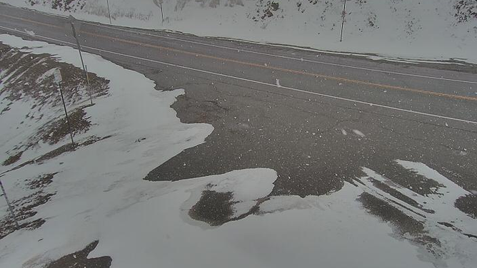
Snow fell across parts of Colorado on Friday but because ground temperatures were so warm, a lot of the wintery precipitation melted.
(Colorado DOT)
7 THINGS YOU CAN MEASURE SNOW WITH IF YOU DON’T HAVE A RULER
Officials warned hazardous travel conditions were expected along the I-70 corridor in the higher elevations through Saturday morning.
The inclement weather also forced Major League Baseball to postpone the game between the Colorado Rockies and the New York Mets until at least Saturday afternoon.
By the time the event is over, forecast models show Denver could pick up as much as five inches of snow over a foot possible in higher elevations.