Bomb cyclone blasts California with heavy rain, high winds, mountain snow
The next round of wet weather is drenching California Wednesday as a massive storm system swirled off their coast, with rain showers spreading across the state from Redding in the north to the Los Angeles area in the south.
Bomb cyclone brings more rain and snow to California
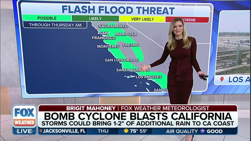
A storm system will deliver 1-2 inches of additional rain to the California coastline. A flash flood threat will be in effect through Thursday morning. Additional snow totals expected in higher elevations of the Sierra Nevada.
For the second time in two weeks, a bomb cyclone is slamming California, with more flooding rains, high winds and heavy mountain snow.
The powerful Pacific storm started pushing into Northern California and the Pacific Northwest Late Monday, with rain falling along the coast and lower elevations while the northern Sierra Nevada is seeing heavy snow that is only adding to its historic totals for the winter.
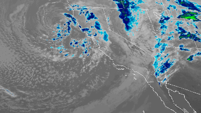
Satellite of cold front clearing California and swirl of parent low off Northern California keeping weather unstable and churning up thunderstorms. Notice the clouds that look like popcorn over the Pacific, that indicates very cold air.
(NOAA)
The storm "bombed out" before it impacted the West Coast, meaning there was a rapid drop in the storm’s central pressure.
56 FEET AND COUNTING: LAKE TAHOE RECORDS 2 OF ITS SNOWIEST MONTHS ON RECORD
The north Bay Area has so far been hit the hardest. On Tuesday, Venado in Sonoma County received 2.96 inches of rain. The Las Trampas in the East Bay Hills near Oakland clocked a wind gust of 65 mph. Oakland's airport recorded a 51 mph gust and San Francisco International Airport had a 48 mph gust.
Heavy snow fell in the Northern Sierra Nevada Mountains creating a nightmare for travelers and keeping first responders busy.
Even moderate rain falling on saturated ground touched off landslides near Yosemite.
WHY CALIFORNIA IS PRIMED FOR LANDSLIDES
Showers, thunderstorms and hail for Northern California on Wednesday

(FOX Weather)
Northern California and the Central Coast had a brief break in the rain Tuesday night, but the next round of wet weather had already moved back on Wednesday as the massive storm system swirled off the California coast with rain showers, thunderstorms and hail across the state from Redding in the north to the Los Angeles area in the south.
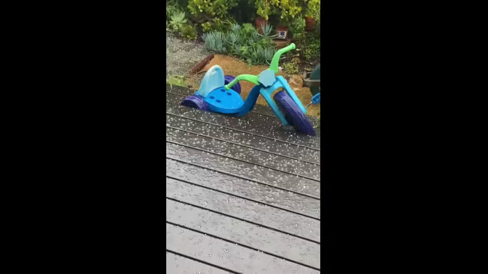
Not a play day, hail in Santa Cruz
After heavy rain and wind on Tuesday, thunderstorms dropped hail on Santa Cruz, California on Wednesday.
The National Weather Service said rainfall totals in California will be much less than what the state saw on Tuesday and with previous storms, however with the already saturated soil, there is still a risk of flash flooding.

(FOX Weather)
The flash flood risk extends from Sacramento to Monterey and Fresno, as well as into Southern California's Santa Barbara, Los Angeles and San Diego.
VIDEO: STRONGEST LOS ANGELES TORNADO IN 40 YEARS DAMAGES SEVERAL BUILDINGS, INJURES 1
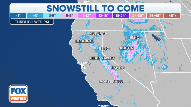
Additional snow totals expected in California through Wednesday evening.
(FOX Weather)
Meanwhile, Winter Storm Warnings continue in the higher elevations of the Sierra Nevada from the California-Oregon border to Yosemite National Park and parts of Southern California.
The National Weather Service in Hanford, California, said heavy snow is expected above 4,000 feet, with snow totals of 2-4 feet above 6,000 feet. Winds will also gust higher than 60 mph on exposed ridgetops and along the crests, according to the NWS.
A year's worth of rainy days in 3 months for Southern California
The low-pressure system will continue to make a slow trek south down the California coast Wednesday, keeping things wet across much of the state before weakening and moving inland into Southern California on Thursday.
Thus, Southern Californians might still need an umbrella for Thursday as scattered showers pelt the area, possibly with thunderstorms and hail. For Downtown Los Angeles, it'll likely mark the 33rd with measurable rain already in 2023 – the most since 1983.
Downtown Los Angeles averages about 33 days with measurable rain for an entire year.