

Severe storms and possible tornadoes threaten the Plains before invading the Midwest and East
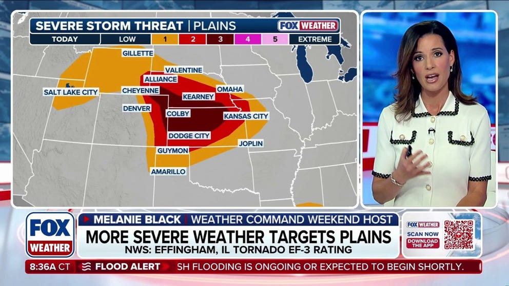
Thunderstorms are expected to develop by late afternoon and continue into the evening across Nebraska and Kansas, where a Level 3 out of 5 severe storm risk is in place.
More rounds of severe weather target the Midwest and Great Plains
NEXT THREAT: More rounds of continuous severe storms are headed for the Midwest and Great Plains, where strong rain, damaging wind, hail, and maybe tornadoes are possible starting tonight and through Sunday.
The risk of severe storms and flash flooding returns this weekend, targeting the Central Plains before spreading into the Midwest and East early next week as another storm system moves through.
Thunderstorms are expected to develop Saturday afternoon across Nebraska and Kansas, before tracking east across the Midwest and into the East by Sunday and Monday, bringing widespread rainfall.
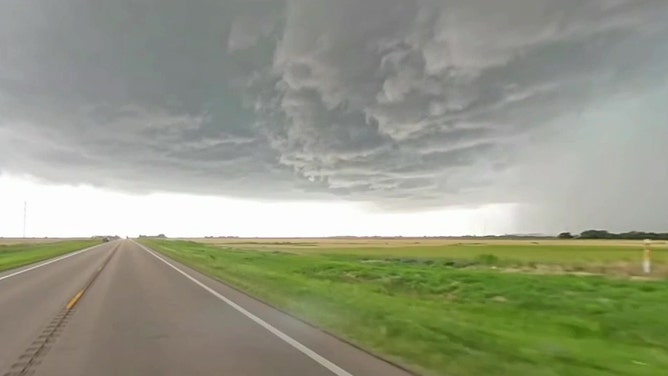
Supercell thunderstorm causes sky to turn ice blue in Harper, Kansas on June 17, 2025.
(Mark Sudduth / FOX Weather)
This has prompted a Level 3 out of 5 severe storm risk across portions of Nebraska and Kansas, as well as a multi-day flash flood risk throughout the Central Plains and Midwest.
POWERFUL TORNADOES, DESTRUCTIVE WINDS BRING WIDESPREAD DEVASTATION TO SEVERAL MIDWEST COMMUNITIES
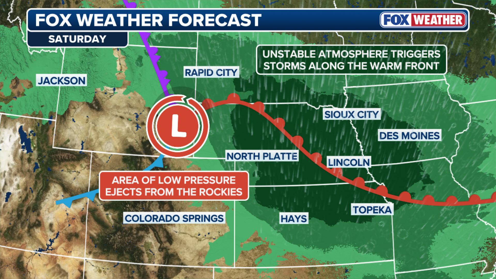
On Saturday, a dip in the jet stream moves from the Central Rockies into the Plains as a surface low develops.
(FOX Weather)
Strengthening southerly winds will bring increasing moisture, with dew points rising into the 60s and instability building through the afternoon.
Thunderstorms are expected to develop by late afternoon and continue into the evening across Nebraska and Kansas, where a Level 3 out of 5 severe storm risk is in place.
Large to very-large hail, severe winds — some topping 75 mph — and tornadoes will all be possible.

(FOX Weather)
With above-average moisture and a highly unstable atmosphere, storms could produce rainfall rates of 1 to 2 inches per hour.
THE SPC 5-POINT SEVERE THUNDERSTORM RISK CATEGORY SCALE EXPLAINED
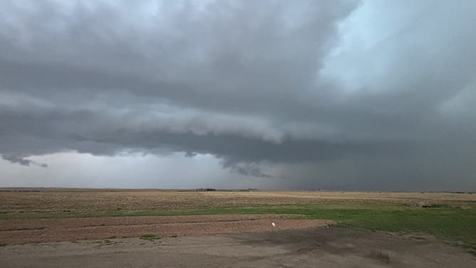
Severe thunderstorms loom in Paxton, Nebraska, Monday, June 1.
(Margaret / FOX Weather)
This may lead to flash flooding across central Nebraska and Kansas, eventually extending into Iowa and western Missouri, the FOX Forecast Center said.
As a result, a Level 3 out of 4 flash flood risk is in effect for Saturday and into the overnight hours.
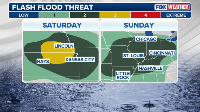
Flash flood threat outlook
(FOX Weather)
By Sunday and Monday, the low-pressure system will track eastward, spreading heavy rain into the Midwest and eventually the East.
More severe storms are expected to develop, producing large hail, damaging winds and possibly tornadoes.
LIFE-THREATENING FLOODING AND DAMAGING WINDS SLAM THE GULF COAST AS ARTHUR PACKS A PUNCH
This has prompted a Level 2 out of 4 flash flood risk for Sunday afternoon across portions of the lower Missouri and lower Ohio Valleys.

(FOX Weather)
Through Monday, widespread rainfall totals of 2 to 3 inches are likely from Nebraska through Missouri and into the Ohio Valley.
Localized amounts exceeding 3 inches are possible where slower-moving, training thunderstorms develop, repeatedly battering the same areas.

(FOX Weather)
Additionally, across the Northeast, rain is expected through Monday and could be heavy at times, particularly from Philadelphia to Boston.