Centerville, KS

See Radar

Current Weather Forecast for Centerville

KS 66014  |   8:56am

Weather Conditions

64°
Feels Like 63°
Partly / Cloudy
Partly Cloudy
62° 71°
UV Index
1
UV Index
Air Quality
Good
Air Quality
Wind
S 15 mph
Wind
Rain
0 in
rain

Today

Fri 3/6
71°
Highest Temperature
Scattered Thunderstorms
37%
Windy with scattered thunderstorms developing. Potential for severe thunderstorms. High 71F. Winds S at 20 to 30 mph. Chance of rain 40%.

Tonight

Fri 3/6
36°
Lowest Temperature
Scattered Thunderstorms
85%
Scattered thunderstorms during the evening. Cloudy skies after midnight. Potential for severe thunderstorms. Low 36F. SSW winds shifting to NW at 15 to 25 mph. Chance of rain 90%.

Tomorrow

Sat 3/7
54°
Highest Temperature
Fair / Mostly Sunny
5%
A few passing clouds, otherwise generally sunny. High 54F. Winds NW at 10 to 20 mph.

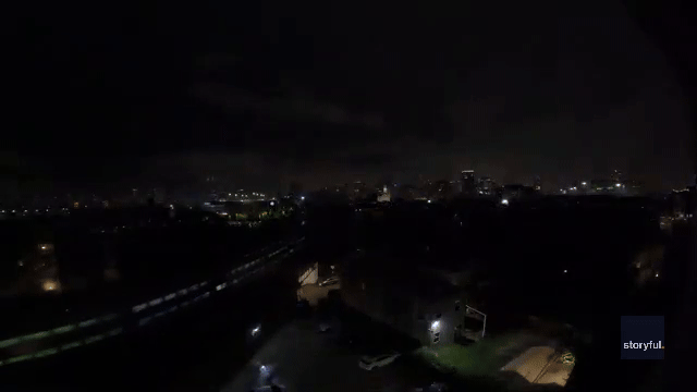
Local Weather Radar - Centerville, KS

Live Centerville Local Radar Forecast by FOX Weather

Precipitation For Centerville thunder
Intermittent precipitation for the next hour.

Next 12 Hours Forecast in Centerville

Hourly Weather Forecast & Temperature

9AM
Scattered Thunderstorms
57%
65°
Feels Like 63°
Scattered Thunderstorms
Wind
SSW 16 mph
Wind
Pressure
1009 mb
Pressure
Humidity
87%
Humidity
UV Index
1
UV Index
Visibility
7mi
Visibility
Visibility
72%
Cloud Cover
10AM
Scattered Thunderstorms
58%
67°
Feels Like 67°
Scattered Thunderstorms
Wind
S 18 mph
Wind
Pressure
1009 mb
Pressure
Humidity
83%
Humidity
UV Index
2
UV Index
Visibility
7mi
Visibility
Visibility
74%
Cloud Cover
11AM
Windy
15%
68°
Feels Like 68°
Cloudy/Wind
Wind
S 20 mph
Wind
Pressure
1009 mb
Pressure
Humidity
78%
Humidity
UV Index
3
UV Index
Visibility
10mi
Visibility
Visibility
80%
Cloud Cover
12PM
Windy
15%
70°
Feels Like 70°
Cloudy/Wind
Wind
SSW 22 mph
Wind
Pressure
1009 mb
Pressure
Humidity
73%
Humidity
UV Index
2
UV Index
Visibility
10mi
Visibility
Visibility
94%
Cloud Cover
1PM
Windy
15%
70°
Feels Like 70°
Cloudy/Wind
Wind
SSW 21 mph
Wind
Pressure
1008 mb
Pressure
Humidity
73%
Humidity
UV Index
2
UV Index
Visibility
10mi
Visibility
Visibility
94%
Cloud Cover
2PM
Windy
15%
70°
Feels Like 70°
Cloudy/Wind
Wind
S 20 mph
Wind
Pressure
1008 mb
Pressure
Humidity
74%
Humidity
UV Index
2
UV Index
Visibility
10mi
Visibility
Visibility
90%
Cloud Cover
3PM
Windy
8%
70°
Feels Like 70°
Cloudy/Wind
Wind
S 20 mph
Wind
Pressure
1007 mb
Pressure
Humidity
75%
Humidity
UV Index
1
UV Index
Visibility
10mi
Visibility
Visibility
90%
Cloud Cover
4PM
Cloudy
20%
69°
Feels Like 70°
Cloudy
Wind
S 18 mph
Wind
Pressure
1007 mb
Pressure
Humidity
77%
Humidity
UV Index
1
UV Index
Visibility
10mi
Visibility
Visibility
90%
Cloud Cover
5PM
Cloudy
15%
69°
Feels Like 70°
Cloudy
Wind
S 18 mph
Wind
Pressure
1007 mb
Pressure
Humidity
77%
Humidity
UV Index
0
UV Index
Visibility
10mi
Visibility
Visibility
84%
Cloud Cover
6PM
Scattered Thunderstorms
38%
69°
Feels Like 70°
Scattered Thunderstorms
Wind
S 17 mph
Wind
Pressure
1007 mb
Pressure
Humidity
77%
Humidity
UV Index
0
UV Index
Visibility
7mi
Visibility
Visibility
94%
Cloud Cover
7PM
Cloudy
18%
68°
Feels Like 68°
Cloudy
Wind
S 16 mph
Wind
Pressure
1007 mb
Pressure
Humidity
83%
Humidity
UV Index
0
UV Index
Visibility
10mi
Visibility
Visibility
94%
Cloud Cover
8PM
Cloudy
15%
67°
Feels Like 67°
Cloudy
Wind
S 16 mph
Wind
Pressure
1007 mb
Pressure
Humidity
86%
Humidity
UV Index
0
UV Index
Visibility
9mi
Visibility
Visibility
88%
Cloud Cover
Fri 3/6
Fri
Scattered Thunderstorms
37%
62°
71°
Windy with scattered thunderstorms. Potential for severe thunderstorms. Highs in the low 70s and lows in the mid 30s.
Feels Like
71°
Feels Like
Wind
S 22 mph
Wind
Humidity
78%
Humidity
UV Index
2
UV Index
Visibility
6:44 AM
Sunrise
Visibility
6:18 PM
Sunset
Sat 3/7
Sat
Fair / Mostly Sunny
5%
36°
64°
Mostly sunny. Highs in the mid 50s and lows in the mid 30s.
Feels Like
28°
Feels Like
Wind
NW 16 mph
Wind
Humidity
64%
Humidity
UV Index
5
UV Index
Visibility
6:42 AM
Sunrise
Visibility
6:19 PM
Sunset
Sun 3/8
Sun
Sunny
5%
35°
70°
Sunny. Highs in the low 70s and lows in the low 50s.
Feels Like
70°
Feels Like
Wind
SW 13 mph
Wind
Humidity
50%
Humidity
UV Index
5
UV Index
Visibility
7:41 AM
Sunrise
Visibility
7:20 PM
Sunset
Mon 3/9
Mon
Sunny
2%
50°
80°
Abundant sunshine. Highs in the low 80s and lows in the upper 50s.
Feels Like
80°
Feels Like
Wind
SW 17 mph
Wind
Humidity
51%
Humidity
UV Index
5
UV Index
Visibility
7:39 AM
Sunrise
Visibility
7:21 PM
Sunset
Tue 3/10
Tue
Scattered Thunderstorms
54%
57°
80°
Scattered thunderstorms. Potential for severe thunderstorms. Highs in the low 80s and lows in the mid 40s.
Feels Like
80°
Feels Like
Wind
SSW 17 mph
Wind
Humidity
67%
Humidity
UV Index
4
UV Index
Visibility
7:38 AM
Sunrise
Visibility
7:22 PM
Sunset
Wed 3/11
Wed
Scattered Showers
39%
38°
59°
Showers ending by midday. Highs in the mid 50s and lows in the low 30s.
Feels Like
41°
Feels Like
Wind
N 15 mph
Wind
Humidity
63%
Humidity
UV Index
4
UV Index
Visibility
7:36 AM
Sunrise
Visibility
7:23 PM
Sunset
Thu 3/12
Thu
Sunny
2%
33°
60°
Sunshine. Highs in the low 60s and lows in the mid 40s.
Feels Like
29°
Feels Like
Wind
S 11 mph
Wind
Humidity
53%
Humidity
UV Index
5
UV Index
Visibility
7:35 AM
Sunrise
Visibility
7:24 PM
Sunset
Fri 3/13
Fri
Fair / Mostly Sunny
1%
46°
70°
A few clouds. Highs in the low 70s and lows in the low 40s.
Feels Like
70°
Feels Like
Wind
SW 15 mph
Wind
Humidity
53%
Humidity
UV Index
5
UV Index
Visibility
7:33 AM
Sunrise
Visibility
7:25 PM
Sunset
Need to see beyond 12 Hours?
Find more forecast on the FREE FOX WEATHER App

Latest Stories from Kansas

Loading...