Ridge riders, extreme heat to trigger multi-day severe storms in Plains, Great Lakes ahead of holiday weekend
A volatile atmospheric collision will trigger fast-moving, long-lived ridge rider storms capable of generating widespread, damaging straight-line winds.

Extreme heat fuels daily severe storm threat looming from the Plains to the Great Lakes
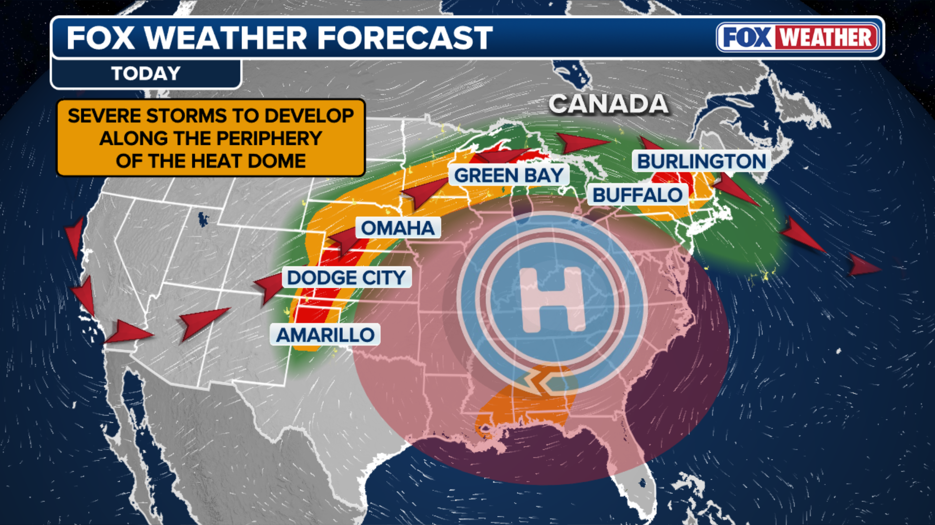
An intense heat dome over the eastern U.S. is fueling severe ridge rider storms from the Plains to the Great Lakes, triggering daily severe storm risks. Destructive straight-line winds and large hail will be the primary threats, but an isolated tornado cannot be ruled out. Full forecast:
A volatile mid-summer weather pattern is taking shape across the central and northern United States as an expanding, high-amplitude heat dome brings dangerous, life-threatening temperatures while colliding with cooler northern air currents.
This "Ring of Fire" setup will trigger multiple days of severe storms, spanning a vast corridor from the Central Plains through the Great Lakes and into the Northeast.
(FOX Weather)
Starting Tuesday and continuing through Thursday, a daily threat of severe storms will loom across the region.
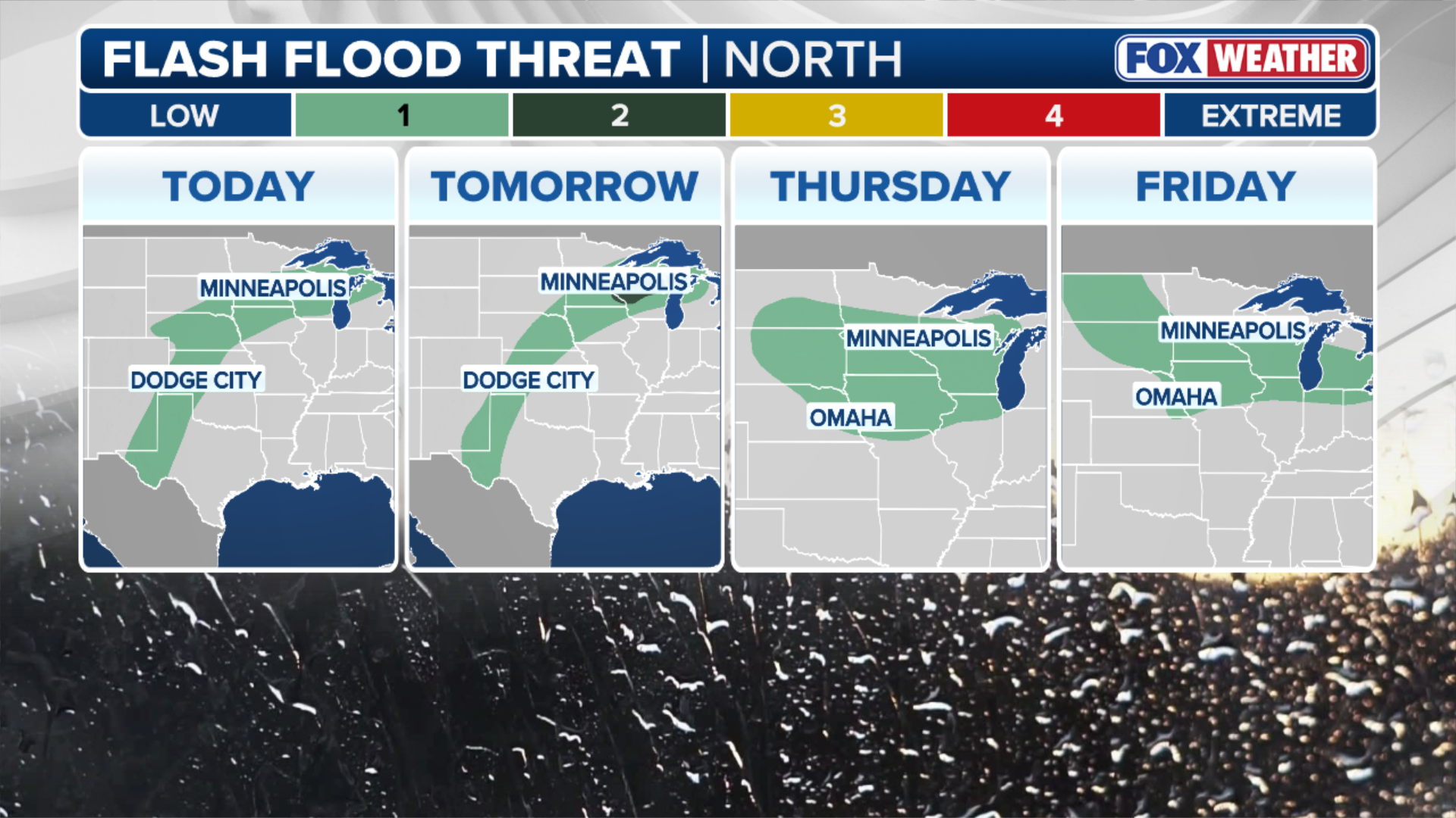
These severe storms will be capable of producing damaging winds and large hail, with a few isolated tornadoes possible. Additionally, repeated rounds of rain over the same areas could lead to localized flash flooding.

(FOX Weather)
On Tuesday, a Level 2 out of 5 severe storm risk covers portions of Kansas, Wisconsin, Michigan’s Upper Peninsula, Upstate New York, and Vermont, with a broader Level 1 out of 5 risk encompassing the regions in between.
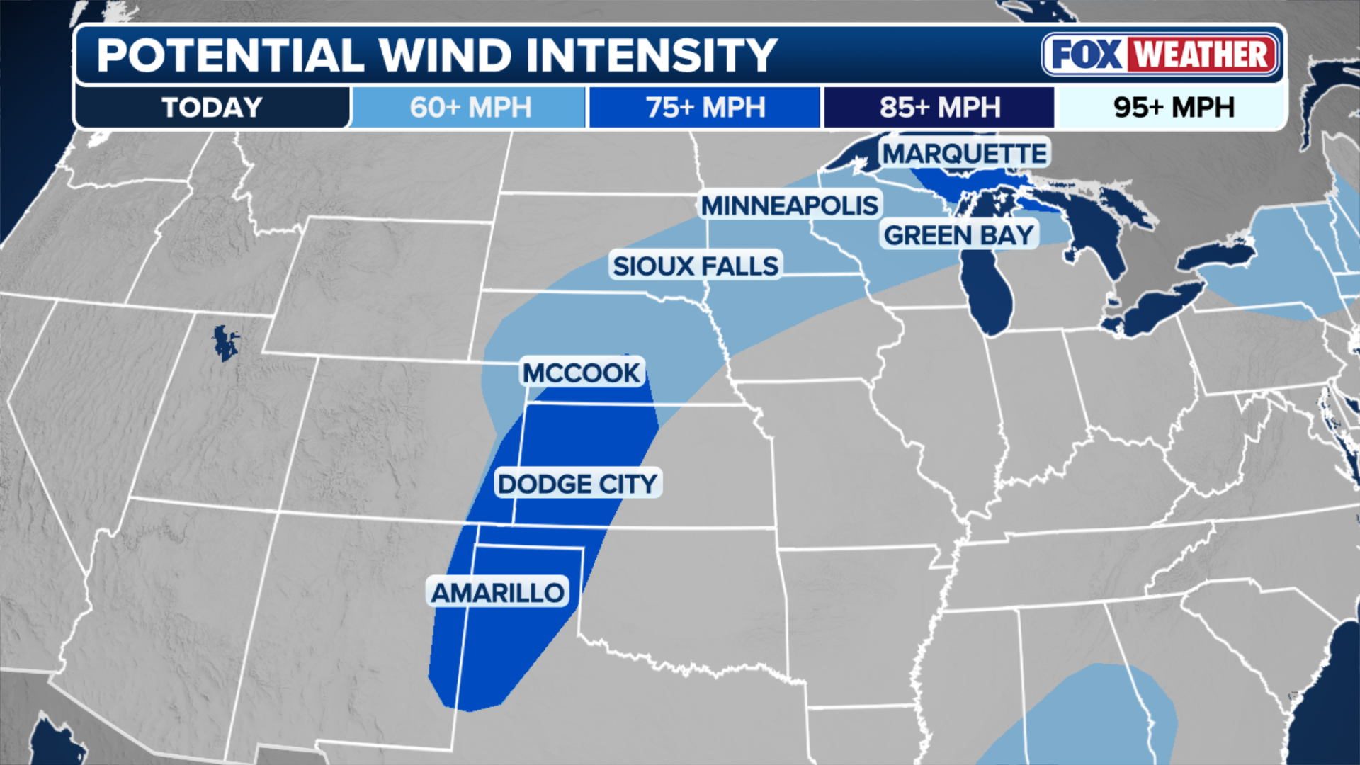
The primary threat of these storms will be damaging straight-line wind gusts, which could exceed 75 mph across the regions.
JULY 4TH WEATHER AND TRAVEL: WHAT TO EXPECT FOR AMERICA’S HISTORIC 250TH BIRTHDAY ACROSS THE US
However, across New York and Vermont, an isolated tornado or two cannot be ruled out given the localized atmospheric spin available, the FOX Forecast Center said.
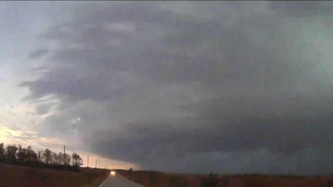
This image shows severe weather in Kansas on Wednesday, Oct. 30, 2024.
(Corey Gerken / FOX Weather)
The extreme temperatures will be the catalyst for these severe storms.
Strong southerly winds are pumping intense heat and deep tropical moisture northward. When this highly unstable airmass interacts with mid-level atmospheric disturbances riding the edge of the heat dome, it creates an ideal environment for explosive thunderstorm development.
(FOX Weather)
These setups are notorious for producing ridge rider storms—fast-moving, long-lived Mesoscale Convective Systems (MCS) which can efficiently generate widespread, damaging straight-line winds.
Beyond the immediate threats of wind and hail, localized flash flooding is a distinct danger, the FOX Forecast Center said. Because these storm complexes frequently "train"—moving repeatedly over the exact same geographic tracks like train cars—pockets of excessive rainfall are expected along their paths, particularly where storm boundaries stall.
(FOX Weather)
The threat will not end after Tuesday. This entire region will remain under a continuous severe storm risk through Thursday as the pattern reloads daily, with every subsequent round capable of producing destructive straight-line wind damage and downpours.
Stick with FOX Weather for the latest updates as the storms unfold.