

Severe storms from Ohio Valley prompt Flash Flood Emergency in North Carolina
The storm system was stronger for longer than expected — and the terrain in the Surry County, North Carolina, area exacerbates the flood risk.
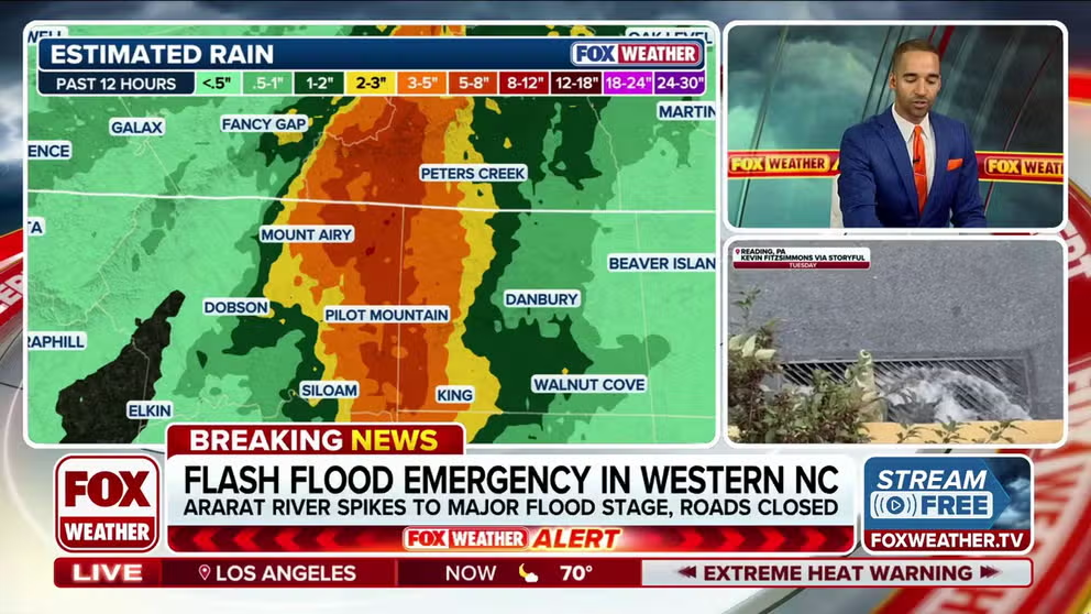
Flash Flood Emergency issued in Western North Carolina
Life-threatening conditions are unfolding amid a Flash Flood Emergency in Western North Carolina as the Ararat River spikes to major flood stage, leaving roads closed in the area.
Severe storms that impacted the Ohio Valley on Saturday moved into North Carolina overnight and caused a Flash Flood Emergency.
Water rescues have been reported and the Ararat River has spiked to major flood stage. The emergency remains in effect until 8:30 a.m.
HUMIDITY TO FUEL FLORIDA DOWNPOURS THROUGH THE WEEKEND, RAISING FLOOD CONCERNS AND TRAVEL THREATS
A stormy weather pattern moved through the Ohio Valley toward the end of a multiday stretch of thunderstorms, prompting flash flood concerns for millions of people.
The storm system was stronger for longer than expected — and the terrain in the Surry County, North Carolina, area exacerbates the flood risk.
Thunderstorms developed across the central Plains and Upper Midwest on Thursday and Friday.

(FOX Weather)
These storms tapped into a high amount of moisture that is surging north along an old frontal boundary leftover from storms earlier in the week.
On Friday, storms brought heavy rain to major cities from St. Louis into Chicago.
On Saturday, the disturbance shifted slightly to the southeast over the Ohio River Valley.
A Level 2 out of 5 severe weather threat was in effect Saturday for parts of Ohio, Kentucky, Tennessee and Alabama.
There was also a Level 2 out of 4 flash flood threat throughout the day across portions of the Midwest, Great Lakes and Tennessee and Ohio Valleys.

(FOX Weather)
The biggest severe threat was damaging winds with storm development.
The same disturbance is sending rain to the Northeast and Southeast through Sunday.