Buckle up: Here are the most dangerous roads in America
AAA estimates about 55 million people will travel more than 50 miles this Thanksgiving, and among those travelers are about 50 million people who will drive.
Here are some of the most dangerous roads in America
Car crashes can occur on any street, road or highway in America, but some are statistically more dangerous than others. Here’s a list compiled by AAA of some of the most dangerous.
Car crashes can occur on any street, road or highway in the U.S., but some are statistically more dangerous than others.
So, as nearly 50 million Americans prepare to head home after Thanksgiving, it's important to know where you should take extra precautions to ensure you arrive safely.
Here's a list compiled by AAA of some of the most dangerous roads in America.
Million Dollar Highway, Colorado
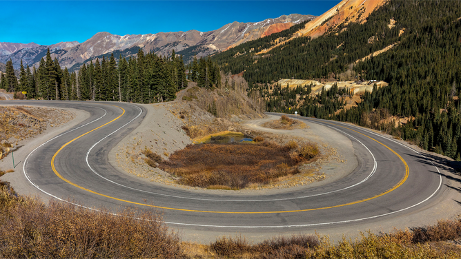
FILE - Circular elevated view of Colorado State Highway 550, known as "Million Dollar Highway," threads its way from Silverton to Ouray.
(Joe Sohm / Visions of America / Universal Images Group / Getty Images)
Colorado's Million Dollar Highway offers some of the most breathtaking views in the country, but it's not for the faint of heart. Winding through Red Mountain Pass in the San Juan Mountains, the Million Dollar Highway climbs 11,000 feet above sea level and has cliffs and hairpin turns.
The Million Dollar Highway is officially known as U.S. Route 550, but according to local legend, it got its name after a woman said she would have to be paid $1 million to drive it again.
AAA says when you mix in some of Colorado's harsh weather, the Million Dollar Highway is one of the most dangerous roads in America, according to a list compiled by USA Today.
U.S. Route 1, Florida
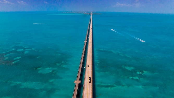
FILE - Aerial view of U.S. Route 1 Overseas Highway to Key West, Florida.
(Visions of America / Joseph Sohm / UCG / Universal Images Group / Getty Images)
AAA says Florida doesn't have a ban on using a handheld cell phone while driving, and research looked into deaths on U.S. Route 1 between 2015 and 2019 and found Florida's section of the highway is one of the deadliest roads in America.
In total, 87 people died between those years.
The south end of the highway, known as the Overseas Highway, connects Miami to the Florida Keys and consists of miles of bridges many people find unnerving, according to AAA.
Lake Pontchartrain Causeway, Louisiana

FILE - Aerial view of Lake Pontchartrain Causeway.
(Jeffrey Greenberg / Universal Images Group / Getty Images)
The Lake Pontchartrain Causeway in Louisiana holds the Guinness World Record for the longest bridge over water at 24 miles long.
And when you get to the middle of the bridge, where there's no land in sight, many people get nervous – especially when the causeway becomes enveloped in fog. AAA says that sometimes the fog becomes so thick that local police must escort drivers across the bridge.
I-4, Florida
FILE - Tampa Bay-area residents and drivers fill the lanes on I-4 as they escape the high winds and floodwaters of Hurricane Ian with just a day left before the storm lands in Tampa, Florida, Tuesday, Sept. 27, 2022.
(Willie J. Allen Jr. / Orlando Sentinel / Tribune News Service / Getty Images)
AAA says Interstate 4 between Daytona Beach and Tampa, Florida, was once the deadliest highway in America, with roughly 1.41 deaths per mile on the highway.
According to AAA, this could be because the highway runs right through Orlando, which is a hotspot for tourists looking to visit Walt Disney World, Universal Studios or other attractions.
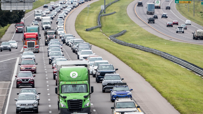
I-45, Texas
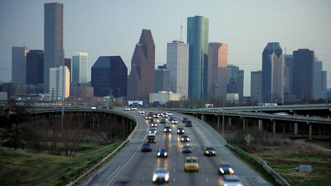
FILE - Houston, Texas, skyline at dusk and I-45 commuter traffic.
(Jeff Greenberg / Universal Images Group / Getty Images)
Interstate 45 in Texas is extremely congested, and AAA says the Galveston-to-Dallas section of the highway was recently named the deadliest road in America by Budget Direct.
They found that I-45 averages about 56.5 fatal crashes for every 100 miles of highway, noting that heavy traffic and driver complacency are to blame.
I-10, Arizona
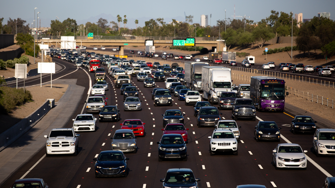
FILE - Vehicles travel on Interstate 10 during rush hour in Phoenix, Arizona, on Thursday, April 22, 2021.
(Courtney Pedroza / Bloomberg / Getty Images)
Interstate 10 runs from Jacksonville, Florida, to Santa Monica, California, but AAA says the stretch of highway running through Arizona is extremely dangerous.
This is because the highway cuts through the desert, which leads to drivers speeding and driving aggressively.
Nearly 500 people were killed on I-10 in Arizona over a six-year period.
I-15, Nevada and California
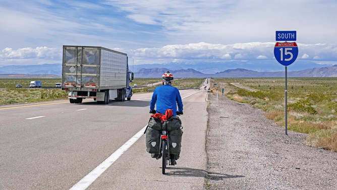
FILE - Solitary touring cyclist cycling along Interstate 15 through Mohave County in Arizona and heading for Las Vegas, Nevada.
(Marica van der Meer / Arterra / Universal Images Group / Getty Images)
The 181-mile stretch of Interstate 15 between Las Vegas and Los Angeles isn't dangerous because of road conditions – it's because of the drivers on the highway.
In fact, one study checked out data over a 15-year period and found it to be the deadliest road in America.
This is because drivers often speed while traveling through the Mojave Desert, and they're likely coming or going from the excitement in Las Vegas. That same study found about one-quarter of crashes on that section of roadway involved a drunk driver.
I-285, Georgia
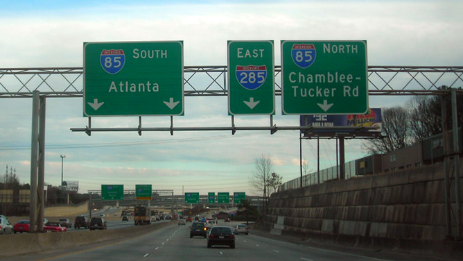
FILE - Highway signs showing I-285 in Georgia.
(Flickr.com / dougtone / FOX Weather)
Interstate 285 in Georgia is called "The Perimeter" because the 64-mile loop encompasses the city of Atlanta. In addition, AAA says that the highway connects all the other major highways in the region, leading to congested roadways.
AAA says Vox calculated the road's fatality rate and found it was 3.5 deaths for every 10 miles, which, at the time of the study in 2015, was the country's deadliest interstate.
U.S. Route 17, South Carolina
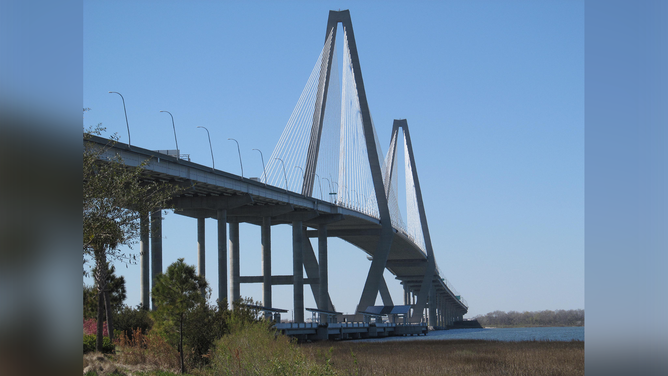
FILE - Route 17 in South Carolina.
(Flickr.com / dougtone / FOX Weather)
Route 17 in South Carolina is one of the most scenic and breathtaking drives you can take in the Southeast, but it's also dangerous.
AAA says the road is filled with sharp turns and narrow lanes, and there's also a lot of wildlife that leads to a driving hazard when they cross the road.
One study named U.S. 17 in South Carolina one of the most dangerous roads in America during the summer.
James Dalton Highway, Alaska
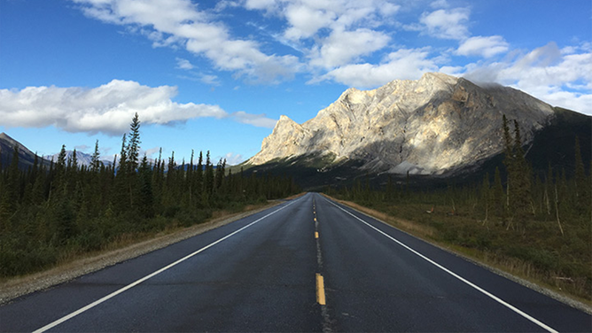
FILE - View of Mount Sukakpak, 20 miles north of Coldfoot on the Dalton Highway.
(Jake Allen, Alaska DOT&PF / FOX Weather)
The James Dalton Highway was constructed in 1974 and stretches 414 miles through Alaska's wilderness from Fairbanks to Deadhorse.
The road is mainly used to transport oil and cuts through some of Alaska's most treacherous terrain.
You may have heard of this highway before, too. Driving on this road is so dangerous that it was the focus of the TV show "Ice Road Truckers."
In addition to the road cutting through forests, steep hills and the Yukon River, what makes this road so dangerous is its remoteness, according to AAA.
There are only three towns along the entire 414-mile route, which includes a 240-mile stretch without any gas stations or rest stops.
Highway 2, Montana
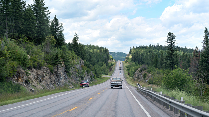
FILE - Highway 2 in the Rockies of Montana.
(Dukas / Universal Images Group / Getty Images)
Montana's Highway 2 stretches east to west across the northern end of the state and maintains a 70-mph speed limit – even when winding through some mountainous regions.
That means you're far away from any help should you need it.
In 2021, the average EMS response time in Montana was about 45 minutes, and that number climbs when EMS workers need to travel on Highway 2, according to AAA.
Road to Hana, Hawaii
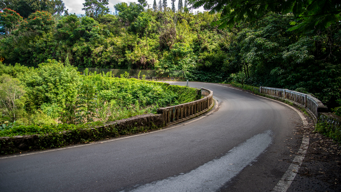
FILE - Beautiful scenic view of the lush greenery on the road to Hana in Maui, Hawaii.
(Michael Siluk / Education Images / Universal Images Group / Getty Images)
You might think you're in paradise when you're in Hawaii and driving on Maui's Road to Hana, but you must be careful.
The 52-mile road connects Kahului to Hana on the eastern shoreline and offers beautiful views of mountaintops, forests and waves crashing on the shore.
But along the way, you'll also come across 620 turns and 59 narrow bridges, according to AAA. It can take drivers anywhere from 2 to 4 hours to make the journey, and Hawaii's tourism authority recommends drivers travel with a permitted tour company rather than making the drive themselves.

How interstate highways shaped America
The interstate highway system tells a story about a nation whose evolution both drove and was driven by something as seemingly simple as pavement.