Tropical cyclones rarely, if ever, make it from the Pacific to the Atlantic
Getting a tropical storm or hurricane to survive a journey from the Pacific Ocean and a trek over land before reentering the Atlantic basin to keep its same name would only occur if the storm maintained enough of its original circulation.
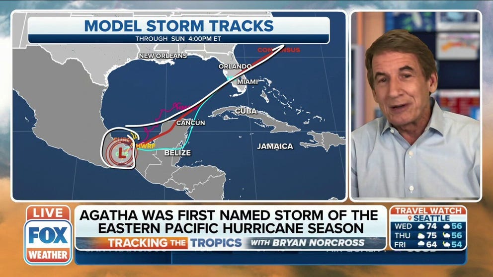
Bryan Norcross: Tropical disturbance to move in direction of Florida is the 'consensus'
FOX Weather Hurricane Expert Bryan Norcross with an in-depth look at the aftermath of Agatha and looks ahead to hurricane season.
MIAMI – In 2022, Hurricane Agatha made landfall along the Pacific coast of Mexico as a Category 2 hurricane before breaking apart over land. At the time, there was talk of renewed tropical development in the Gulf of Mexico as Agatha’s remnants drifted back over water.
Could the storm have been reborn as Agatha in the Atlantic basin? No, but had it survived its trek, it would have eventually turned into Tropical Storm Alex. (Agatha did not reemerge into the Gulf waters and instead fizzled over Mexico. Tropical Storm Alex would eventually form as a separate storm later in June.)
HERE ARE THE NAMES YOU’LL SEE DURING THE 2022 ATLANTIC HURRICANE SEASON
Why the potential name change, though? The World Meteorological Organization maintains separate names for hurricanes in the Pacific Ocean basin and the Atlantic Ocean basin, which includes the Gulf of Mexico.
The agency did change its policy in 2001 to allow a tropical storm or hurricane that survived a journey from the Pacific Ocean and a trek over land before reentering the Atlantic basin to keep its same name on one important condition: that the storm maintained enough of its original circulation.
It’s easier said than done.
"It's not likely, however, because Mexico has huge mountains at the latitude that crossovers would most likely happen," FOX Weather Hurricane Specialist Bryan Norcross said. "The eastward movement that would be required for a storm to head toward the Gulf or Caribbean (from the Pacific) happens, but it's rare, and usually only happens at the beginning or end of hurricane seasons."
7 FACTS TO KNOW ABOUT HURRICANES
And so far, no storm has managed that Pacific-to-Atlantic crossover feat since the naming policy went into effect in 2001.
Remnants of tropical systems have had better success going from the Atlantic basin to eventually span a new storm in the Pacific though only one – Hurricane Otto which struck Nicaragua in November 2016 -- has held together enough along the trek to maintain its same name.
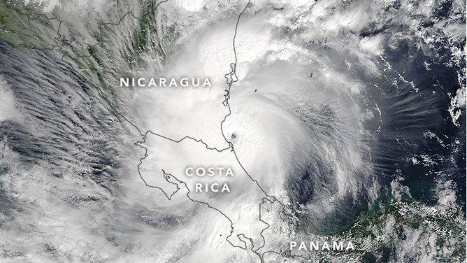
Hurricane Otto
(NASA Earth Observatory)
BEWARE THE ‘I’ STORM: IT HAS MORE RETIREES THAN ANY OTHER LETTER USED FOR ATLANTIC HURRICANE NAMES
"A number of storms have crossed from the Atlantic to the Pacific," Norcross said. "Storms usually track east to west farther south, where the terrain is more cooperative. Also, the ‘normal’ direction of movement of a hurricane is east to west or northwest."