Watch: Storms sweep through South and Midwest, spawning tornadoes and causing floods
Photos and videos capture floodwater overtaking an apartment in Arkansas, floods rising halfway up a stop sign in Kentucky, an ominous-looking shelf cloud in Mississippi and a tornado in Illinois.
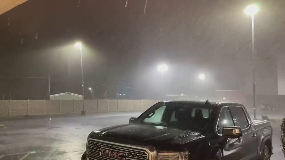
Rain pours in western Kentucky as thunderstorms pummel southern US
Video posted by L Alan Mason in the early morning hours of Tuesday shows pouring rain falling in Murray, Kentucky.
A powerful storm system continued its march across the South and Midwest on Tuesday, bringing tornadoes and thunderstorms to areas already devastated by severe weather.
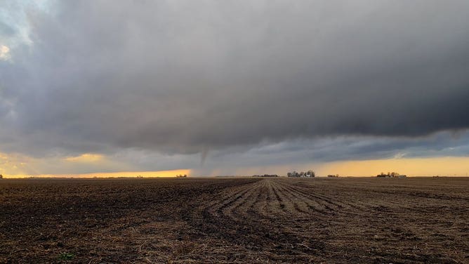
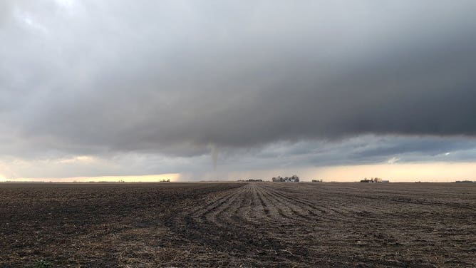
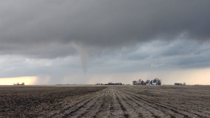
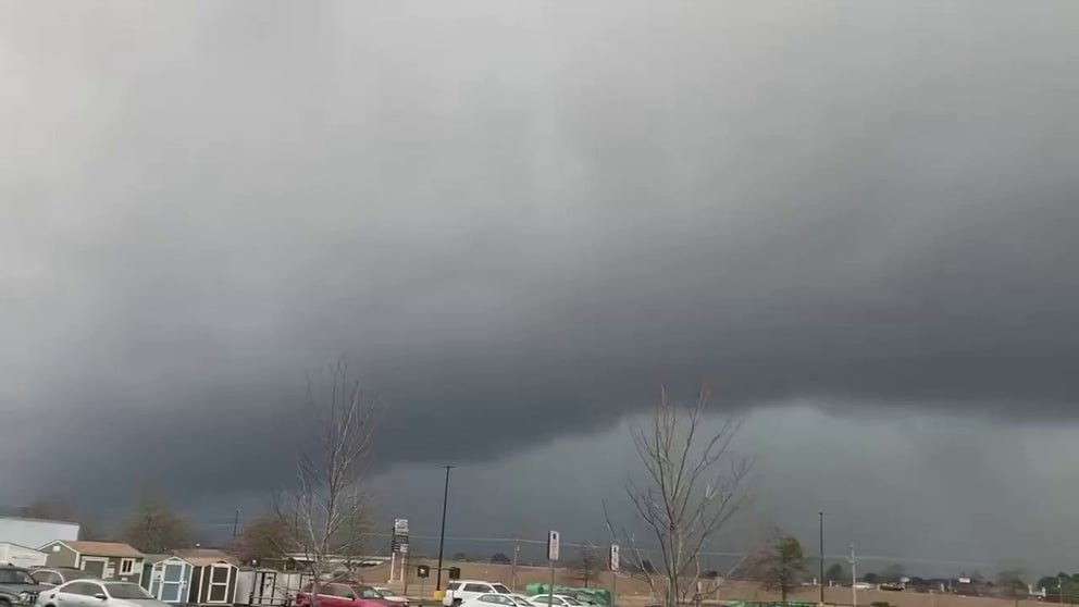
These images capture a tornado forming over a field in the town of Niantic in central Illinois.
![A tornado in Niantic, Illinois.]() Image 1 of 3
Image 1 of 3A tornado in Niantic, Illinois. (@VORTEXJeff / Twitter)
![A tornado in Niantic, Illinois.]() Image 2 of 3
Image 2 of 3A tornado in Niantic, Illinois. (@VORTEXJeff / Twitter)
![A tornado in Niantic, Illinois.]() Image 3 of 3
Image 3 of 3A tornado in Niantic, Illinois. (@VORTEXJeff / Twitter)
One video shows floodwater creeping through an apartment in western Arkansas. At one moment, the camera pans down to reveal the water inching closer to the resident’s feet.
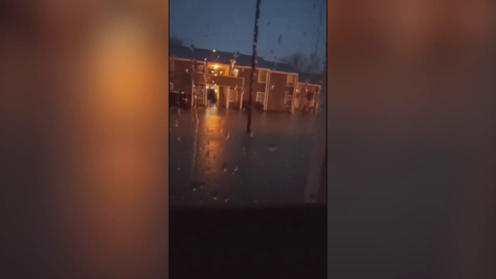
Floodwater pools in Arkansas apartment during severe thunderstorm
Videos posted by Kesha Iliveitforme Edwards on Tuesday shows inches of water in an apartment in flooded West Memphis, Arkansas.
A road in the Natural State was also seen washed away by floodwater.
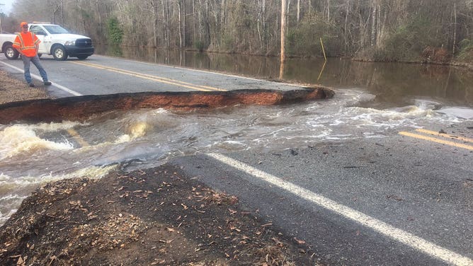
Highway 203 near Hampton, Arkansas cut in half by fast moving water.
(Arkansas Department of Transportation / FOX Weather)
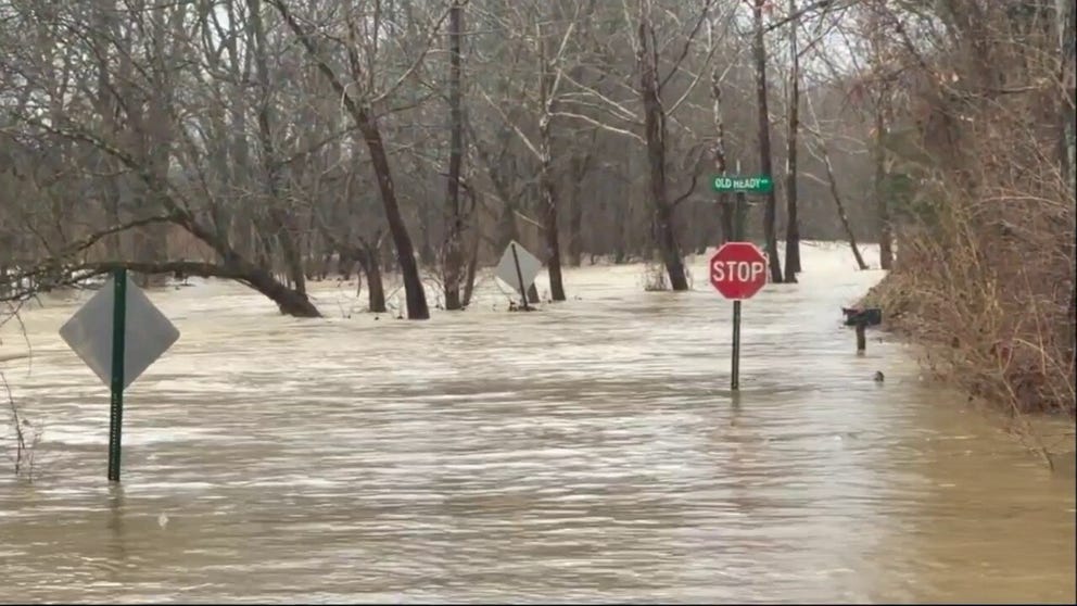
In Kentucky, floodwater can be seen rising halfway up a stop sign. Footage also shows the flood being powerful enough to quickly carry debris down the current.
Debris swept through rushing floodwater in Kentucky
Video posted by photographer Kurtis Ryan Coady on Tuesday shows debris, including a hay bale and trash can, rushing through floodwater after heavy rains in Fisherville.
Roads also flooded in Lexington, Kentucky. Video captured on Tuesday showed vehicles driving through and splashing water several feet high.
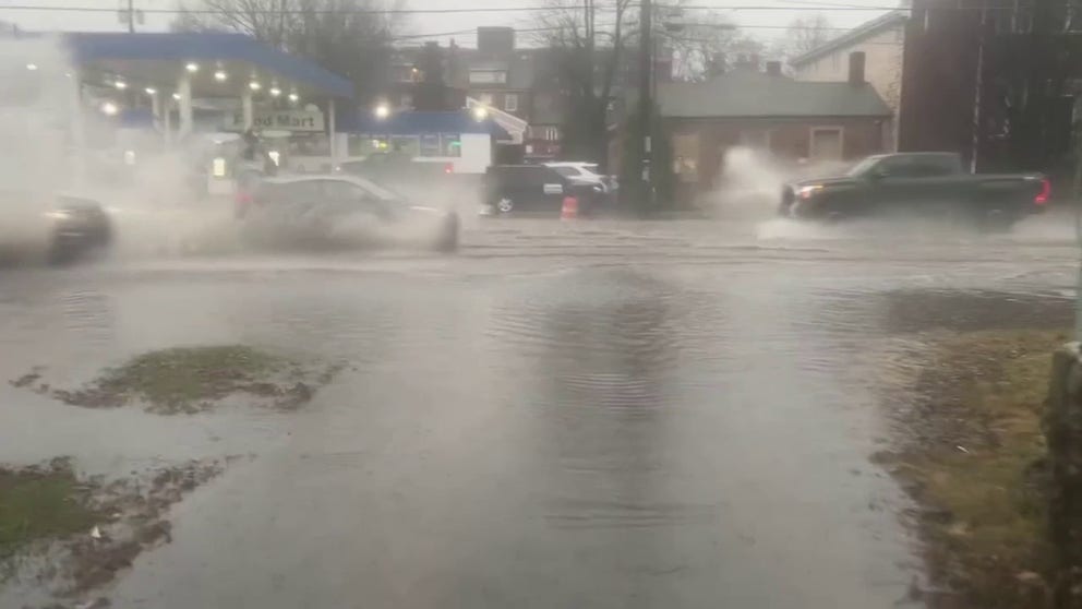
Flooding strikes Lexington, Kentucky
Video posted to Twitter by @ReelistDavid shows vehicles splashing floodwater on West Main Street in Lexington, Kentucky.
Northeastern Mississippi also experienced heavy rain. As a precursor to the storm, the city of Saltillo was the site of a shelf cloud sighting.
Shelf cloud looms over Tupelo, Mississippi, as severe weather hits
Video taken by Lee Lemmons shows the storm approaching and hitting Saltillo, part of the greater Tupelo region, on Tuesday. Saltillo and Tupelo were put under a severe thunderstorm warning until 10:15 am with the NWS advising of possible pea-sized hail.
According to the National Weather Service, shelf clouds are usually associated with a solid line of storms, with wind and then rain following behind.
A funnel cloud was spotted in central Alabama.
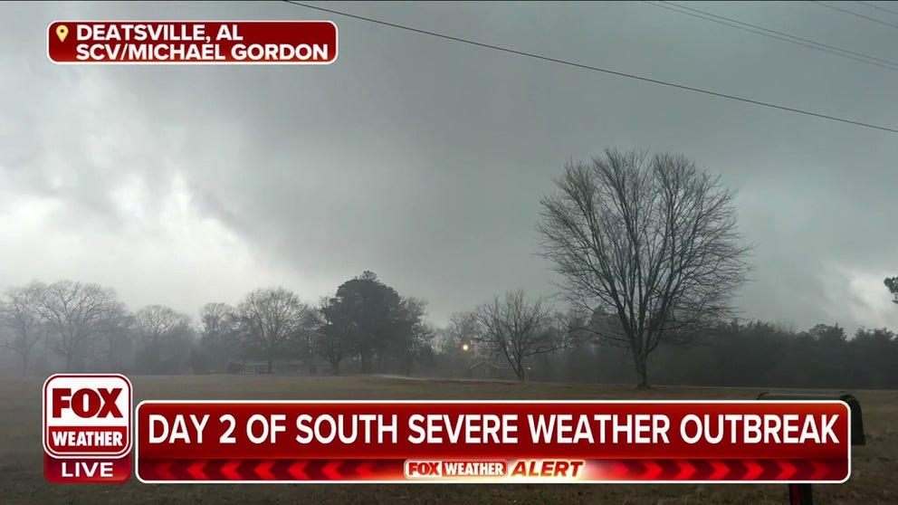
Funnel cloud spotted in central Alabama
Funnel cloud emerges in Deatsville, Alabama on Tuesday on the second day of a severe weather outbreak to hit the South.
As the dark, gray cloud looms over the town of Deatsville, trees can be seen with their branches swaying in the wind, and debris and rain being blown about.
Five areas in central Alabama were identified with likely tornado damage on Tuesday, the NWS said. Thomas Parker captured some footage showing debris scattered across the ground near Marion, in Perry County.
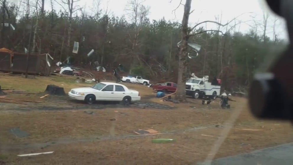
'Likely tornado damage' identified in central Alabama
Footage by Thomas Parker shows storm debris scattered across the ground near Marion, in Perry County.