Volcanic eruption in Papua New Guinea visible from space
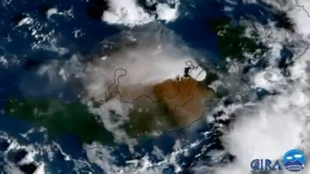
Japan's Himawari 9 satellite showed the plume of ash and steam billowing from Mt. Ulawun on the northern side of the island just after sunrise Tuesday.
Satellite imagery shows powerful Mt. Ulawun volcanic eruption in Papua New Guinea
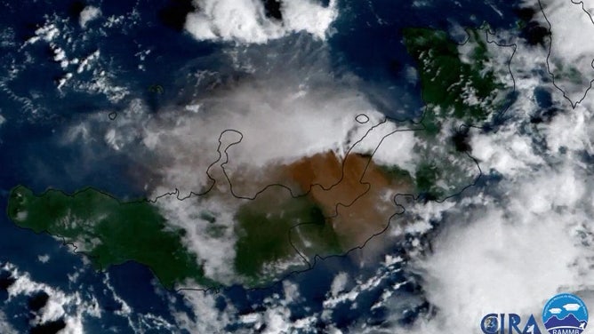
Mt. Ulawun erupted in Papua New Guinea Tuesday, sending an ash and steam plume miles high across the region and snarling local air traffic. (Satellite courtesy: NOAA / CIRA)
PORT MORESBY, Papua New Guinea – Weather satellites captured the eruption of Mt. Ulawun volcano in Papua New Guinea on Tuesday, sending some ash across the islands and snarling local air traffic.
Japan's Himawari 9 satellite showed the plume of ash and steam billowing from the northern side of the island just after sunrise Tuesday.
WHAT HAPPENS BEFORE A VOLCANO ERUPTS?
The island’s Air Niugini airline posted on Tuesday it had suspended all flights to Hoskins Airport "due to volcanic ash fall on the runway and taxiways, and in the vicinity of the airport."
Japans Himawari 9 weather satellite captures the eruption of Mt. Ulawun on Nov. 21, 2023.
(NOAA)
Ash particles are harmful to planes and their engines, and air traffic is routinely halted or diverted around any ash clouds.
CAN VOLCANIC ERUPTIONS AFFECT THE WEATHER?
The island’s Geohazards Monitoring Division has since downgraded the volcano to a Level 1 alert as activity has waned in the hours since its latest eruption, though the volcano is still active.
Papua New Guinea is home to 79 volcanoes, of which 19 are considered active as they sit along the Pacific Rim’s "Ring of Fire."