Tsunami detection along the Pacific Ring of Fire gets a boost from new satellite technology
Low-frequency sound and gravity waves make their way into the ionosphere after a tsunami is triggered, and the evolving technology would detect those ripples and warn of a potentially deadly tsunami was triggered
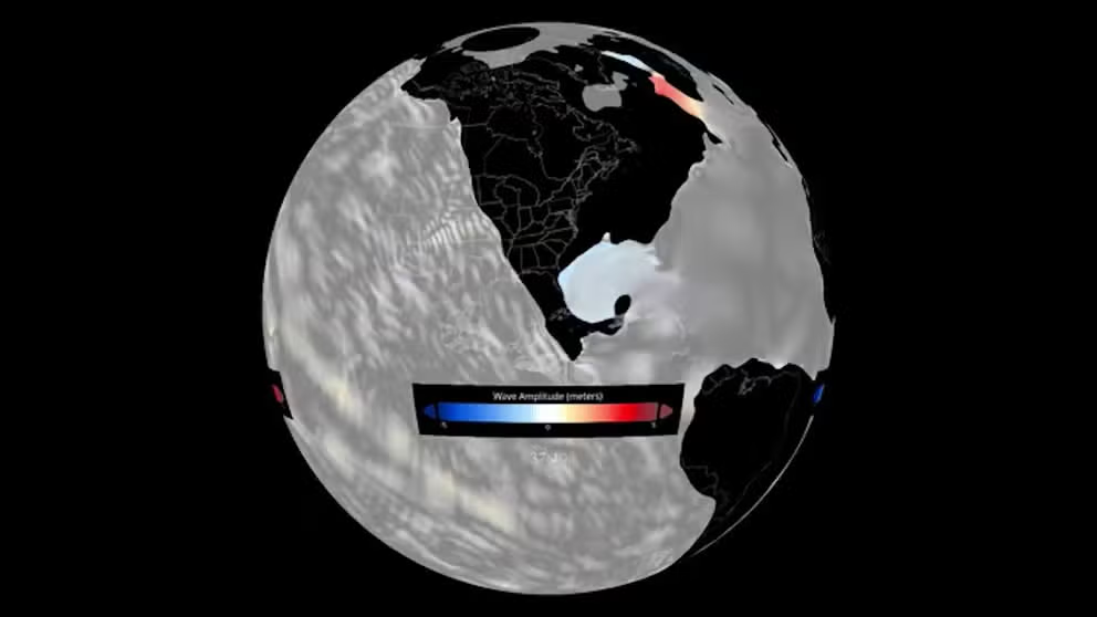
NOAA simulates tsunami from dinosaur-killing asteroid
A 6-mile-wide asteroid struck the Earth some 66 million years ago and generated a tsunami that created waves 2.5 miles high as it crashed ashore. NOAA has now created a simulation of the event. (NOAA Video)
Tsunamis caused by earthquakes, volcanoes or other events can destroy coastal communities around the world, and now scientists at NASA’s Jet Propulsion Laboratory are testing new ways to detect the deadly ocean waves from the far reaches of the atmosphere.
The new, experimental monitoring system, GUARDIAN (GNSS Upper Atmospheric Real-time Disaster Information and Alert Network), can use data from clusters of GPS and other satellites that orbit Earth.
According to the JPL, radio signals from the global navigational satellite systems are examined by scientific ground stations around the world. That information is reviewed by the JPL’s Global Differential GPS network, which improves real-time positional accuracy down to only a few inches.
From there, the system can search for clues that a potentially deadly tsunami has been triggered somewhere on Earth.
RESEARCHERS TAP ARTIFICIAL INTELLIGENCE TECHNOLOGY FOR DEVELOPMENT OF TSUNAMI WARNING SYSTEM
How can the technology detect tsunamis?
It’s not only water that’s displaced by a tsunami.
When a tsunami occurs, copious amounts of ocean water rise and fall in unison, displacing a significant amount of air above it.
That displaced air then moves out in all directions in the form of low-frequency sound and gravity waves, according to the JPL. Those ripples reach the ionosphere in a short period of time, and the clash of pressure waves with charged particles can then distort the signals from nearby navigational satellites.
Léo Martire, a JPL scientist developing GUARDIAN, said that while navigation tools usually correct ionospheric disturbances, scientists can use them to warn of tsunamis.
"Instead of correcting for this as an error, we use it as data to find natural hazards," Martire said in a news release.
9.0 QUAKE ROCKED THE PACIFIC COAST 323 YEARS AGO AND SENT AN ‘ORPHAN TSUNAMI’ TO JAPAN
System could give an additional hour of tsunami lead time
Martire, who co-chairs a task force within the United Nations' International Committee on GNSS, said the technology is still evolving. But the committee is exploring how it can be used to develop early warning strategies, according to the news release.
The near-real-time data would need to be interpreted by experts, but it's one of the fastest monitoring tools and can produce details about a potential tsunami in about 10 minutes.
That, officials say, could provide as much as an hour of advanced warning for people in danger depending on the tsunami's location from shore.
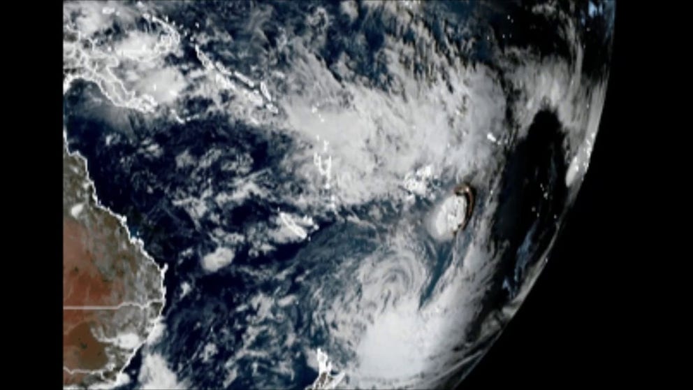
Satellite imagery shows eruption near Tonga as tsunami warned
A tsunami alert was in place for Tonga on January 15 after a large volcanic eruption near the Pacific nation. The Hunga Tonga-Hunga Ha’apai volcano’s eruption could be seen from space, in these images from Japan’s Himawari satellite.
"We envision GUARDIAN one day complementing existing ground- and ocean-based instruments such as seismometers, buoys, and tide gauges, which are highly effective but lack systematic coverage of the open ocean," JPL development team member Siddharth Krishnamoorthy said.
The JPL said that the GUARDIAN team is currently only focusing on the Pacific Ocean's Ring of Fire, as around 78% of the more than 750 confirmed tsunamis between 1900 and 2015 occurred in that region, according to NOAA data.
The JPL said that the GUARDIAN team is developing a website to allow scientists to investigate data from the ionosphere. From there, the JPL said users could access the data from about 90 stations along the Ring of Fire to find the potentially life-saving information that a tsunami was triggered.
Eventually, the JPL said, coverage will hopefully be expanded to a point in which the information would automatically flag hazards such as tsunamis, earthquakes and volcanic eruptions.