Look: Golf ball-size hailstones pelt Illinois, Iowa as severe thunderstorms roll through
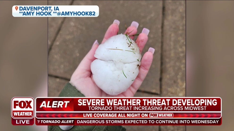
Large hail reports first came in as the storm rolled through Cedar Rapids and Davenport in Iowa. Hail stones reached the size of ping pong balls in Cedar Rapids, growing to reports of 2.5-3-inch-diameter stones in Davenport -- matching about the size of tennis balls to baseballs.
Huge hailstones fall in Chicago suburb during severe storms
Check out these huge hailstones that fell in a Chicago suburb during severe storms Tuesday afternoon.
DAVENPORT, Iowa. -- Massive hailstones the size of golf balls, tennis balls or even the size of a softball have been reported in Iowa and Illinois on Tuesday afternoon as powerful thunderstorms rolled through the region.
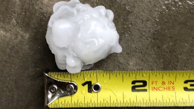
Baseball-sized hail in eastern Iowa
Baseball-sized hailstones confirmed in Davenport, Iowa on Tuesday.
Large hail reports first came in as the storm rolled through Cedar Rapids and Davenport in Iowa. Hail stones reached the size of ping pong balls in Cedar Rapids, growing to reports of 2.5-3 inch-diameter stones in Davenport -- matching about the size of tennis balls to baseballs.

(FOX Weather)
HOW LARGE IS GOLF-BALL SIZED HAIL? AND OTHER HAIL MEASUREMENTS
One report out of Davenport reported a hailstone of 4 inches in diameter -- about the size of a softball or grapefruit.
![Large hail is seen in Davenport, Iowa, on Tuesday, April 4, 2023.]() Image 1 of 5
Image 1 of 5Large hail is seen in Davenport, Iowa, on Tuesday, April 4, 2023. (@amyhook82 / Twitter)
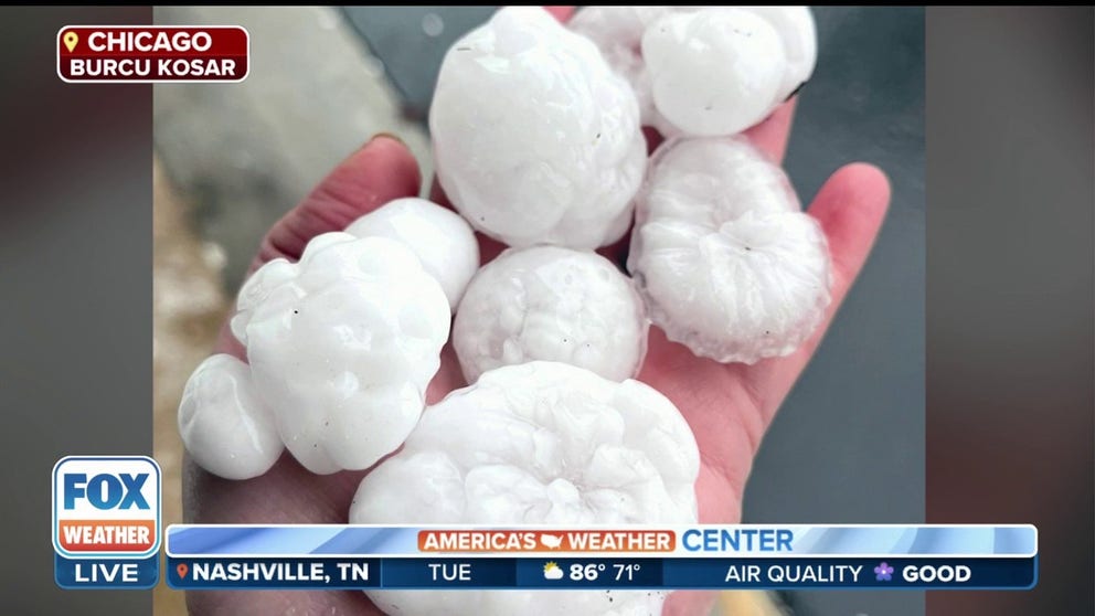
![Hail in Chicago area]() Image 2 of 5
Image 2 of 5Large hailstones fall during severe thunderstorms in Oswego, Illinois near Chicago on April 4, 2023. (Burcu Kosar / @Burcu_Kosar on Twitter)
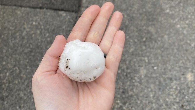
![Hail in Aurora, Illinois]() Image 3 of 5
Image 3 of 5Large hail found as severe thunderstorms rolled through North Aurora, Illinois on April 4, 2023. (Randall David / @theonlyRanRan on Twitter)
![Hail in Aurora, Illinois]() Image 4 of 5
Image 4 of 5Large hail found as severe thunderstorms rolled through Aurora, Illinois on April 4, 2023. (Jessica Neill / @congoblue on Twitter)
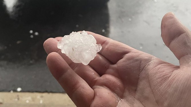
![@ScottPavel / Twitter]() Image 5 of 5
Image 5 of 51.5-inch diameter hail found as severe thunderstorms rolled through Aurora, Illinois on April 4, 2023. (@ScottPavel / Twitter)

The storms rolled into northern Illinois with large hail continuing. Madlen and New Bedford reported ping-pong- to golf-ball-sized hailstones. A spotter in the western Chicago suburbs showed several hailstones of golf ball size with some even larger. A report from Jefferson Park in the heart of the Chicago suburns reported ping pong-sized hail.
HOW TO WATCH FOX WEATHER ON TV
The storms were aiming for the Chicago metro area with Severe Thunderstorm Warnings in effect for over 8 million people. In addition to large hail, strong wind gusts of 50-70 mph are likely. Moline was hit a gust of 90 mph earlier in the day.

Large hailstones fall during severe thunderstorms near Chicago on April 4, 2023.
(Burcu Kosar / FOX Weather)
Penny-sized hail and thunderstorms wreaked havoc on air travel in the Chicago area as the storms moved in early Tuesday afternoon. Ground stops were in effect at busy O'Hare Airport and some incoming flights diverting to Indianapolis as the storms approached and moved through.
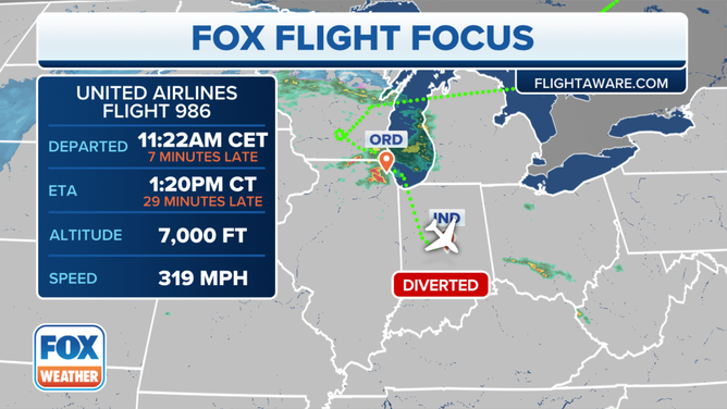
Inbound flight to Chicago's O'Hare Airport diverted to Indianapolis as severe thunderstorms hit the Chicago area on April 4, 2023.
(FOX Weather)
These storms were just the first salvos of what's expected to be a very active night across the western Great Lakes and Mississippi Valley with a potential severe weather and tornado outbreak likely overnight into Wednesday.