

Northern Plains brace for explosive storms as severe threats increase with damaging winds and large hail
Damaging wind gusts higher than 75 mph will be possible.
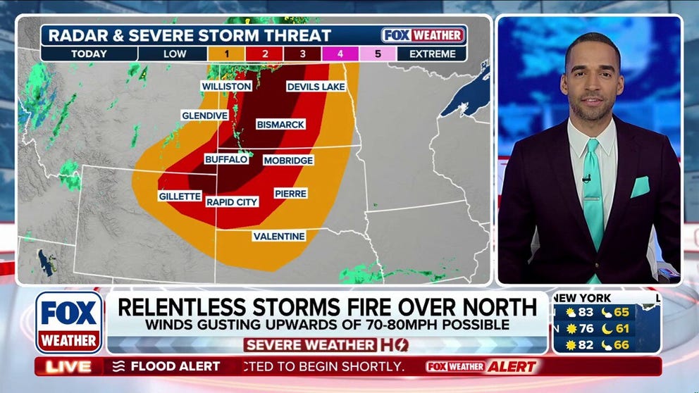
Explosive storms target Northern Plains with 80 mph winds and damaging hail
Strong to severe storms continue to target the Northern Plains, with explosive development expected by this afternoon. Winds upwards of 70 to 80 mph and egg-sized hail are both possible, as a Level 3 threat has been issued across parts of North Dakota and South Dakota. Latest:
Severe storms have reignited in the Northern Plains, bringing a risk for large hail and damaging winds after a week of severe thunderstorms blasted the Central U.S.
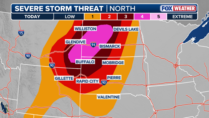
A rare Level 4 out of 5 severe storm threat issued for damaging winds in the Northern Plains Sunday night.
(FOX Weather)
A rare Level 4 out of 5 severe storm threat has been issued for portions of the Northern Plains through Sunday night.
As well, a Particularly Dangerous Situation (PDS) Severe Thunderstorm Watch has been issued for the region. The biggest threat will be damaging winds, according to the FOX Forecast Center.
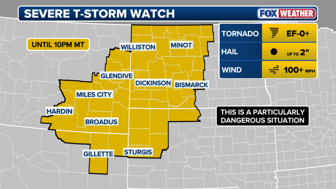
A Particularly Dangerous Situation (PDS) Severe Thunderstorm Watch has been issued for parts of the Plains.
(FOX Weather / FOX Weather)
Today's severe weather threat shifts further east, bringing a Level 4 out of 5 threat across parts of North and South Dakota, where winds upwards of 100 mph and egg-sized hail are both possible.
On Sunday, daytime hours will be nice and breezy, but the late afternoon and evening hours are when the storms roll in and become more intense.

Rain clouds outside Wimbledon, North Dakota, US, on Wednesday, June 15, 2022.
( Ben Brewer/Bloomberg / Getty Images)
As a powerful upper-level system lifts out of the Rockies and pushes a cold front eastward, severe storms will rapidly ignite across parts of Montana and North Dakota.

(FOX Weather)
A Tornado Watch has been issued through 7 p.m. CT for parts of Missouri and Arkansas.
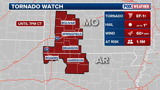
Tornado Watches issued in the Northern Plains on Sunday.
An increasing wind threat has placed a Level 3 out of 5 severe storm threat in effect for parts of northeastern Wyoming, far southeastern Montana, northwestern/western South Dakota, and much of North Dakota on Sunday.
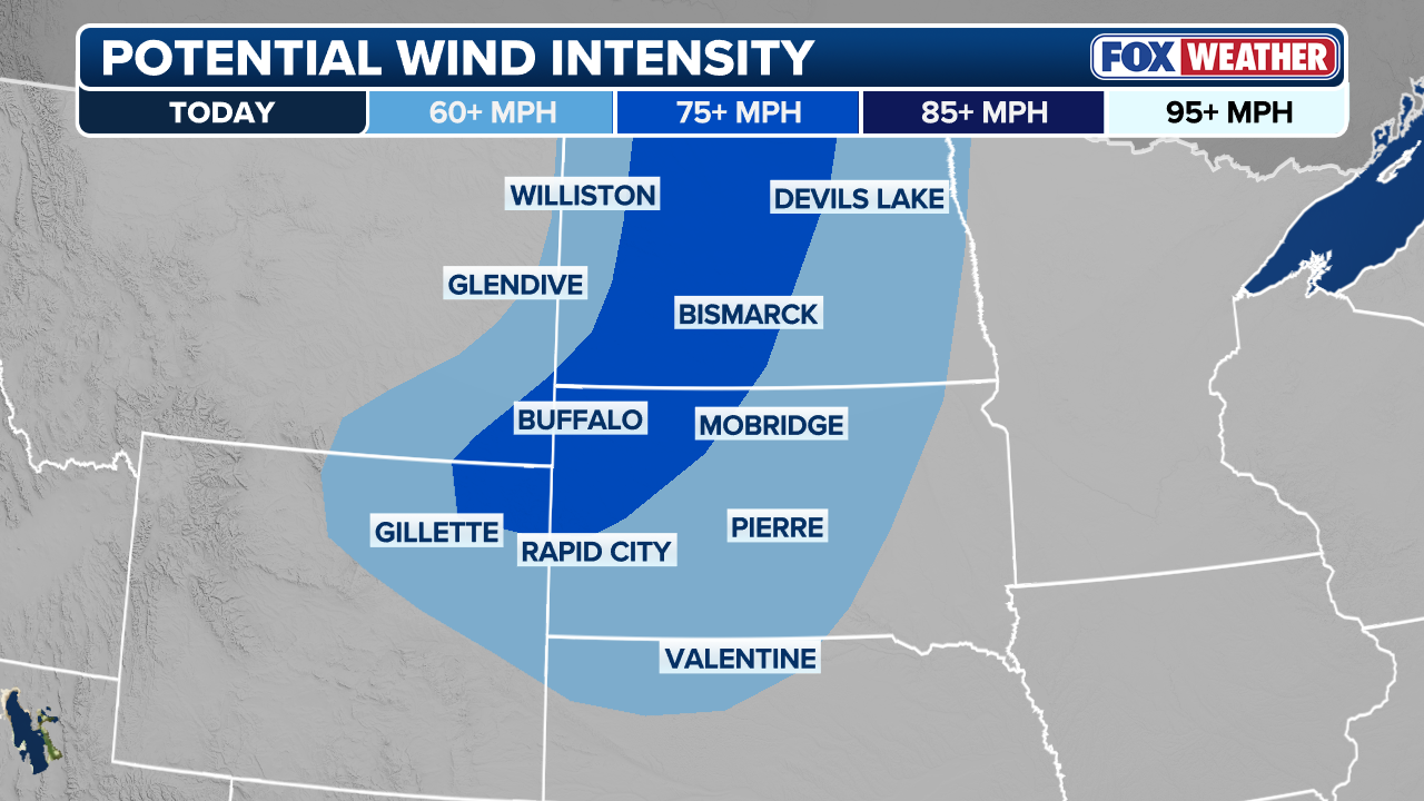
(FOX Weather)
That said, into Sunday night, the main concern for cities like Bismarck will be a transition from initial discrete supercells capable of large, damaging hail to a fast-moving line of storms.
This convective line will bring an increasing threat of severe, damaging wind gusts into the overnight hours.
Damaging wind gusts higher than 100 mph will be possible.
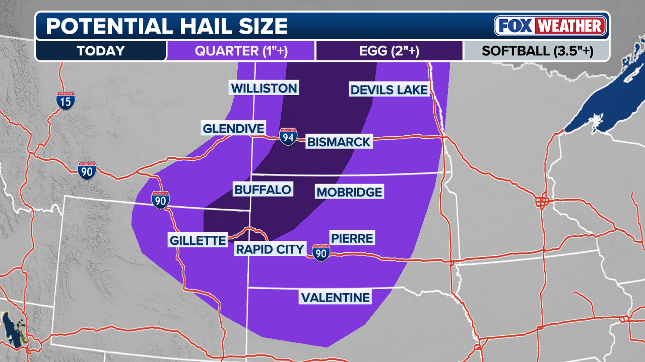
(FOX Weather)
By early next week, severe storm coverage is expected to expand across the region as a new weather system arrives, bringing a renewed threat of severe weather, the FOX Forecast Center said.
WHAT IS A SUPERCELL THUNDERSTORM?
Stay tuned to FOX Weather for the latest severe weather coverage.