Coastal flooding from Christmas blizzard could reach up to 3 feet in parts of Northeast on Friday
Flood levels are forecast to be among the top 10, and in some cases the top 5, on record along the south shore of Long Island, the Jersey Shore and the Connecticut coast.
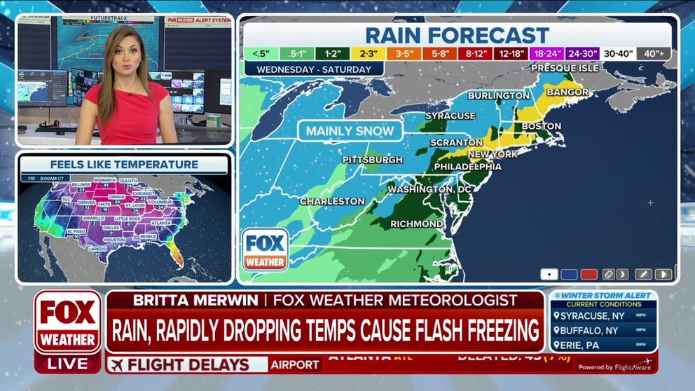
Rain, rapidly dropping temperatures may cause flash freezing in Northeast
Flash freeze will make any wet surfaces dangerously icy beginning Friday evening, creating hazardous road travel on Saturday.
A powerful storm that will bring rain, snow, bitter cold and damaging winds to the Northeast this week will also lead to coastal flooding along much of the region's coast.
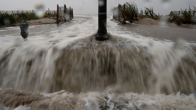
Coastal flood alerts have been issued across much of the Northeast and New England coasts, where forecasters are warning of nearly 3 feet of flooding in some places due to the powerful winds produced by the storm that will soon become a bomb cyclone. Most locations covered by the alerts will see up to 2 feet of flooding.

(FOX Weather)
This comes in the absence of blizzard conditions on the warm side of the dangerous winter storm that is walloping the Midwest and Great Lakes as it begins to spread toward the East Coast ahead of the Christmas holiday weekend.
The FOX Forecast Center said windswept rain is expected Friday in the Northeast as powerful winds blast the region with widespread 50-plus-mph wind gusts.
In addition, 60- to 70-mph gusts cannot be ruled out with the passage of the arctic cold front Friday into Friday night. Some power outages are likely for parts of the Northeast, and more widespread outages are possible in interior portions of the region.

(FOX Weather)
The strong onshore winds at the coast will lead to a flood event along south-facing coasts, especially with the Friday morning high tide.
Flood levels were forecast Wednesday to be among the top 10, and in some cases the top 5, on record along the south shore of Long Island, the Jersey Shore and the Connecticut coast. Freeport was forecast to be at levels that would've come in second behind Superstorm Sandy. On Thursday, forecasts lowered the flood threat a bit because of an expected weakening or change in direction of the winds at the time of high tide.
Even after the rain ends, the dangers will not end. Rapidly dropping temperatures will quickly freeze up any water that remains on the roads, leading to treacherous driving conditions from Friday night into at least Saturday.

(FOX Weather)
Sandy's storm surges reached over 12 feet
The forecast flooding levels for this storm are far below what was experienced during Superstorm Sandy a little more than 10 years ago.
Sandy crashed ashore near Atlantic City, New Jersey, on Oct. 29, 2012, killing more than 100 people and causing billions of dollars in damage.
The New York City tri-state area and the Jersey Shore were struck by the core of Sandy, but the superstorm’s effects extended thousands of miles away from its center.
Kings Point, New York, on the north shore of Long Island, recorded a massive storm surge of 12.65 feet. In Manhattan, the water level at Battery Park climbed to nearly 14 feet.
Closer to Sandy's landfall location, the casino-lined boardwalk in Atlantic City, New Jersey, suffered damage as almost 9 feet of water rushed onto the barrier island. And the iconic boardwalk in Seaside Heights, New Jersey, fell into the ocean after it was unable to withstand Sandy's intense storm surge.
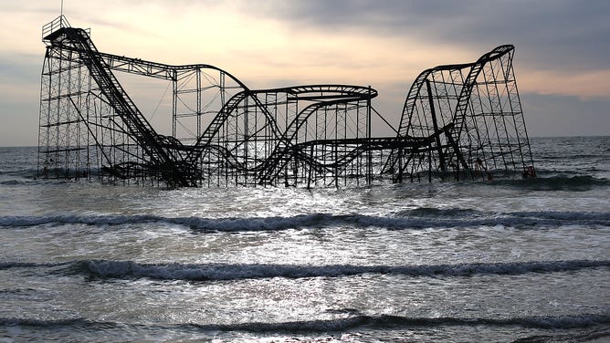
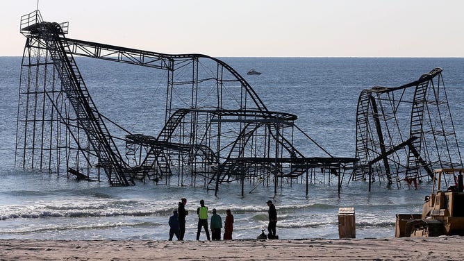
![The Star Jet roller coaster remains in the water after the Casino Pier it sat on collapsed from the forces of Superstorm Sandy.]() Image 1 of 10
Image 1 of 10The Star Jet roller coaster fell into the water after the Casino Pier it sat on collapsed from the forces of Superstorm Sandy in Seaside Heights, New Jersey. (Mark Wilson)
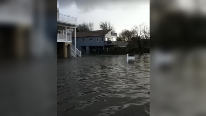
![]() Image 2 of 10
Image 2 of 10Kenneth Miller's flooded home in Waretown, New Jersey after Superstorm Sandy. (Kenneth Miller)
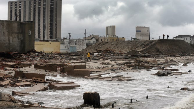
![]() Image 3 of 10
Image 3 of 10People stand on a mound of construction dirt to view the area where a 2,000-foot section of the "uptown" boardwalk was destroyed by flooding from Hurricane Sandy on October 30, 2012 in Atlantic City, New Jersey. (Mario Tama)
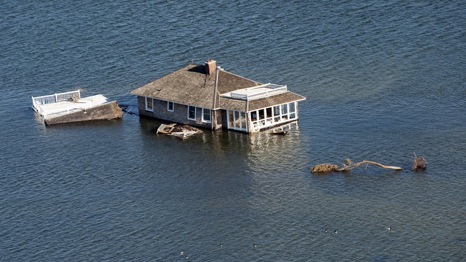
![Aerial views of a house that was moved off its foundation and sits in the middle of the bay near Mantaloking, New Jersey after Superstorm Sandy hit.]() Image 4 of 10
Image 4 of 10Aerial views of a house that was moved off its foundation and sits in the middle of the bay near Mantaloking, New Jersey after Superstorm Sandy hit. (Debra L Rothenberg)
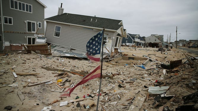
![]() Image 5 of 10
Image 5 of 10Sandy damaged and destroyed homes in this Jersey Shore neighborhood. (Mark Wilson)
![]() Image 6 of 10
Image 6 of 10Waters from Hurricane Sandy start to flood Beach Ave. on October 29, 2012 in Cape May, New Jersey. (Mark Wilson)
![Workers prepare to remove the Star Jet roller coaster that has been in the ocean for six months after the Casino Pier is sat on collapsed when Superstorm Sandy hit, May 14, 2013 in Seaside Heights, New Jersey.]() Image 7 of 10
Image 7 of 10Workers prepare to remove the Star Jet roller coaster that has been in the ocean for six months after the Casino Pier is sat on collapsed when Superstorm Sandy hit, May 14, 2013 in Seaside Heights, New Jersey. (Mark Wilson)
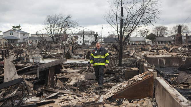
![Superstorm Sandy wiped out many homes in NYC's Breezy Point borough with both water and fire.]() Image 8 of 10
Image 8 of 10Superstorm Sandy wiped out many homes in NYC's Breezy Point borough with both water and fire. (Robert Nickelsberg)
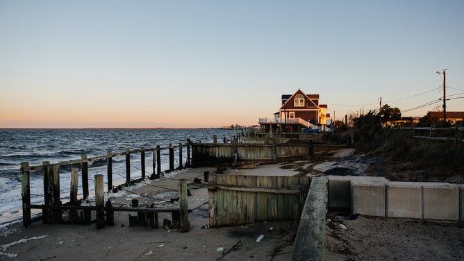
![]() Image 9 of 10
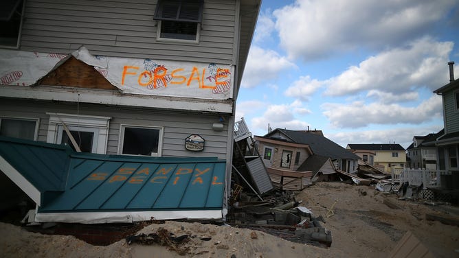
Image 9 of 10Sunrise is seen on a home foundation overtaken by vegetation at Fortescue Beach in Fortescue, New Jersey on Wednesday, October 18, 2022. (Michelle Gustafson for The Washington Post)
![]() Image 10 of 10
Image 10 of 10Six months after Sandy ruined homes and debris still litter the Jersey Shore. (Mark Wilson)
Editors note: An earlier version of this story indicated that the forecast flooding levels would rival Superstorm Sandy. This story has been updated to remove that wording based on the latest forecast details.