Historic winter storm slams California with life-threatening flooding, snow
Five to around ten inches of rain fell in some valleys and some mountain regions of California reported more than 5 feet of snow. The storm system that produced the winter weather was triggered severe storm in the Plains on Sunday.
Historic storm brings heavy rain, mountain snow to California
A historic storm system that slammed California with heavy rain and mountain snow is winding down as crews begin to assess the damage left behind.
LOS ANGELES – A historic storm system that slammed the Golden State with heavy rain and mountain snow is beginning to let up along the West Coast as crews assess the damage left behind by the winter wallop.
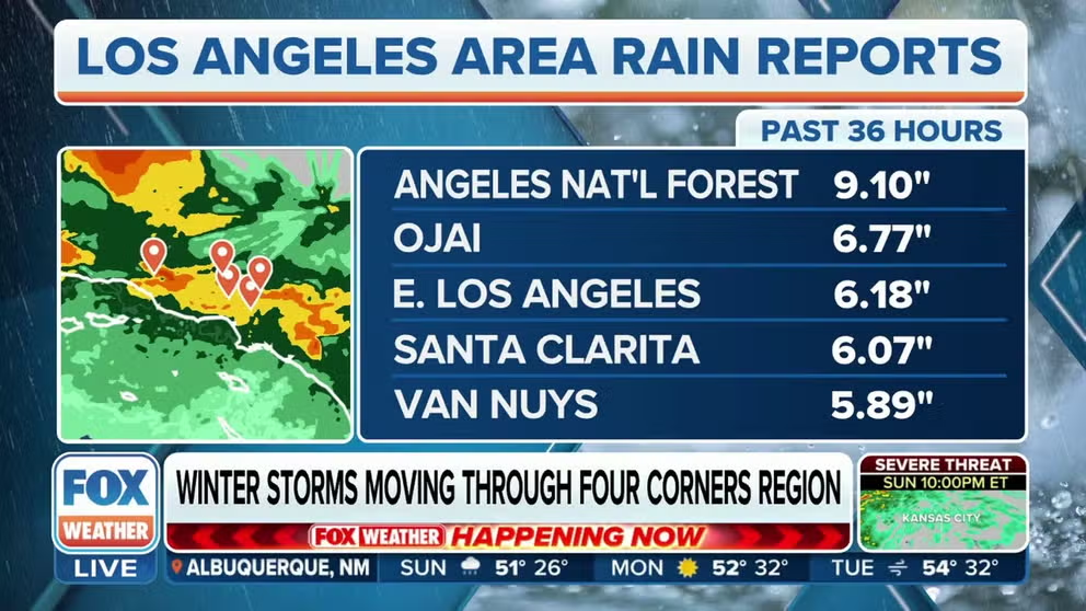
At the peak of the storm, millions were under winter alerts and flood advisories as 5"-10" of rainfall fell in the lower elevations and more than 5 feet of snow fell in the mountains.
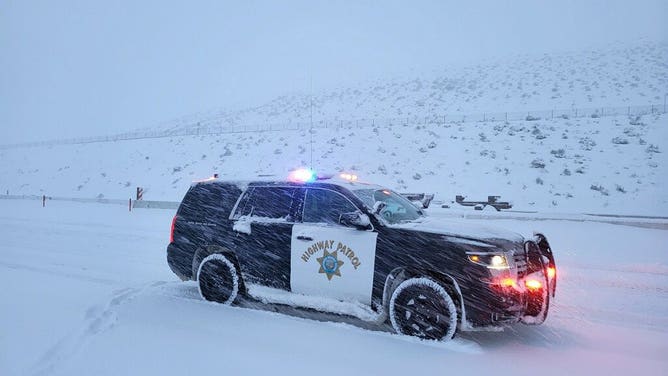
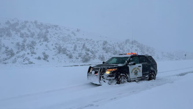
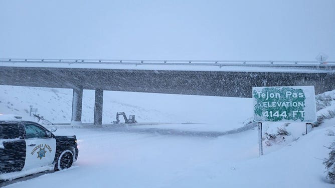
The snow made areas along Interstate 5 north of Los Angeles look like a winter wonderland, which shut down traffic for extended period.
The National Weather Service office in San Diego issued its first-ever Blizzard Warning on Friday, while the Los Angeles NWS office issued its first Blizzard Warning in 34 years and warned some residents to stay off the roads.
WHAT MAKES A BLIZZARD DIFFERENT FROM AN ORDINARY SNOWSTORM?
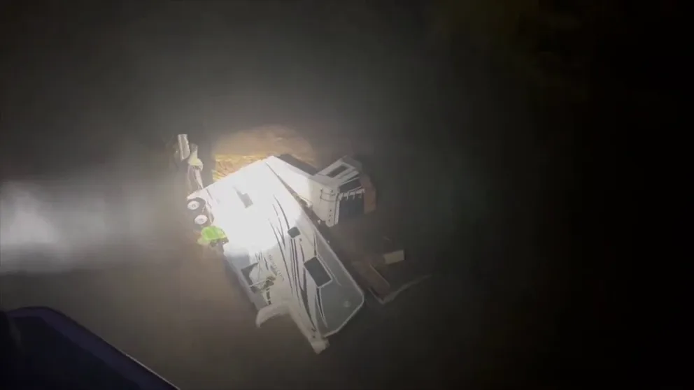
![California snow]() Image 1 of 5
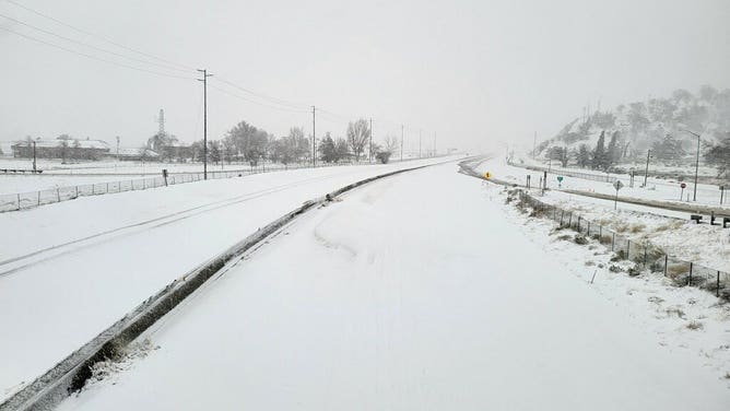
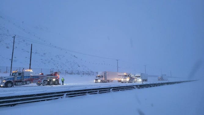
Image 1 of 5The Grapevine in Central California was closed due to heavy snow and ice. (chp)
![California snow]() Image 2 of 5
Image 2 of 5The Grapevine in Central California was closed due to heavy snow and ice. (CHP)
![California snow]() Image 3 of 5
Image 3 of 5The Grapevine in Central California was closed due to heavy snow and ice. (CHP)
![California snow]() Image 4 of 5
Image 4 of 5The Grapevine in Central California was closed due to heavy snow and ice. (CHP)
![California snow]() Image 5 of 5
Image 5 of 5The Grapevine in Central California was closed due to heavy snow and ice. (CHP)
The NWS also issued Blizzard Warnings for higher elevations across Santa Barbara and Fresno counties. Yosemite and Sequoia National Parks are included in the Blizzard Warnings as well. The FOX Forecast Center warned that 80-mph wind gusts could have resulted in wind chills values of 35 degrees below zero, which can cause frostbite on exposed skin in just minutes.
Bitterly cold temperatures helped dropped snow levels to as low as 1,000 feet, which meant communities that typically never see snow were slipping and sliding across the coastal ranges.
WHAT WERE THE IMPACTS IN LOS ANGELES COUNTY THE LAST TIME A BLIZZARD WARNING WAS ISSUED IN 1989?
The NWS office in Los Angeles said after a little investigating – and with the help of the ALERT California cameras – it is "confident in saying snow or graupel fell on Mt. Lee," where the Hollywood sign sits, on Thursday morning.
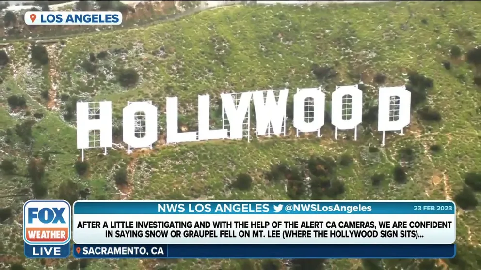
Snow or graupel fell on Hollywood sign in Los Angeles
Snow or graupel fell on Mt. Lee where the Hollywood sign is on Thursday as a winter storm moves across California.
The treacherous conditions forced the temporary closure of the Yosemite National Park, in the Sierra Nevada Mountains. Rangers said they won't reopen until March 1.
Running Springs, in the San Bernardino Mountains, reported one of the highest snowfall amounts, with more than 5 feet of new powder in just 24 hours.
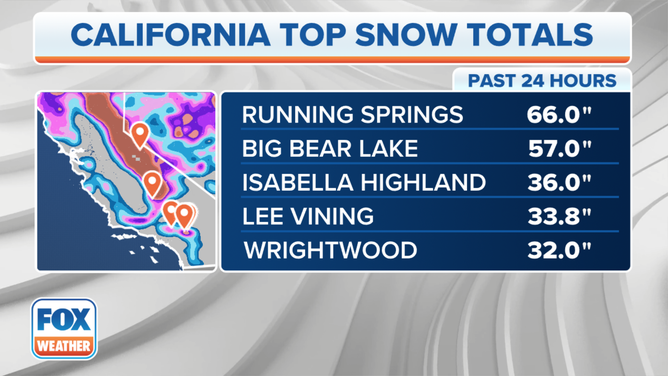
California snowfall totals
(FOX Weather)
Where it didn't snow it rained and there was plenty of it
Rain became widespread Friday and Saturday before slowly diminishing as the storm system pushed eastward.
Rainfall totals topped 5 inches in many communities as the system tapped into deep Pacific moisture.
The heavy rainfall made some freeways resemble rivers in Los Angeles and Ventura counties.
Ventura County deputies resorted to helicopters to monitor the flooding, but fortunately the agency did not report any fatalities associated with the event.
The FOX Forecast Center warned that some rivers will be at risk of exceeding flood stage, but didn't expect a repeat of the January floods from historic atmospheric river events.
Aerial video of flash flooding in Central California
Air patrols over Ventura County, California, following flooding rainfall in the central part of the state.
Unsettled weather pattern to continue in West
The FOX Forecast Center warned after a brief break a pair of storm systems would produce more rounds of rain and snow to finish the weekend and start the workweek.
Forecast models showed the potential for heavy snow for the Olympics, Cascades and Rockies. Between 2–3 feet were expected for the Olympics and Cascades, while smaller amounts were expected in the Rockies.
The second, more power storm system is on track to impact California during the workweek with 1-3" of rain in the valleys and several feet of snow in the higher elevations. And a third will follow.
Unlike the recent, historic system, impacts will be limited in the southern part of the state, with Central and Northern California receiving the bulk of the adverse weather.
WHAT'S THE DIFFERENCE BETWEEN A SNOW LEVEL AND A FREEZING LEVEL?
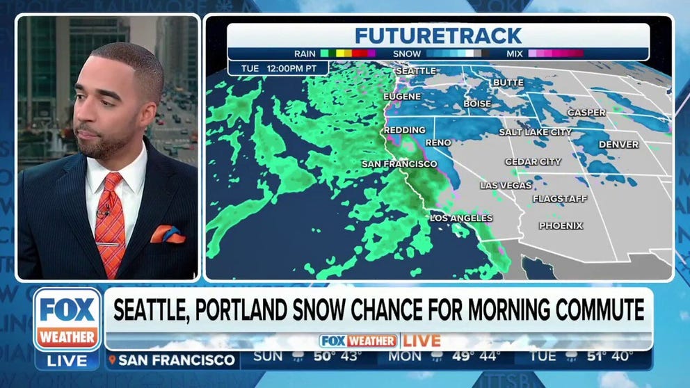
Three more rounds of rain and snow for winter weary West Coast
No rest for the weary. After unheard of snow at low elevations and flooding rains lashed at California just days ago, 3 more storms are on the way. Meteorologist Michael Estime times out the triple-play and gives forecast snow and rain totals from Washington to San Diego.