Weather could interfere with NASA's attempt to launch tropical satellites
The mission is part of CubeSat launches for NASA’s Time-Resolved Observations of Precipitation structure and storm Intensity with a Constellation of Smallsats (TROPICS) mission
NASA to launch satellite probes to study the tropics
NASA is launching satellite probes as early as this weekend to help study the tropics.
In an effort to better understand tropical weather, NASA will deploy six satellites to help monitor and study the formation and development of tropical cyclones.
NASA's TROPICS mission stands for Time-Resolved Observations of Precipitation structure and storm Intensity with a Constellation of Smallsats, and the acronym is very literal.
The first obstacle the CubeSats will have to overcome is finding enough clearance through Florida's daily showers and thunderstorms, which have been known to lead to lengthy delays because of launch restrictions.
Both Sunday's and Monday's launch windows could be impacted by nearby storms, according to the launch forecast.
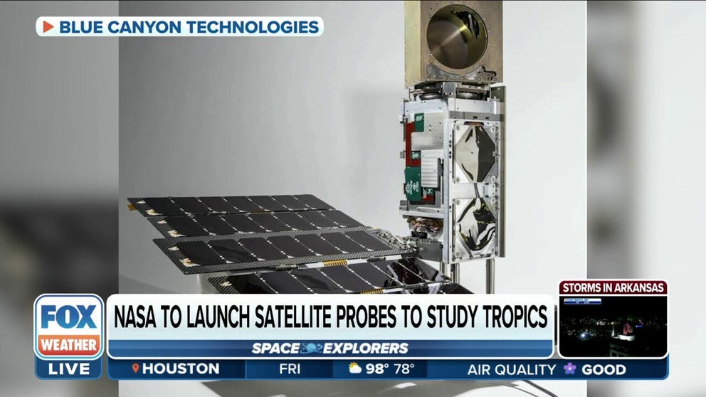
Once cleared for launch, the pair will be the first of six satellites built by Blue Canyon Technologies in Boulder, Colorado, to catch a ride aboard an Astra rocket from the Cape Canaveral Space Force Station.
The six CubeSats, weighing about 10 pounds apiece, will rapidly fly over the tropical cyclone belt, taking microwave measurements that will provide details of storm structure, thermodynamics and precipitation throughout the lifecycle of a tropical system.
NASA says if all launches are successful, the TROPICS satellites will be spread across three orbital planes to cover more of the globe more frequently.
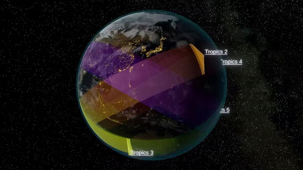
TROPICS Constellation orbit
The TROPICS constellation has two CubeSats in each of three orbital planes. (Video: Sean Loughran and Nick Zorn (MIT LL))
"TROPICS will give us very frequent views of tropical cyclones, providing insight into their formation, intensification, and interactions with their environment and providing critical data for storm monitoring and forecasting," said Scott Braun, a research meteorologist at NASA’s Goddard Space Flight Center in Greenbelt, Maryland.
SATELLITE THAT WILL HELP PREDICT EXTREME WEATHER HAS NEW LAUNCH DATE
The satellites will scan every hour, about four to six times more often than is possible with current satellites.
Scientists say the increased scans will help as "We’re missing a lot of what’s happening in the storm," said Bill Blackwell, principal investigator for the TROPICS.
The increased scans will provide more frequent updates and allow meteorologists to see each storm from beginning to end.
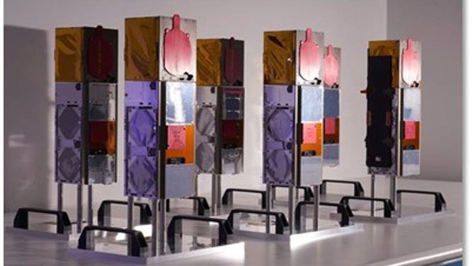
The TROPICS CubSat constellation. (Image by Blue Canyon Technologies)
An instrument aboard the satellites, known as a microwave radiometer, will help track water vapor, oxygen, and clouds in the atmosphere, all emitting energy as heat and light. NASA says the amount of heat and light – or radiance – at these frequencies comes from different altitudes, allowing the TROPICS satellites to create three-dimensional images of the cyclones’ environments.
"With the TROPICS constellation, we’ll have much more frequent observations of tropical cyclones and in wavelengths that can help us understand thermodynamic structure in the eye and in the storm environment," said Blackwell.
HERE’S WHY THE ATLANTIC HURRICANE SEASON RUNS FROM JUNE TO NOVEMBER
Scientists say the frequencies TROPICS uses are also very sensitive to characteristics of ice and clouds, which will help meteorologists study how tropical cyclones develop and intensify.
If successful, the satellites will join the TROPICS Pathfinder satellite, which has previously captured images of Hurricane Ida over the U.S., Cyclone Batsirai over Madagascar, and Super Typhoon Mindulle over eastern Japan.
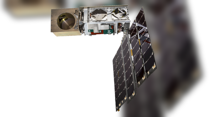
TROPICS Pathfinder satellite. (Image: Blue Canyon Technologies)
Track the weather in your area with the FOX Weather app. The free FOX Weather livestream is also available 24/7 on the website and app and on your favorite streaming platform. The FOX Weather Update podcast also provides weather information for the entire country.