Humans added to water cycle diagram for first time
A new depiction of the water cycle created by the U.S. Geological Survey now includes the role humans play in the availability of Earth’s most precious resource.
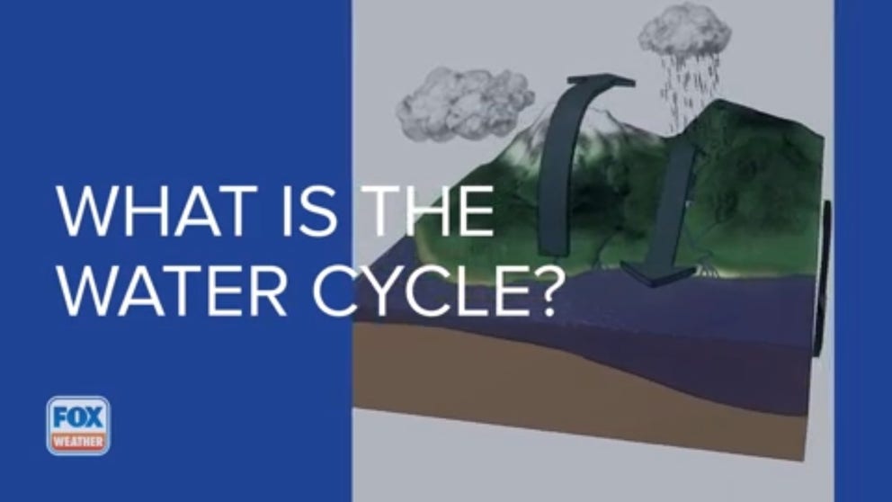
What is the water cycle?
Water is among the most precious resources on our planet. The water cycle depicts where water is stored and how it moves.
The diagram used by educators to teach students about Earth’s water cycle has gotten an update, and it now includes how humans affect the availability of our most precious resource.
The water cycle graphic developed by the U.S. Geological Survey shows where H2O is stored and how it moves about the planet whether it be as a solid, liquid or gas.
Until now, students have seen the water cycle depicted as a circular, natural process – water moving from the atmosphere to the ground to the ocean and back again.
7 WAYS TO CONSERVE WATER AT HOME DURING A DROUGHT
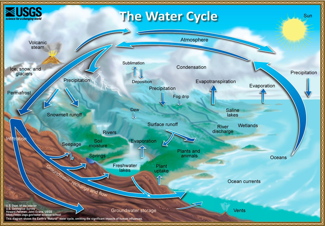
(USGS)
The reality is much more complex. In addition to the natural storage and movement of water, humans are a critical part of the system.
"So much about the water cycle is influenced by our actions, and it’s important that we clearly see the role that each of us can play in sustainable water use amid a changing climate," said Tanya Trujillo, the Department of the Interior’s Assistant Secretary for Water and Science.
The USGS has now released an updated water cycle diagram that moves away from a circular process and shows the intricacies of the interconnected system. Water still moves from the atmosphere to the ground to the ocean, but it has many more stops along the way. It now includes human-built features such as reservoirs, urban runoff and water use by farms, industries and cities.
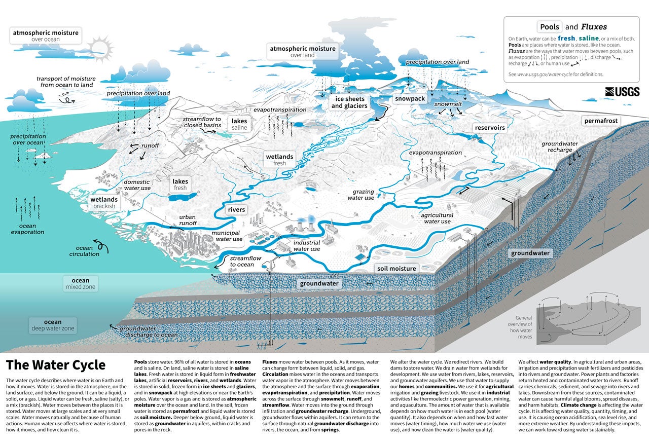
(USGS)
"This updated water cycle diagram will set a new international standard for how we visualize and communicate water’s complex journey on Earth, with the potential to better inform our next generation of scientists, natural resource managers and policymakers as they tackle the increasing challenge of sustainable water-resource management," said USGS Director David Applegate.
HOW TO WATCH FOX WEATHER ON TV
The new diagram also depicts how different landscapes, such as coastal plains and basins, are connected across a continent.
According to USGS, the diagram is available in both English and Spanish, but it will likely be translated into many other languages as it is used around the world just as the previous version was.