Winter storm to bring quick round of snow to upper Midwest, Great Lakes through midweek
Between 4 and 8 inches of snow is expected across a large portion of the upper Midwest
Quick-hitting snowmaker to sweep across the upper Midwest
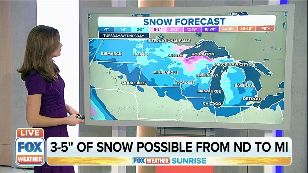
Three to five inches of snow is possible from North Dakota to Michigan.
A winter storm will spread snow and gusty winds across parts of the upper Midwest and Great Lakes through midweek.
The National Weather Service has issued Winter Weather Advisories from portions of the Dakotas into Minnesota, Iowa, Wisconsin, northern Illinois and northern and western Michigan. Winter Storm Warnings are in effect for parts of northern Wisconsin, the western Upper Peninsula of Michigan and western Lower Michigan.
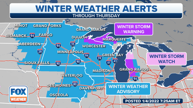
Winter weather alerts are in effect across the upper Midwest and Great Lakes.
(FOX Weather)
Snow will develop Tuesday afternoon from west to east across the Dakotas.
By Tuesday night, the snow will spread into the upper Midwest and Great Lakes from Minnesota to Wisconsin, the Upper Peninsula of Michigan and western Lower Michigan.
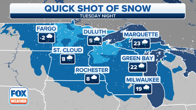
Forecast for Tuesday night, Jan. 4, 2022.
(FOX Weather)
On Wednesday, the winter storm will continue sliding eastward, with snow expected from parts of Minnesota into Wisconsin and Michigan.
Some lake enhancement will result in locally heavier snow downwind of lakes Michigan and Superior in portions of Michigan.
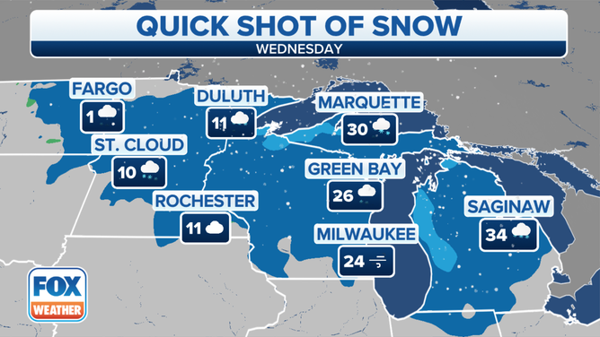
Forecast for Wednesday, Jan. 5, 2022.
(FOX Weather)
Between 4 and 8 inches of snow is expected across a large portion of the upper Midwest through Wednesday.
Locally higher amounts upward of a foot or more are possible in the lake-effect snowbelts south of Lake Superior in the Upper Peninsula of Michigan and extreme northern Wisconsin.
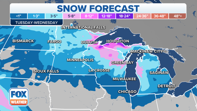
Snow forecast through Wednesday, Jan. 5, 2022.
(FOX Weather)
Additionally, gusty winds may result in areas of blowing and drifting snow, which means visibility could drop to near zero at times.
WHAT YOU SHOULD KNOW ABOUT BLOWING, DRIFTING SNOW
Wind gusts over 30 mph are forecast from the Northern Plains into the upper Midwest and Great Lakes Tuesday night into Wednesday.
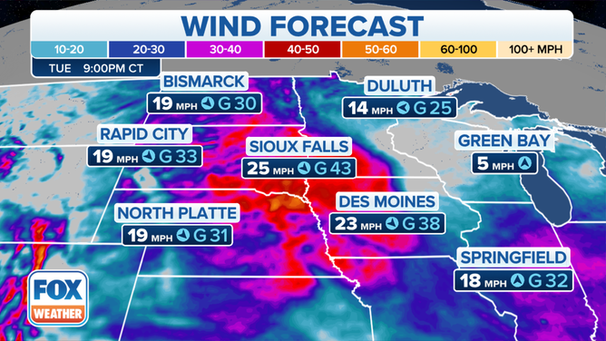
Wind forecast for Tuesday evening, Jan. 4, 2022.
(FOX Weather)