

Millions along I-95 corridor to see triple digit temps as dangerous heat returns to Northeast, Mid-Atlantic
The heat will drive the chance for strong to severe thunderstorms Friday into Saturday, bringing cooler temperatures, but also potential hazards like damaging wind gusts.
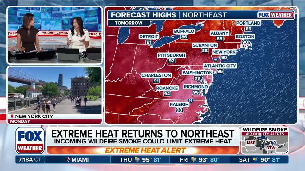
Extreme heat returns to Northeast, fuels severe storm chances
Dangerous temperatures have returned to the Northeast and Mid-Atlantic as some areas push toward the triple digits, accompanied by intense heat indices. Meanwhile, the conditions are setting the stage for chances of severe storms Friday into Saturday. Full forecast:
PHILADELPHIA — Intense heat is returning to millions across the Northeast and the Mid-Atlantic, with temperatures expected to approach triple-digits along the Interstate 95 corridor through Friday, a little more than a week after the deadly, record-setting July 4 heat wave scorched the region.
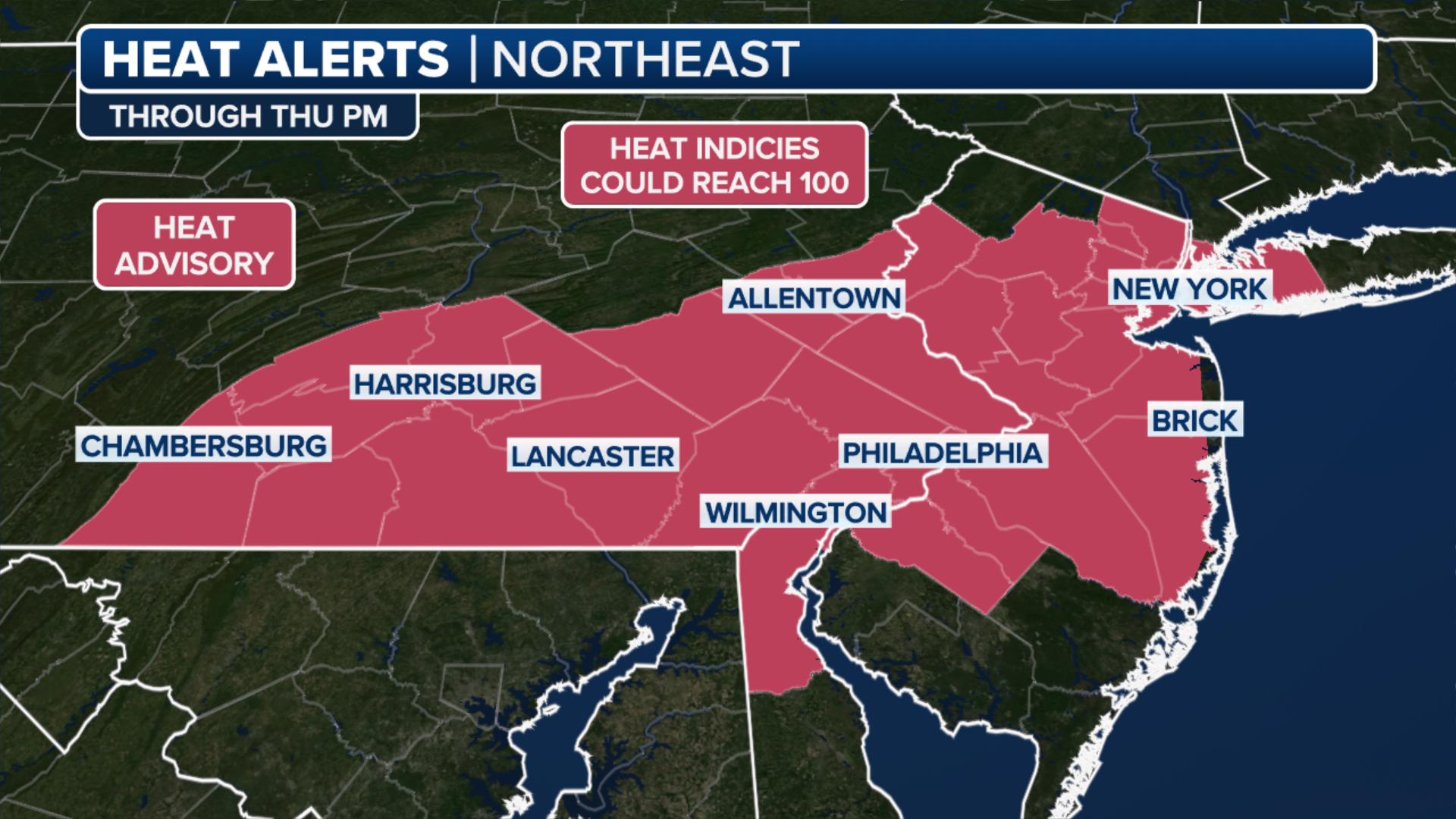
Heat Advisories have been issued for millions of people in Boston, New York City, Philadelphia and as far west as Buffalo, New York through Wednesday.
According to the FOX Forecast Center, "This heat could also help set the stage for a threat of strong to severe thunderstorms by the end of the workweek and into the weekend."

A tourist uses a fan to cool off as they wait in line to enter the U.S. Capitol Building on July 02, 2026 in Washington, DC.
(Kevin Dietsch/Getty Images / Getty Images)
An Extreme Heat Warning is in effect for Philadelphia, as well as Central and South New Jersey.
While this heat wave will not be as oppressive as the holiday one, these are still dangerous conditions for people without access to adequate hydration and cooling.
(FOX Weather)
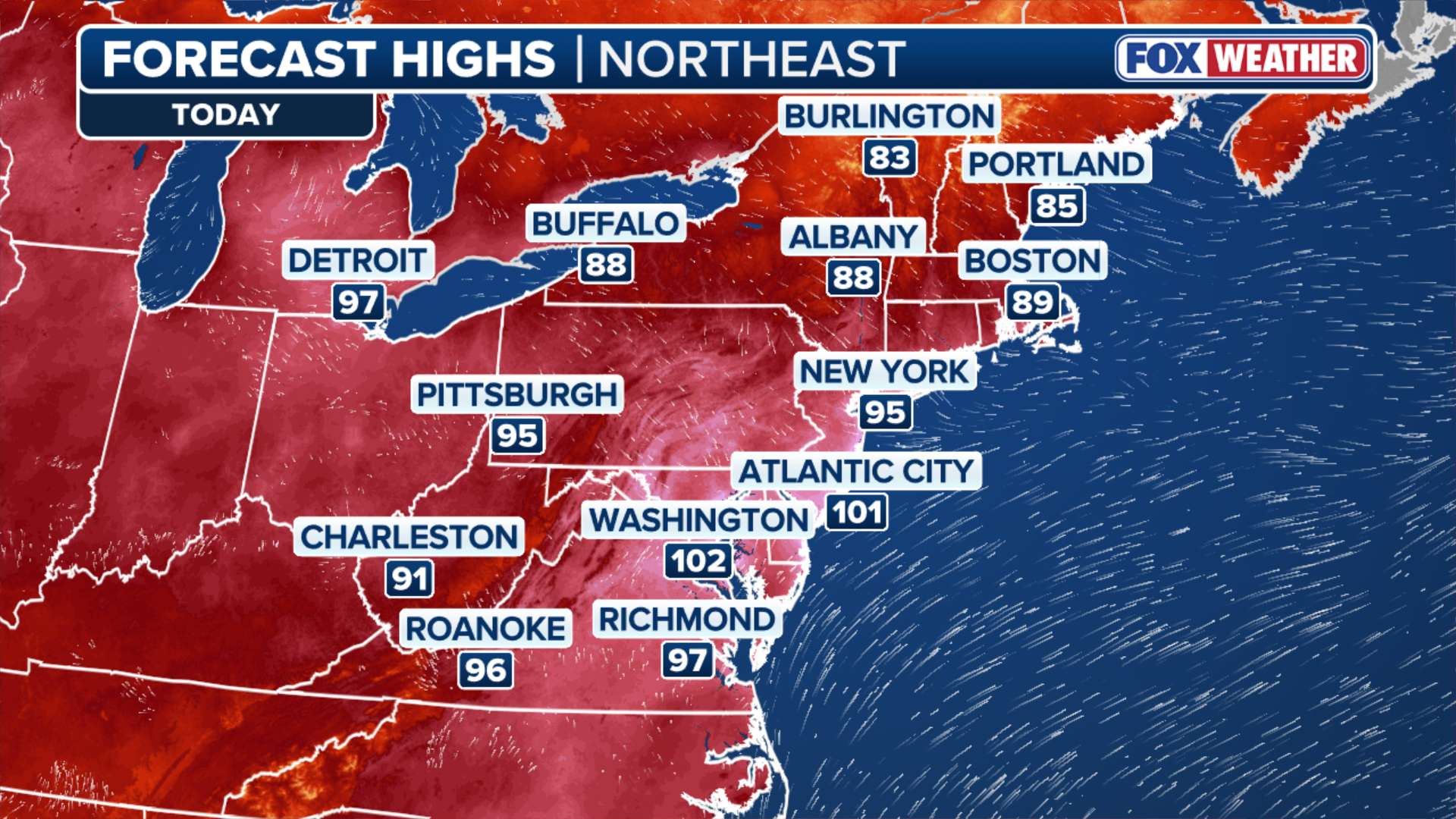
Following Tuesday's heat, temperatures are again expected to jump into the 90s and low 100s across the region, with the heat index ranging between 100 and 110 degrees in some locations.
For example, Washington, D.C. is expected to reach 102 degrees, feeling like 109 on Wednesday.
(FOX Weather)
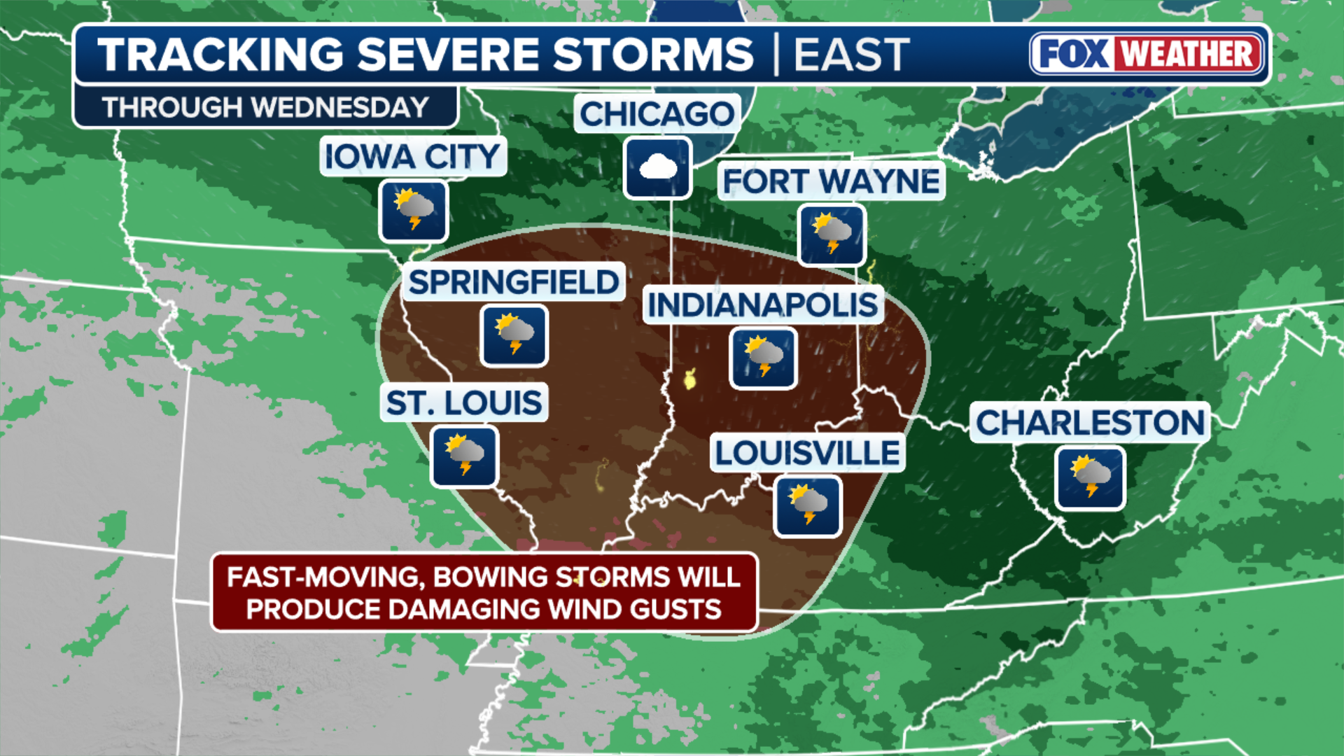
Meanwhile, the heat will drive the chance for strong to severe thunderstorms late in the workweek and into the weekend.
Although the exact magnitude of these storms remains uncertain, a favorable setup places major I-95 cities—including Washington, D.C., New York City, and Boston—at risk Friday into Saturday. Along with cooler temperatures, the storms could bring hazards like damaging wind gusts.
While widespread severe weather is not expected at this time, moisture-rich thunderstorms could produce heavy rainfall and increase the risk of flash flooding across the Ohio Valley and Mid-Atlantic, according to the FOX Forecast Center.
As a result, a Level 1 out of 4 flash flood risk is already in place for much of the region from Saturday into early Sunday.
(FOX Weather)
Rainfall rates within the strongest storms could exceed 2 inches per hour, the FOX Forecast Center said.
Stay tuned to FOX Weather as we continue to track the heat and potential severe weather developing this week.