

New England faces increasing severe storm threat with lashing winds capable of knocking out power to thousands
A rare Level 3 out of 5 severe weather risk has been issued for parts of northern New York, Vermont, New Hampshire and much of Maine for Tuesday.
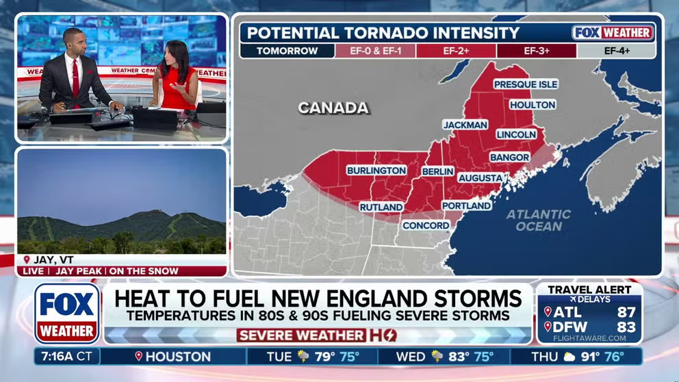
New England faces rising severe storm threat as heat dome fuels risks
A large heat dome is shifting into the Northern tier, bringing increased severe storm threats to New England by Tuesday. A rare Level 3 of 5 threat has been issued across parts of the region with damaging wind gusts being the primary threat. Full forecast:
A large, shifting heat dome is setting the stage for severe weather across much of New England, with increasing heat and humidity expected to fuel thunderstorms capable of producing damaging winds by midweek.
During the afternoon and through the overnight hours on Tuesday into Wednesday, storms are expected to fire up with a primary threat of damaging wind gusts threatening much of the upper Northeast.
A couple of tornadoes are also possible, especially near the U.S.–Canada border, where a rare threat of EF-2 or stronger tornadoes exists.
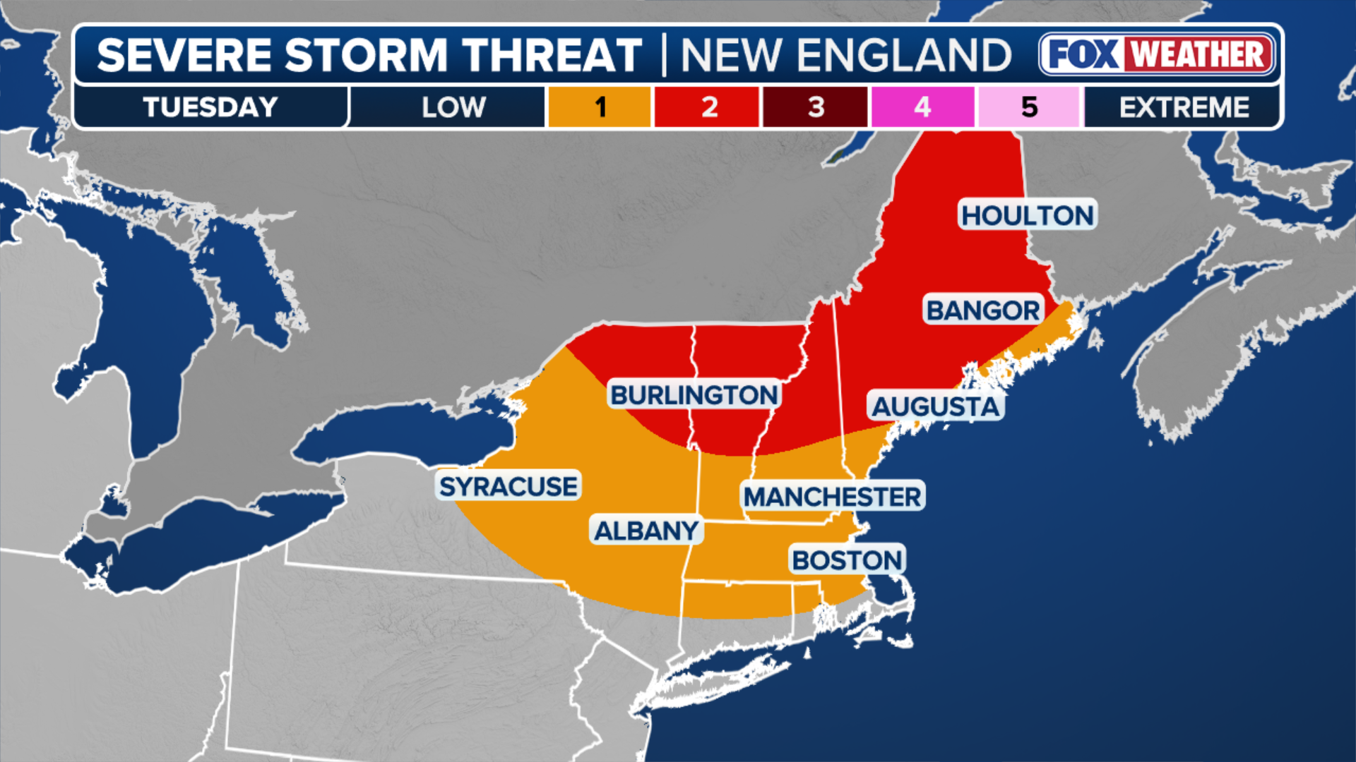 New England Severe Weather Threat.
(FOX Weather)
A Level 3 out of 5 severe weather risk has been issued for parts of northern New York, Vermont, New Hampshire and much of Maine for Tuesday.
Driving the severe storm threat will be a robust disturbance moving out of Canada tracking into northern New England.
Ahead of this disturbance, afternoon temperatures in the 90s and dew points in the upper 60s will create a moderately unstable atmosphere ripe for storms to erupt.
According to the FOX Forecast Center, clusters of thunderstorms are expected to develop along the northern edge of a shifting heat dome as a ridge of high pressure shifts into the northern tier of the U.S.
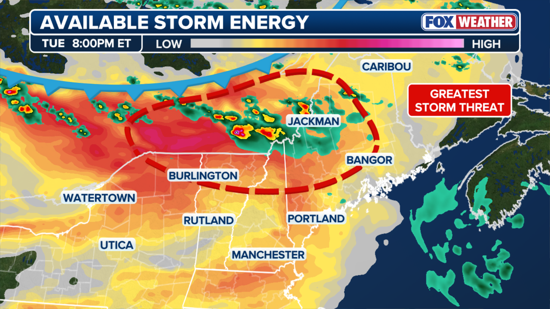
(FOX Weather)
As the heat fuels the storms, the FOX Forecast Center said the biggest cities to watch for are Burlington, Vermont, Berlin, New Hampshire and Bangor, Maine.
WHAT IS A HEAT DOME AND HOW CAN IT AFFECT YOU DURING THE SUMMER MONTHS?
While the population number is relatively low compared to other severe events, this part of the country does not experience heightened threats like this too often. If the storms are well-defined, damage is certainly possible from the winds alone.
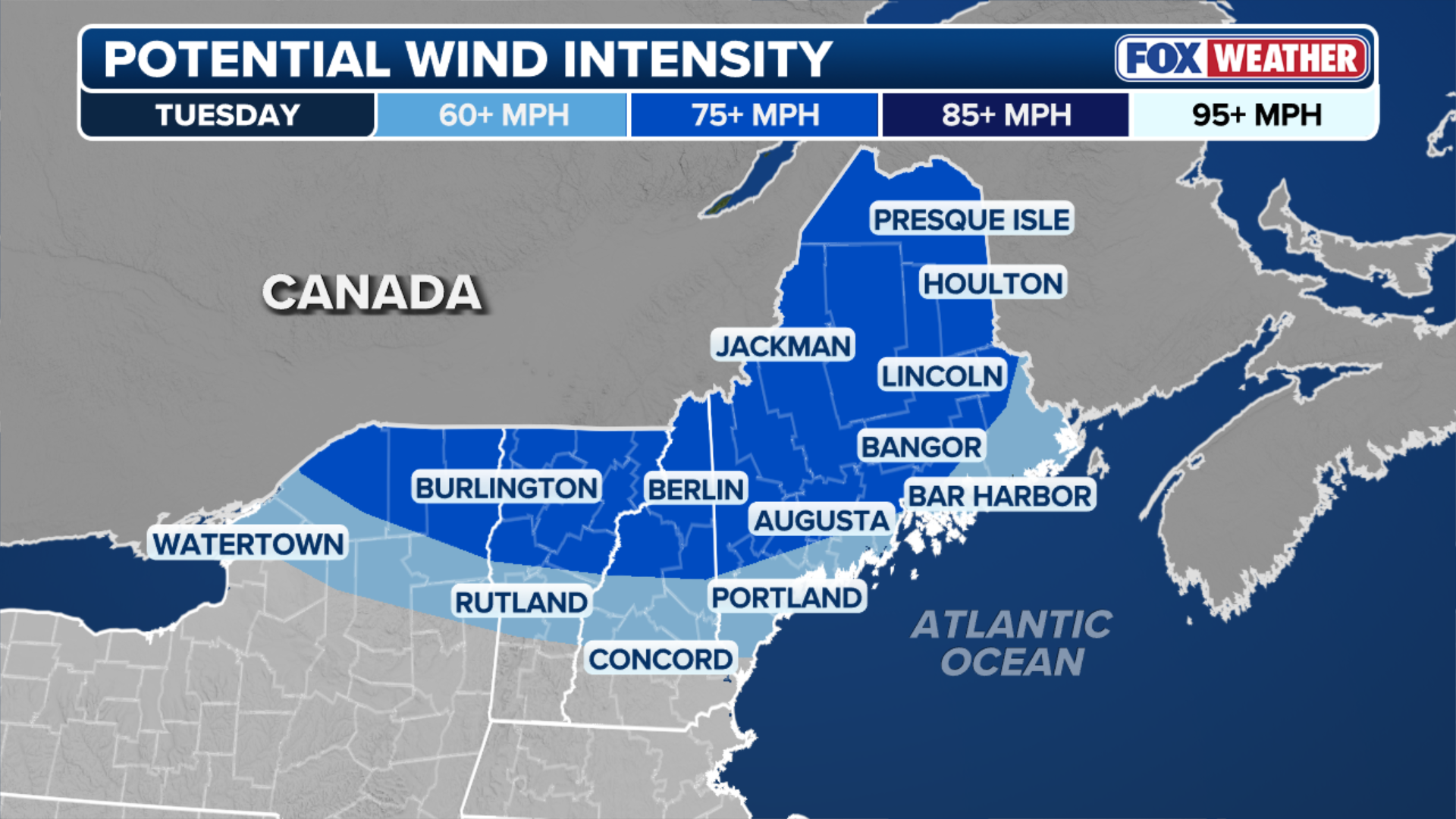 Potential wind intensity outlook
(FOX Weather)
The exact intensity and coverage of the severe weather event will depend on timing.
The current forecast tracks the worst of the storms into New England well after sunset, meaning the loss of daytime heat should naturally help weaken them overnight. However, if the system speeds up and rolls in earlier than expected during the peak of afternoon heating, the coverage and overall danger of these severe storms will likely spike.
Stay with FOX Weather as we continue to track the evolving severe weather threat across New England.