Threat of tropical moisture to linger along Gulf Coast
New Orleans could see upwards of 3 inches of rain over the next few days. Warm Gulf of Mexico water temperatures could help enhance heavy rainfall.
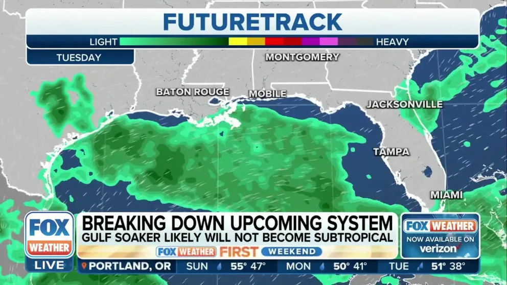
Upcoming Gulf Coast soaker likely will not become subtropical
More rounds of rain are eyeing the Gulf Coast this week. Rain should begin once again on Wednesday with a developing area of low pressure, and slowly linger before moving onshore Thursday or Friday.
A developing low-pressure system that is expected to form over or near the Gulf of Mexico will likely keep the weather pattern rather unsettled through the upcoming week for coastal communities.
Southern parts of Louisiana, Mississippi and Alabama could be in store for at least a couple of inches of rain, in addition to rough seas and the potential for lightning and gusty winds.
Rainfall has already begun along the Gulf Coast, but every day an additional round of precipitation could lead to an increased flooding risk.

(FOX Weather)
"We're working off the Gulf of Mexico, so there's plenty of moisture funneling in here, especially for the state of Georgia, as well, where the Masters now are underway," said FOX Weather meteorologist Brigit Mahoney.
The FOX Forecast Center rougher seas to trigger minor beach erosion and increase the risk of rip currents.
The increased threat of rip currents could impact some popular spring break beaches from near the Mississippi-Alabama state line eastward into Florida’s Panhandle.
Forecasters will closely be monitoring the area of low pressure for any signs of tropical organization but due to water temperatures and hostile atmospheric winds, little to no development is expected to occur.
Development of tropical cyclones out of season is unusual but not unheard of. According to a NOAA database, 80 cyclones have been tracked during the off-season in the Caribbean Sea, Gulf of Mexico and Atlantic Ocean.
If a system fails to develop into a trackable entity in either April or May, the hurricane season will begin on its annual start date of June 1.