Chantal weakens to tropical depression after landfall along South Carolina coast
Tropical Storm Chantal had maximum sustained winds of around 50 mph at landfall, which occurred at Litchfield Beach, South Carolina, early Sunday morning.
Tropical Storm Chantal begins to weaken after making landfall in South Carolina
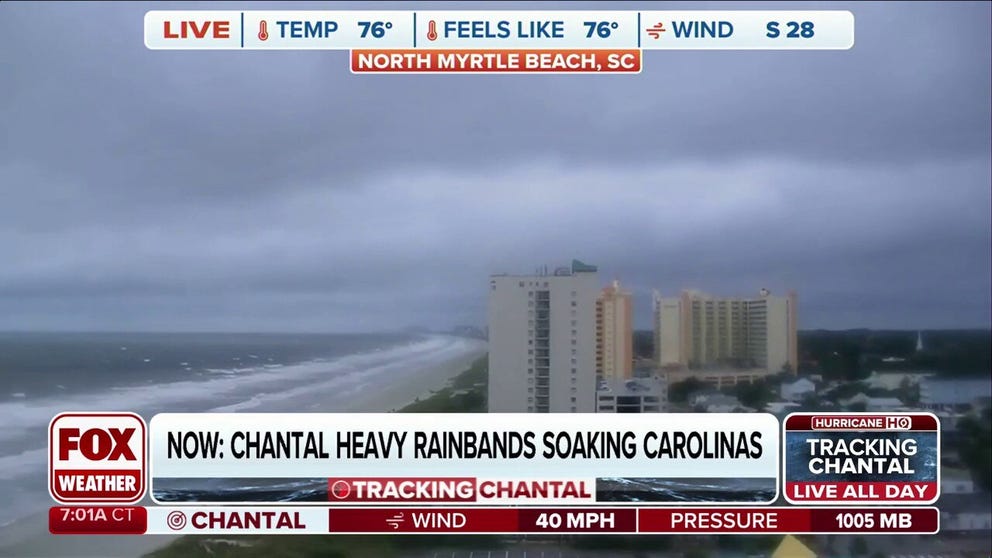
Tropical Storm Chantal continues to weaken after the storm made landfall along the South Carolina coast early Sunday morning. FOX Weather Storm Specialist Mike Seidel was in North Myrtle Beach, South Carolina, with the latest on the storm's impacts on July 6, 2025.
CHARLESTON, S.C. – What was once Tropical Storm Chantal made landfall along the South Carolina coast as officials warned of rough surf and flash flooding as the system continued tracking its way through the Carolinas and into the Mid-Atlantic.
Lifeguard organizations across the Grand Strand have reported performing rescues of those who ventured into the rough waters of the Atlantic Ocean.
Tropical Storm Chantal had maximum sustained winds of around 50 mph at landfall, which occurred at Litchfield Beach, South Carolina, early Sunday morning.
Chantal was downgraded to a tropical depression, and the National Hurricane Center (NHC) said Chantal is expected to continue to rapidly weaken now that the storm has made landfall.
DOWNLOAD THE FREE FOX WEATHER APP

(FOX Weather)
Chantal is expected to produce heavy rain across portions of northeastern South Carolina on Sunday and across portions of North Carolina through Monday.
Rainfall totals of 2-4 inches, with locally higher amounts of up to 6 inches, are expected. This is increasing the risk of flooding across the region.
In addition, a combination of storm surge and the tide will cause normally dry areas near the coast to be flooded by rising waters moving inland from the coast.

Tropical Storm Chantal makes landfall in South Carolina
Tropical Storm Chantal made landfall along the South Carolina coast early Sunday morning, and officials are warning of flash flooding and rough surf at beaches as the system continues to push inland. FOX Weather Meteorologists Michael Estime and Tom Wachs breaks down the forecast on July 6, 2025.
A storm surge of 1-2 feet is possible from South Santee, South Carolina, to Surf City, North Carolina.
Isolated tornadoes are also possible on Sunday across portions of eastern North Carolina and extreme northeastern South Carolina.
Rough surf and potentially life-threatening rip currents are also likely along beaches across the area.