Nearly 100 reports of severe weather Thursday kick off four-day stretch of storms in America's heartland
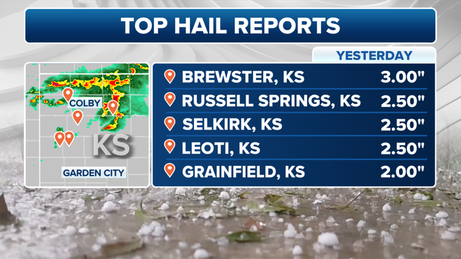
NOAA's Storm Prediction Center received nearly 100 reports of severe weather, including baseball-sized hail that damaged windows in Brewster, Kansas.
Landspout tornado spotted in Colorado while golf-ball size hail strikes Kansas
There were nearly 100 severe weather reports Thursday night including several for golf-ball-sized hail, gusts over 60 mph and even a handful of tornadoes.
AKRON, Colo. — A multiday severe weather threat across much of the nation’s heartland kicked off on Thursday with reports of massive hail and a few tornado reports.
NOAA's Storm Prediction Center received nearly 100 reports of severe weather, including baseball-sized hail that damaged windows in Brewster, Kansas.
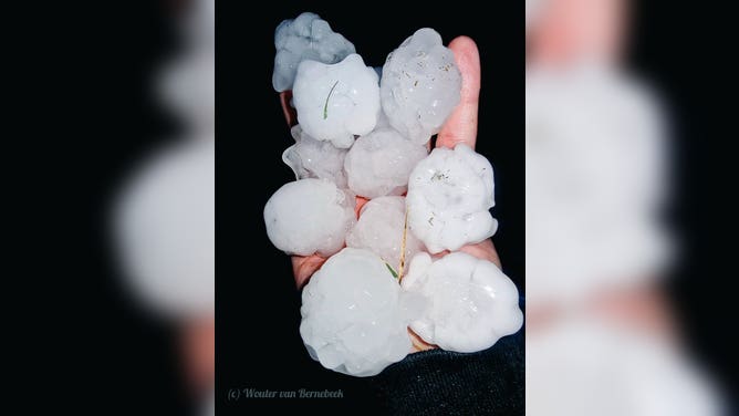
Hail up to 2" in size in Grainfield, Kansas
(@StormchaserNL / FOX Weather)
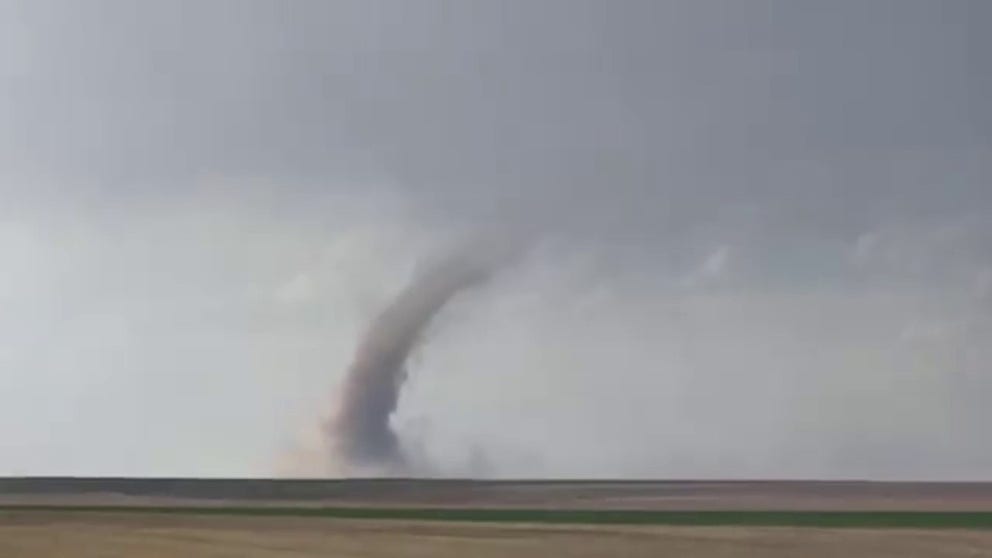
One of the first sightings of extreme weather on Thursday happened in northeast Colorado.
Storm chasers captured video of a landspout outside the town Akron, which is about 60 miles west of the Colorado-Nebraska border.
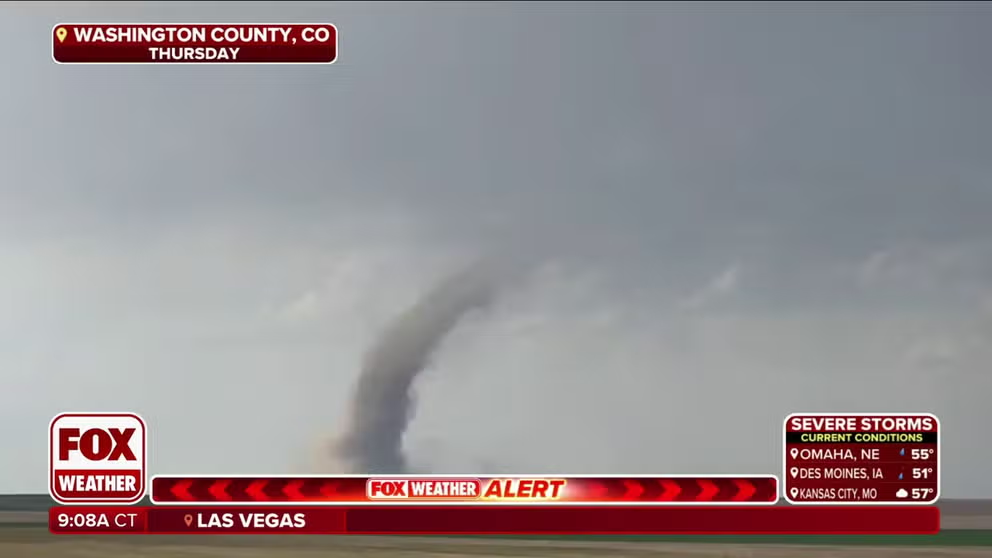
Landspout spotted in northeast Colorado
Ahead of the eruption of severe storms on Thursday, a landspout was spotted developing in northeast Colorado, outside of the town of Akron.
At least one other tornado was spotted in Cheyenne County, Kansas, but due to the rural nature of both instances of twisters, there were no immediate reports of damage.
TORNADO ALLEY: 7 THINGS TO KNOW
Some thunderstorms also brought blistering wind gusts. A thunderstorm gust reached 70 mph near Sharon Springs, Kansas, while gusts reached 67 mph in Spur, Texas and 63 mph in Cottonwood, South Dakota and Shawnee, Oklahoma.
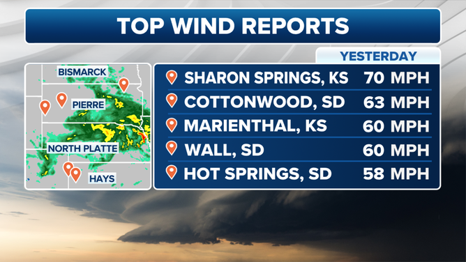
Thursday April 25 Wind Reports
(FOX Weather)
Shawnee suffered some broken trees and a blown over semi truck during their strong thunderstorms.
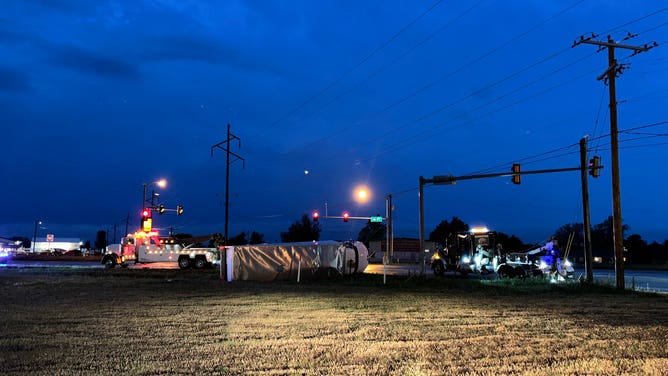
Wind damage in Shawnee, Oklahoma on April 26, 2024.
(KOKH/ @JamisonTV / FOX Weather)
Most of the severe weather reports on Thursday were from observations of hail throughout the Plains.
The largest hailstones occurred in Kansas and several reports indicated stones of at least golf-ball to egg-sized in some rural communities.
(FOX Weather)
REAL OR FAKE? HOW TO SPOT WEATHER IMAGES GENERATED BY AI
The large hail caused some windows to break, but there were no reports of any injuries.
The severe weather threat continues in the Plains and Midwest through the weekend.