Severe storms with damaging winds, hail and tornadoes impact nation's heartland
Behind the cold front, significantly cooler air will filter into the country. Cities that recently had highs in the 70s and 80s will struggle to reach the 60s. The more comfortable conditions are expected to reach all the way down to the Gulf Coast, with New Orleans reaching just the lower 70s next week.
Severe storms produce tornadoes, lightning over Midwest
A round of thunderstorms turned severe on Thursday with several tornadoes reported in southern Illinois.
ST. LOUIS – A cold front stretched across a large section of the eastern half of the nation was the focal point of showers and thunderstorms on Thursday, some of which were severe and produced tornadoes.
NOAA's Storm Prediction Center (SPC) highlighted states from the U.S.-Mexico border through the Ohio Valley for an increased threat of storms, with portions of Missouri, Illinois, Indiana, Kentucky and Tennessee at the highest risk.
SIGNIFICANT DAMAGE REPORTED IN NORTHERN OHIO AFTER SEVERE THUNDERSTORMS ROAR THROUGH GREAT LAKES
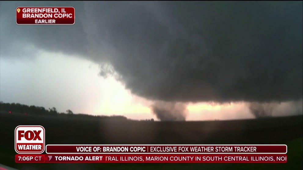
FOX Weather Storm Tracker captures video of tornado in Illinois
Video from Greenfield, Illinois, appeared to show at least one tornado rolling though rural farmland between St. Louis, Missouri and Springfield, Illinois.
The National Weather Service office that covers the region issued a Tornado Warning after the sighting and said the storm was moving east at 30 mph.
Given the rural nature of Green County, few if any structures were in the immediate path of the supercell.
The sighting was one of nearly a dozen warned by the NWS, with tornadoes also reported to be around the towns of Dorsey and Cahokia.
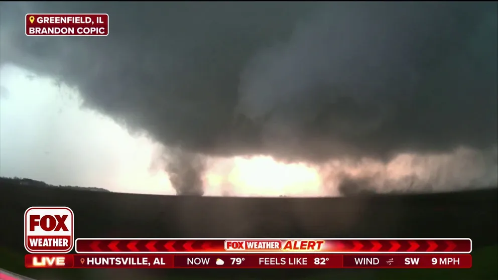
Twisters spin through Illinois as storms tear across Midwest
FOX Weather Storm Tracker Brandon Copic caught video of a tornadoes spinning through a field in Illinois.
PowerOutage.us reported more than 15,000 outages during the height of the storm system, with many centered in the south-central region of the state.
The NWS said they'll have multiple teams surveying damage on Friday to determine the exact amount of tornadoes that touched down.
The wet weather even caused problems in Chicago, with the Cubs announcing its game against the Miami Marlins was postponed until Saturday.
WATCH: TORNADOES SPOTTED SPINNING THROUGH ILLINOIS
Refreshing airmass behind cold front
The cold front will help to usher in unusually cold air for mid-April, which might feel chilly to some.
Where highs were recently in the 70s and 80s across the Plains, temperatures will struggle to reach the 60s.
Chicago will be one of the many cities experiencing the chill, with high temperatures through the weekend expected to be 5-10 degrees below average.
By next week, the cooler and drier air is expected to reach the Interstate 10 corridor along the Gulf Coast, where New Orleans could see a couple of days with highs in the lower 70s.

(FOX Weather)