Brief tornado threat lingers in eastern North Carolina on Wednesday
Lingering severe storms Wednesday morning could spawn a brief tornado or localized damaging wind gusts across eastern North Carolina and the Outer Banks.
Brief tornado threat lingers in eastern North Carolina on Wednesday
Lingering severe storms Wednesday morning could spawn a brief tornado or localized damaging wind gusts across eastern North Carolina and the Outer Banks.
The threat of severe weather will finally push off the coast on Wednesday on the tail end of a powerful cross-country storm that created headaches for travelers heading out of town for Thanksgiving.
Heavy rain and strong winds hit the Gulf Coast states on Tuesday. Alabama and Florida saw several Tornado Warnings in the late-afternoon and evening hours.
Storm spotters and the National Weather Service both confirmed a tornado west of Dothan, Alabama.
On Monday, the NWS received 10 reports of tornadoes from central Louisiana into central Mississippi in the lower Mississippi Valley.
Structural damage and downed trees were reported from one of the suspected tornadoes in Natchitoches Parish, Louisiana, according to the NWS. Golf-ball-sized hail also pelted portions of Louisiana on Monday evening. Listen to the cacophony in the video below:

Golf-ball-sized hail pelts Louisiana
A Ferriday, Louisiana, resident took refuge in his garage just as golf-ball-sized hail pelted his car and front yard.
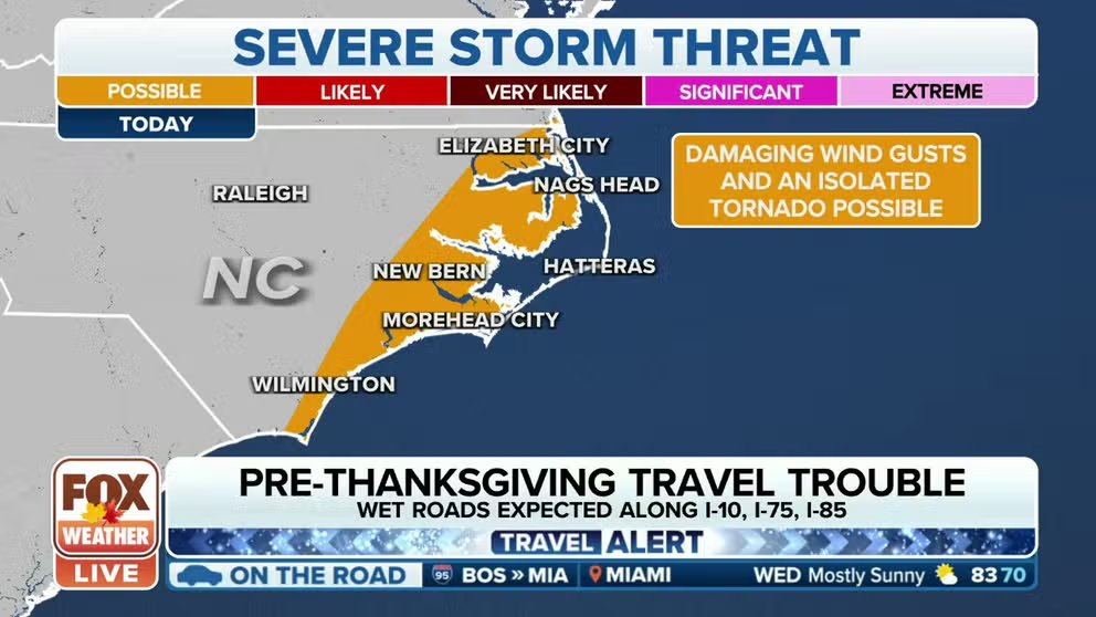
The same area of showers and thunderstorms continues to push east on Wednesday morning, shifting the severe weather threat to eastern North Carolina.

(FOX Weather)
Wednesday's severe weather threat
Lingering severe storms Wednesday morning could spawn a brief tornado or localized damaging wind gusts across eastern North Carolina and the Outer Banks.
The threat includes the cities of Wilmington, Jacksonville, New Bern, Havelock and Elizabeth City.

(FOX Weather)