

Super El Niño’s grip on global weather: What's happened and what’s ahead
Water temperatures sit roughly 2.67° C above average, making this the warmest of any recorded Super El Niño event.
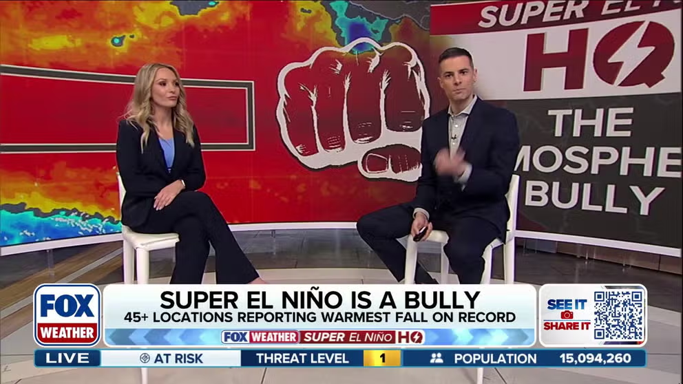
The Atmospheric Bully: Super El Niño flexes its muscles — what happens next?
A brewing Super El Niño is flexing its influence across the atmosphere, shaping weather patterns from the Southwest to the Atlantic. FOX Weather Meteorologists Ian Oliver and Haley Meier break down how the powerful climate pattern will continue to affect the U.S. this fall and winter.
THE TAKEAWAY
- Super El Niño events are uncommon and can influence weather far beyond the tropical Pacific.
- The pattern has contributed to unusual tropical activity, record heat and historic flooding across parts of the United States.
- The Northern Tier and Pacific Northwest may remain warmer and drier, while the South and Gulf Coast trend cooler and wetter, with snow favored along the active subtropical jet stream.
The effects of the brewing Super El Niño have steered weather patterns around the globe throughout hurricane season and into fall, influencing extreme, and in some cases, historic weather events.
In the equatorial Pacific, sea-surface temperatures continue to rise as El Niño sends downstream impacts around the globe – in what could be the strongest El Niño on record.
POLAR VORTEX DISRUPTION COULD BE EARLIEST ON RECORD, BUT EL NIÑO IMPACT MAY KEEP US WARM
Water temperatures are about 2.67°C above average, making this the warmest recorded Super El Niño event.
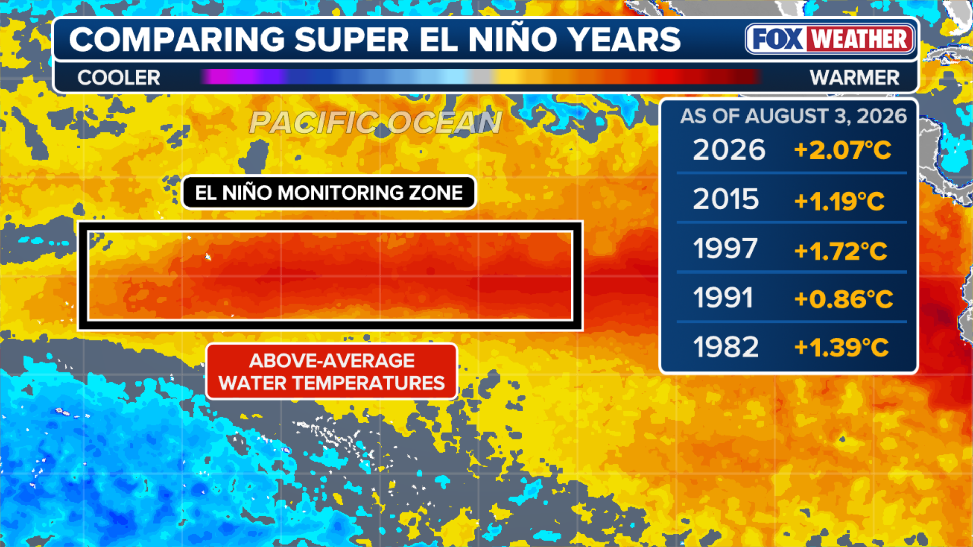 Comparing El Niño years.
(FOX Weather)
When sea surface temperature anomalies in critical parts of the Pacific Ocean have warmed to at least 2 °C or more above normal, a super El Niño event is considered to be underway.
Super El Niños are rare, with only a handful of these exceptionally strong events occurring since the 1950s.
SUPER EL NIÑO THEN AND NOW: HOW THIS YEAR'S STRENGTHENING EVENT COMPARES TO HISTORIC EXTREMES
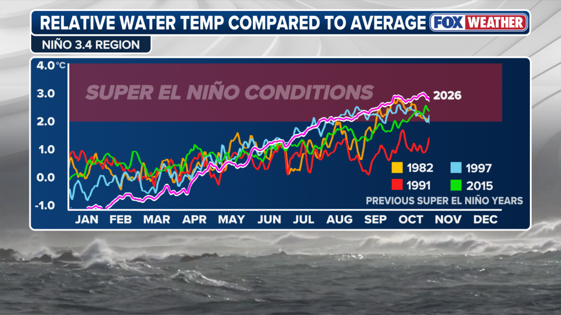 Comparing El Niño trends.
(FOX Weather)
In the heat of this rare event and its present impacts reshaping weather patterns around the globe, here’s a look at how Super El Niño has affected weather.
THE RIPPLE EFFECT OF EL NIÑO: WHAT DOES IT MEAN AND HOW DOES IT IMPACT THE WORLD'S ECONOMY?
Super El Niño impact thus far
The Atlantic hurricane season was one for the record-books — and not for devastating reasons.
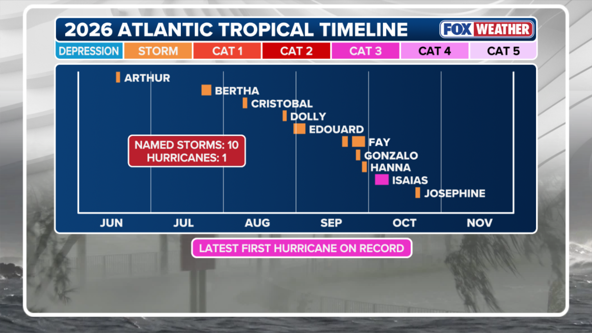 2026 Atlantic Tropical Impacts.
(FOX Weather)
The Atlantic hurricane season was notably quiet, including a record 342-day stretch without a hurricane – with the drought ending with Hurricane Isaias.
The Atlantic basin has produced 10 named storms so far this season, as El Niño’s typical atmospheric pattern suppressed tropical activity and limited the development of major hurricanes.
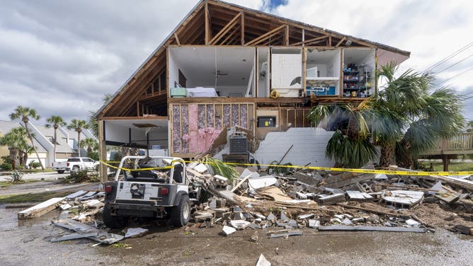
A home is partially destroyed after Hurricane Isaias came ashore. Hurricane Isaias made landfall Friday, October 9 along the U.S. Gulf coast.
(Jen Golbeck/SOPA Images/LightRocket via Getty Images / Getty Images)
While the Atlantic remained relatively quiet, the Pacific packed a punch – with the Eastern Pacific producing 20 named storms so far this year, well above the average of 15.
SUPER EL NIÑO THEN AND NOW: HOW THIS YEAR'S STRENGTHENING EVENT COMPARES TO HISTORIC EXTREMES
Most storms tracked away from land, but four made close calls near Hawaii, even though none ultimately made landfall.

Damage reported on Maui as Hurricane Lowell impacts the Hawaiian Islands.
(Hawaii Department of Transportation / FOX Weather)
Pacific Accumulated Cyclone Energy, or ACE, stands at a record 354.1, compared with an average of 130.6.
The El Niño warming brought prolonged, record-breaking heat in October, with more than 45 locations recording their warmest fall on record.
COULD HISTORY REPEAT ITSELF? HOW PAST SUPER EL NIÑO WINTERS OFFER CLUES ABOUT WHAT'S AHEAD
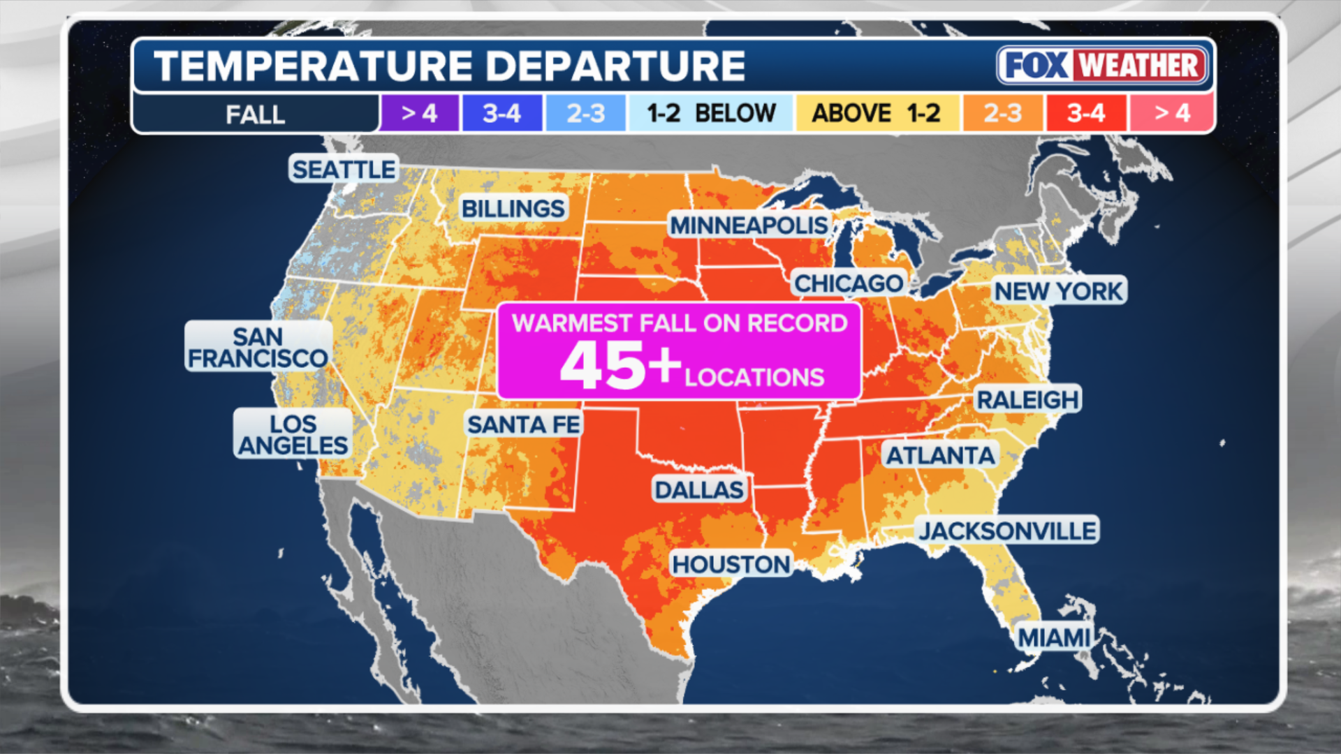 October Heat.
(FOX Weather)
An amplified area of high pressure and a polar jet stream displaced unusually far north allowed unseasonable heat to persist across much of the Midwest and South.
Meanwhile, the subtropical jet stream shifted unusually far south, steering multiple storm systems across the Southwest and triggering historic flooding.
HOW HIGH PRESSURE AND LOW PRESSURE DRIVE THE WEATHER
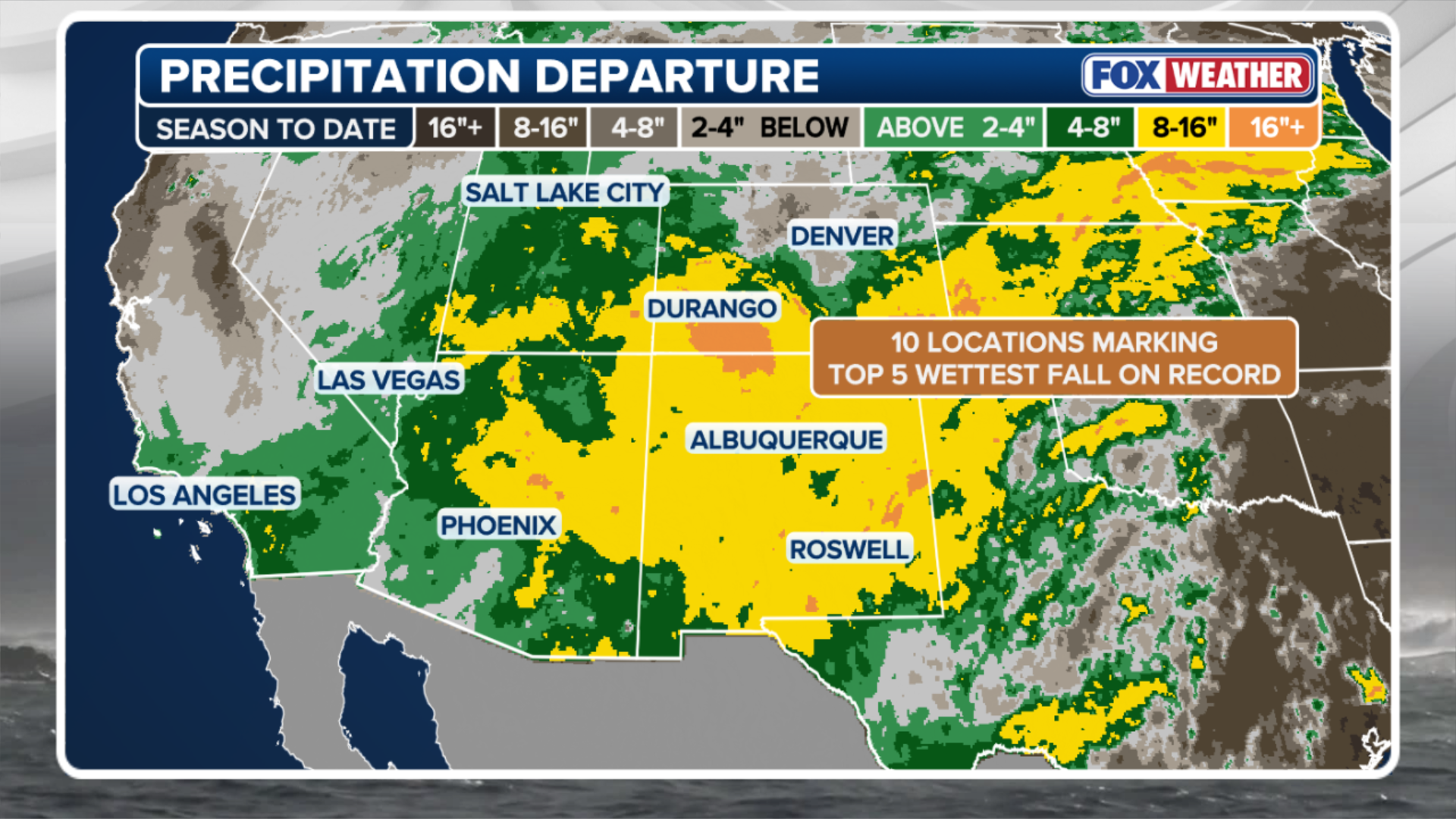 Seasonal rainfall in the Southwest.
(FOX Weather)
Several rivers reached record crests, causing widespread damage and infrastructure problems throughout impacted areas in the region.
Across the Four Corners, fall rainfall totals are 8 to 16 inches above average.
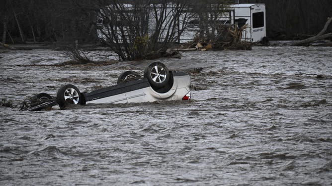
Flood damage along the Piedra River, north of Navajo State Park in Colorado on Nov. 2, 2206.
(John Livingston/CPW/X / FOX Weather)
What a historic Super El Niño could mean for winter
With winter approaching, the Super El Niño influence on the weather patterns across the globe will continue.
The forecast calls for more of the same. Above-average temperatures are favored across the Northern Tier and Pacific Northwest, while cooler conditions are expected across the South and Gulf Coast.
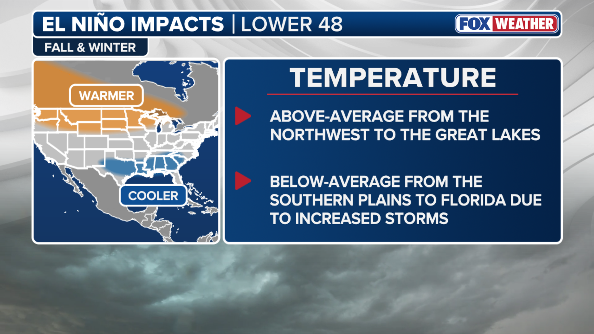 El Niño impacts.
(FOX Weather)
Precipitation will likely follow a similar pattern, with wetter conditions concentrated across the southern United States.
Above-average snowfall is possible across California, the Four Corners and the Mid-Atlantic, where the subtropical jet stream is expected to remain active.
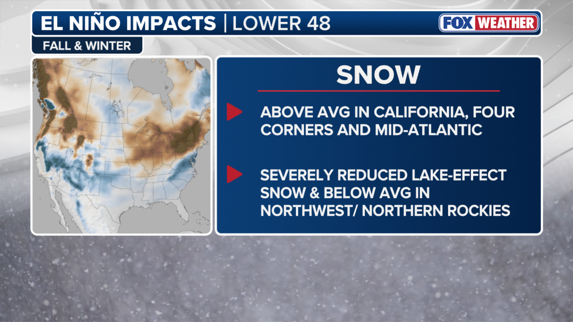 El Niño impacts.
(FOX Weather)
Meanwhile, the Rockies and Pacific Northwest could see below-average snowfall, while lake-effect snow downwind of the Great Lakes may also be substantially reduced.