Thunderstorms continue into weekend for central Gulf Coast, Southeast
Although the heaviest rainfall should be confined to coastal locations, much of this region has seen above-average rain recently, so where heavy rain does fall, it could result in flash flooding concerns.
Scattered storms, showers to produce heavy rain in Southeast through weekend
There will be continued scattered afternoon thunderstorms from central Alabama/Georgia, down to the Gulf Coast and northern Florida. Though they will produce heavy rain, their spread out nature will keep flooding localized and minor.
Heavy rainfall and possible flash flooding will continue into the weekend for the central Gulf Coast and Southeast.
The very moist air mass lingering over the region will result in scattered afternoon thunderstorms from central Alabama and Georgia down to the central Gulf Coast and Florida. However, the upper-level disturbance that caused so much flooding earlier this week will weaken, according to the FOX Forecast Center.
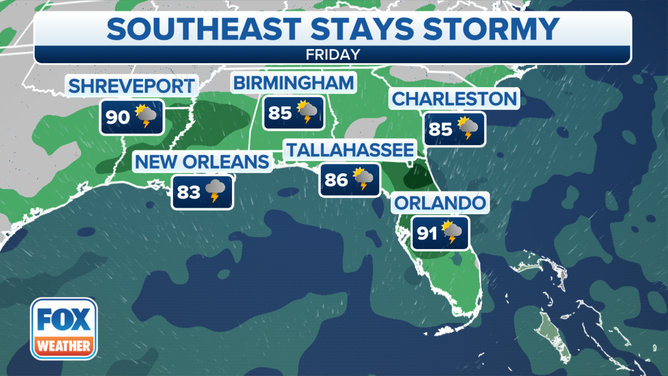
The Southeast stays stormy on Friday.
(FOX Weather)
HOW TO WATCH FOX WEATHER ON TV
"It's going to be those thunderstorms widespread through the afternoon," FOX Weather meteorologist Steve Bender said. "So if you are trying to get the last little moments of summer, get to the beach early in the day."
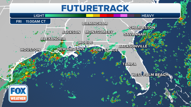
Here's a look at the FOX Weather FutureTrack valid at 11 a.m. Central along the Gulf Coast.
(FOX Weather)
And the next five days in Tampa, Florida, look electric, Bender said.
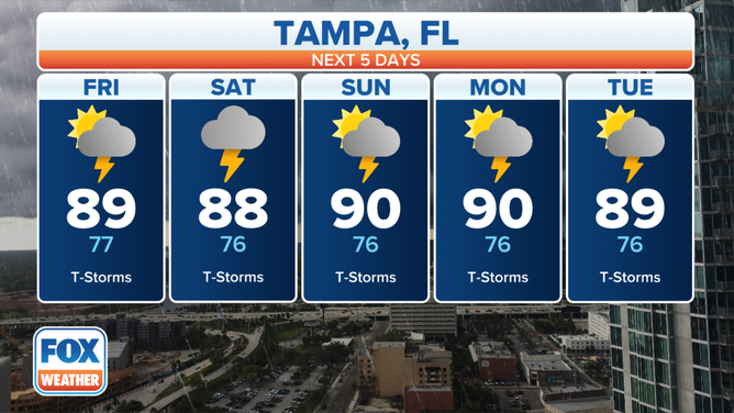
Thunderstorms are in the forecast the next five days in Tampa, Florida.
(FOX Weather)
"Thunderstorms expected each and every afternoon. And we're going to see this on the Gulf side flare up early in the day as well," he said. "So coastal areas of Louisiana from Lake Charles, but really back towards New Orleans, that's where you're seeing those showers."
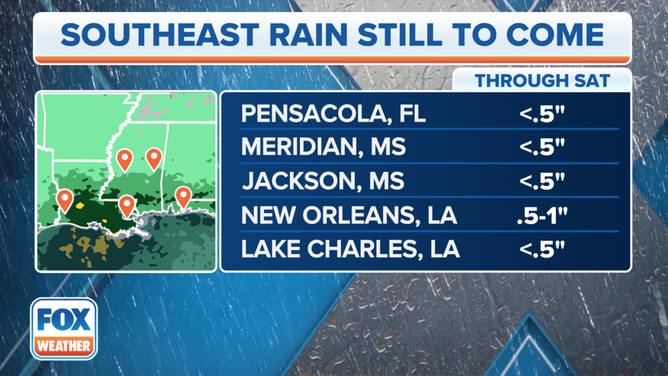
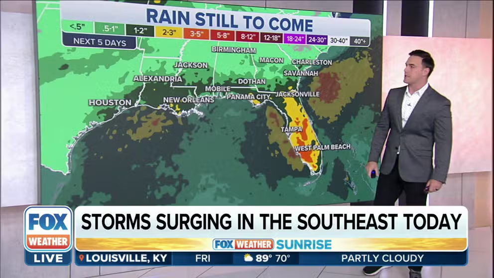
Rain totals show what is expected in the Southeast through Saturday.
(FOX Weather)
Although the heaviest rainfall should be confined to coastal locations, much of this region has seen above-average rain recently, so where heavy rain does fall, it could result in flash flooding concerns.
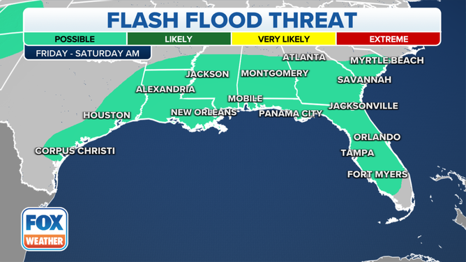
A flash flooding threat is possible Friday across parts of the central Gulf Coast and Southeast.
(FOX Weather)
NOAA's Weather Prediction Center has highlighted the risk of flash flooding in its Excessive Rainfall Outlook across parts of the central Gulf Coast and Southeast before a stalled front lingering over the region finally begins to dissipate on Saturday.
Earlier this week, central and southeastern Mississippi were hit with devastating flooding on Wednesday as intense storms dropped as much as 10 inches of rain in 12 hours. Radar estimates indicated over 8 inches of rain fell in just three hours in parts of Scott and Newton counties. This is a 1,000-year rain rate and the sixth 1,000-year rain event in a month.
Much of this rain fell on already-saturated ground, and it brought the storm total rain since Monday to 6 to 15 inches.
Because of the rain, a number of rivers in Mississippi have risen to flood stage. Two rivers, the Big Black River and the Chickasawhay River, are in moderate flood stage.
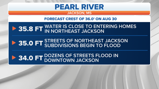
Levels on the Pearl River will continue to rise through the weekend and are forecast to reach major flood stage next week. Homes and businesses in Jackson may flood again, less than a week after flooding initially hit the city.
(FOX Weather)