Up to 6 inches of snow possible Tuesday morning in Denver, High Plains
'There is a good chance the morning commute will face impacts such as slick roads,' the NWS says
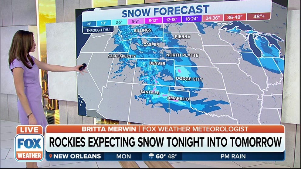
Snowy Tuesday morning commute expected in Denver as snow sweeps through
A snowy Tuesday morning commute is expected in Denver as snow sweeps through the Rockies and High Plains.
DENVER – Accumulating snow will slow down the Tuesday morning commute in the Denver metro area as a weather system sweeps through the Rockies and High Plains.
The National Weather Service has issued Winter Weather Advisories for parts of the Front Range of Colorado and Wyoming, including the city of Denver. Winter Storm Watches are posted in the adjacent High Plains of eastern Colorado and western Kansas.
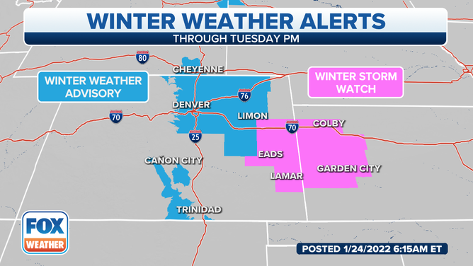
Winter Weather Advisories and Winter Storm Watches are in effect for parts of the Rockies and High Plains.
(FOX Weather)
Snow will first develop Monday night in the Rockies of Montana and Wyoming before sliding southward into the Interstate 70 corridor and the Denver metro area toward daybreak Tuesday.
"There is a good chance the morning commute will face impacts such as slick roads," the NWS office in Boulder, Colorado, wrote in its forecast discussion Monday morning.
YOU WERE JUST INVOLVED IN A WEATHER-RELATED CRASH – NOW WHAT?
The Denver metro area is forecast to pick up 3 to 6 inches of snow through the day on Tuesday. The Plains of eastern Colorado should see between 2 and 4 inches, while the Rockies foothills south of Denver are expected to receive 4 to 8 inches. Snowfall amounts of 3 to 6 inches are predicted in the High Plains of western Kansas.
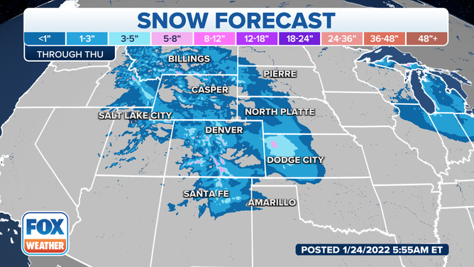
Snow forecast in the Rockies and High Plains.
(FOX Weather)
The snow will sweep into parts of northern New Mexico and the Texas Panhandle by Tuesday night. A few inches of snow is possible in the higher elevations through Wednesday.