Snow expected for many across the western US
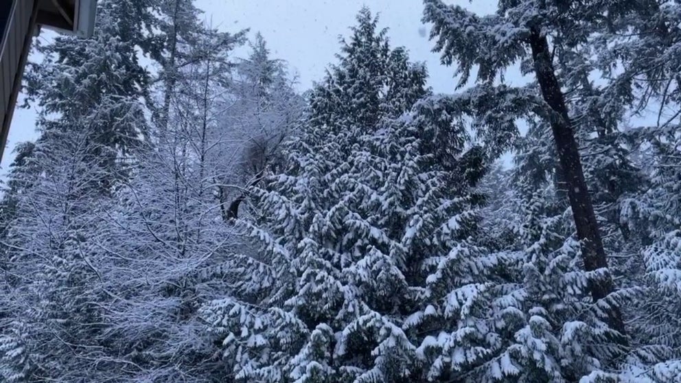
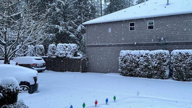
Snow falls in Seattle on Sunday morning.
FOX Weather's Scott Sistek captures the snow falling in Seattle, Washington, on Sunday morning.
Weather across the western U.S. remains active as several winter storms impact the country, providing much-needed snow.
Winter Weather Alerts are in place from the West Coast to the Upper Midwest.
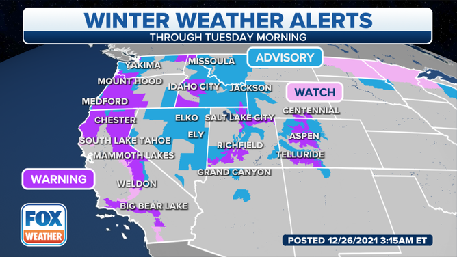
Winter Weather Alerts - Dec. 26, 2021.
(FOX Weather)
An upper-level weather pattern located in the western half of the United States will bring unsettled weather throughout the holiday weekend.
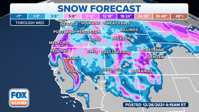
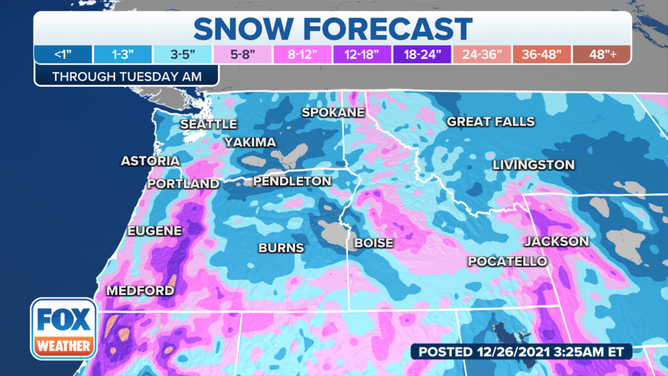
Snow forecast - Dec. 26, 2021.
(FOX Weather)
Pacific moisture combined with arctic cold air will give many the chance to see snow throughout the weekend, even for those who typically see rain. The cold air will provide snow chances for the northwest U.S. and even snow on Oregon beaches. Mountain ranges from the Sierra Nevada to the Central Rockies will especially see heavy snowfall rates that will help to blanket the slopes.
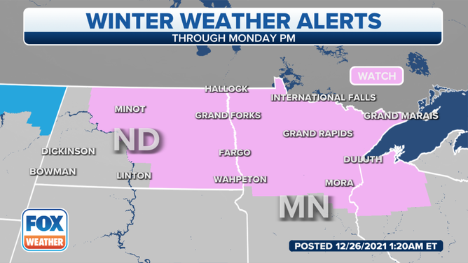
Northern Plains/Upper Midwest
Not only are the Northern Plains dealing with frigid cold temperatures, but snowy conditions are also expected.
(FOX Weather)
Widespread heavy snow is anticipated for the northernmost regions from Sunday afternoon through Monday. Along with the heavy snowfall rates, blowing snow will also reduce visibility, creating hazardous travel.
One to three inches of snow can be expected for the Upper Midwest, while the highest accumulations will remain in the northern region, where some totals could be upwards of eight inches.
Central Rockies
Hazardous travel continues within the Rocky Mountains as snow continues Sunday through early Monday morning.
Snow squalls were seen early Sunday near Salt Lake City.
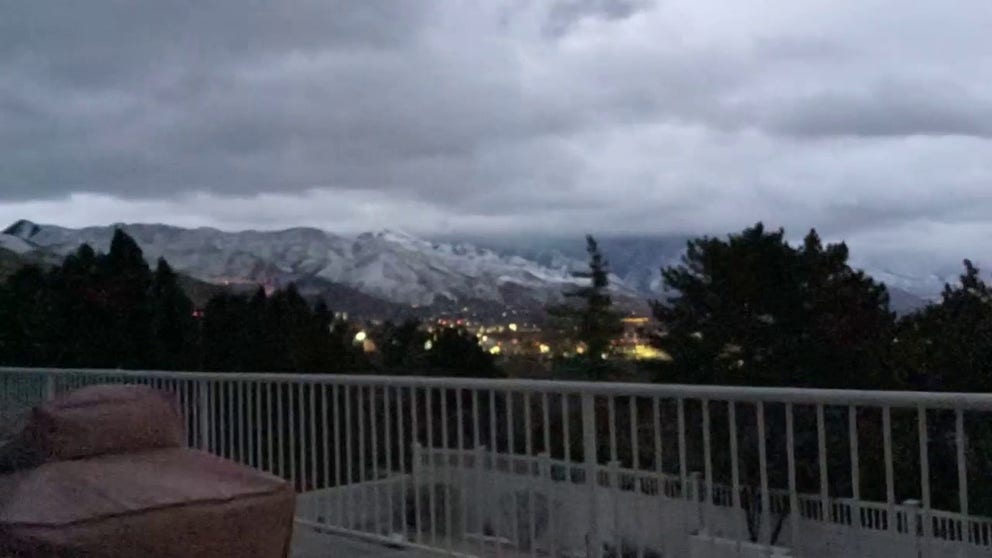
Snow squalls near Salt Lake City
FOX Weather's Steve Baron recorded this timelapse of the snow squalls near Salt Lake City, Utah, Sunday morning.
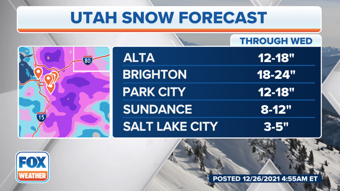
The heavy snow is a welcome sight for Utah ski resorts. The heaviest snow is expected to continue through Sunday evening.
In the Colorado Rockies, snow is expected to be heavy at times Sunday afternoon, totaling upwards of an additional foot of snow. The NWS says that passes could see localized higher amounts.
With the extreme winds, blowing snow will also be a concern, creating blizzard-like conditions.
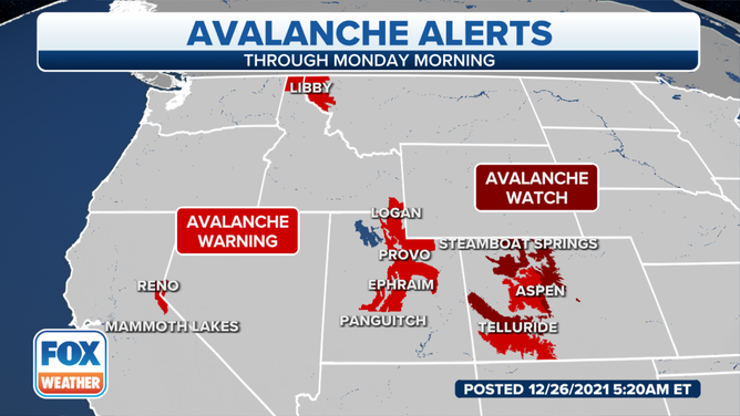
With the new snow and strong winds, the current snowpack creates dangerous conditions for avalanches. Backcountry conditions are especially dangerous and could trigger avalanches.
(FOX Weather)
California
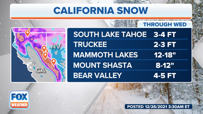
The Sierra Nevada has already picked up extensive snow in the last several days. The National Weather Service says that an additional two to five feet of snow is forecasted through early Tuesday.
(FOX Weather)
The NWS says that while the mountains can expect several feet of snow, the expected amounts in the foothills range from four to 15 inches through Tuesday.
The Winter Storm Warning will continue through Tuesday morning.
Mountain travel is highly discouraged as some roads will be impassable.
Pacific Northwest
Snow is seen in Seattle on Sunday morning.
(FOX Weather)
Many valleys that aren’t accustomed to snow will see significant snowfall through Sunday, with additional accumulation into Monday. Other lower elevations in western Washington, including Seattle, will see snow.
A range of snow accumulations for selected lower elevation locations is forecasted in Oregon. The NWS in Portland says that the region can expect two to four inches for the nearer sea-level elevations in the Willamette Valley and at the coast and four to six inches for the Gorge and foothills.
(FOX Weather)
The NWS says that mountainous regions could see 1 to 3 feet of snow.
Officials say that travel is strongly discouraged this weekend with heavy snow.