

Major cities along I-95 corridor face increased risk of urban flooding as storms reignite over Mid-Atlantic
Flood Watches have been issued from Harrisburg to Philadelphia and south through Baltimore to Washington, D.C.
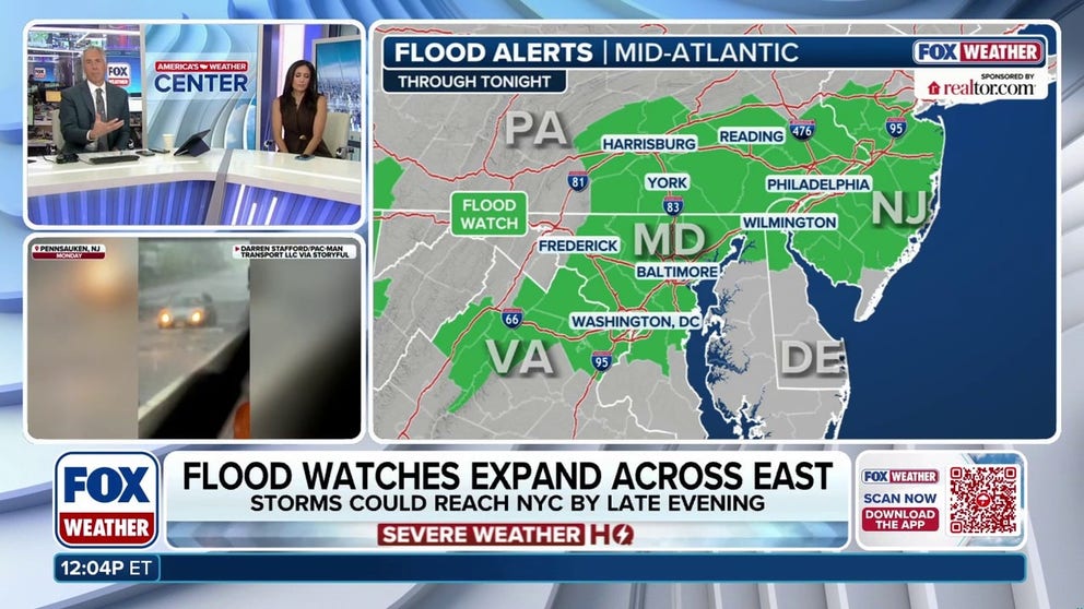
I-95 corridor faces increased risk of urban flooding as storms reignite over Mid-Atlantic
The NWS is warning of an increased urban flood threat Thursday afternoon for major metros along the I-95 corridor in the Mid-Atlantic. Cities including Washington, D.C., Baltimore and Philadelphia are on watch as yet another round of potent thunderstorms targets the area. See the timing:
WASHINGTON — The National Weather Service (NWS) is warning of an increased urban flood threat Thursday afternoon across the Mid-Atlantic, including Washington, D.C., Baltimore and Philadelphia as another round of potent thunderstorms are expected to develop over the region.
Flood Watches have been issued from Harrisburg to Philadelphia and south through Baltimore to Washington, D.C.
KNOW YOUR FLOOD TERMINOLOGY: WHAT FLOOD WATCHES, WARNINGS AND EMERGENCIES REALLY MEAN
![WASHINGTON, DC - JULY 04: Visitors shield themselves from dust blown into the air by high winds from a passing storm during "Salute to America 250" Fourth of July celebrations on the National Mall on July 04, 2026 in Washington, DC.]() Image 1 of 5
Image 1 of 5WASHINGTON, DC - JULY 04: Visitors shield themselves from dust blown into the air by high winds from a passing storm during "Salute to America 250" Fourth of July celebrations on the National Mall on July 04, 2026 in Washington, DC. (Photo by Joe Raedle/Getty Images))
![]() Image 2 of 5
Image 2 of 5A tree falls on top of power lines during severe storms in Lyme, Connecticut, on July 4, 2026. (Lyme Fire Company)
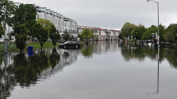
![DEAL, NEW JERSEY, US - JULY 6: A view of flooded streets after heavy rain in Deal, New Jersey, on Monday, July 6, 2026.]() Image 3 of 5
Image 3 of 5DEAL, NEW JERSEY, US - JULY 6: A view of flooded streets after heavy rain in Deal, New Jersey, on Monday, July 6, 2026. ((Photo by Lokman Vural Elibol/Anadolu via Getty Images))
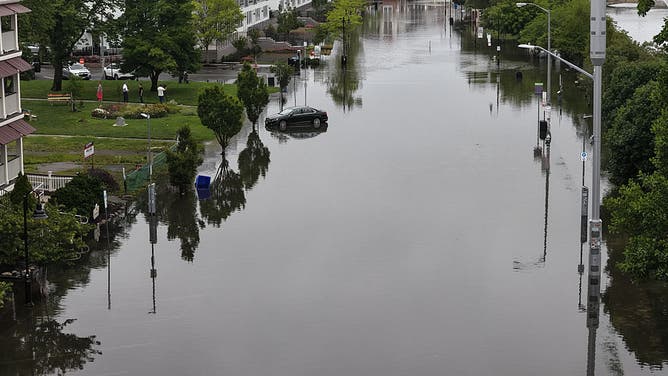
![DEAL, NEW JERSEY, US - JULY 6: A view of flooded streets after heavy rain in Deal, New Jersey, on Monday, July 6, 2026.]() Image 4 of 5
Image 4 of 5DEAL, NEW JERSEY, US - JULY 6: A view of flooded streets after heavy rain in Deal, New Jersey, on Monday, July 6, 2026. ((Photo by Lokman Vural Elibol/Anadolu via Getty Images))
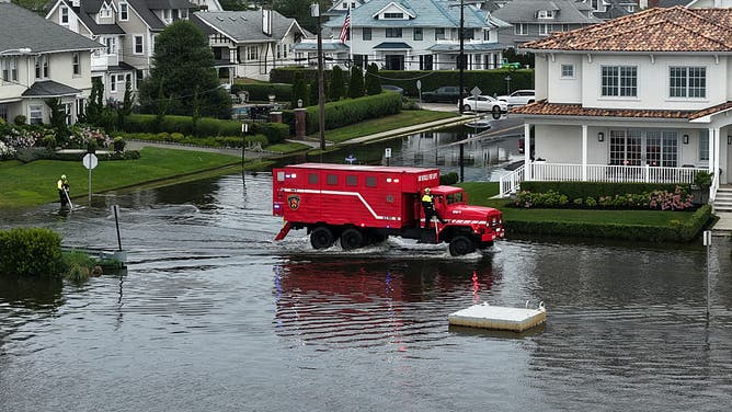
![DEAL, NEW JERSEY, US - JULY 6: A view of flooded streets after heavy rain in Deal, New Jersey, on Monday, July 6, 2026.]() Image 5 of 5
Image 5 of 5DEAL, NEW JERSEY, US - JULY 6: A view of flooded streets after heavy rain in Deal, New Jersey, on Monday, July 6, 2026. ((Photo by Lokman Vural Elibol/Anadolu via Getty Images))


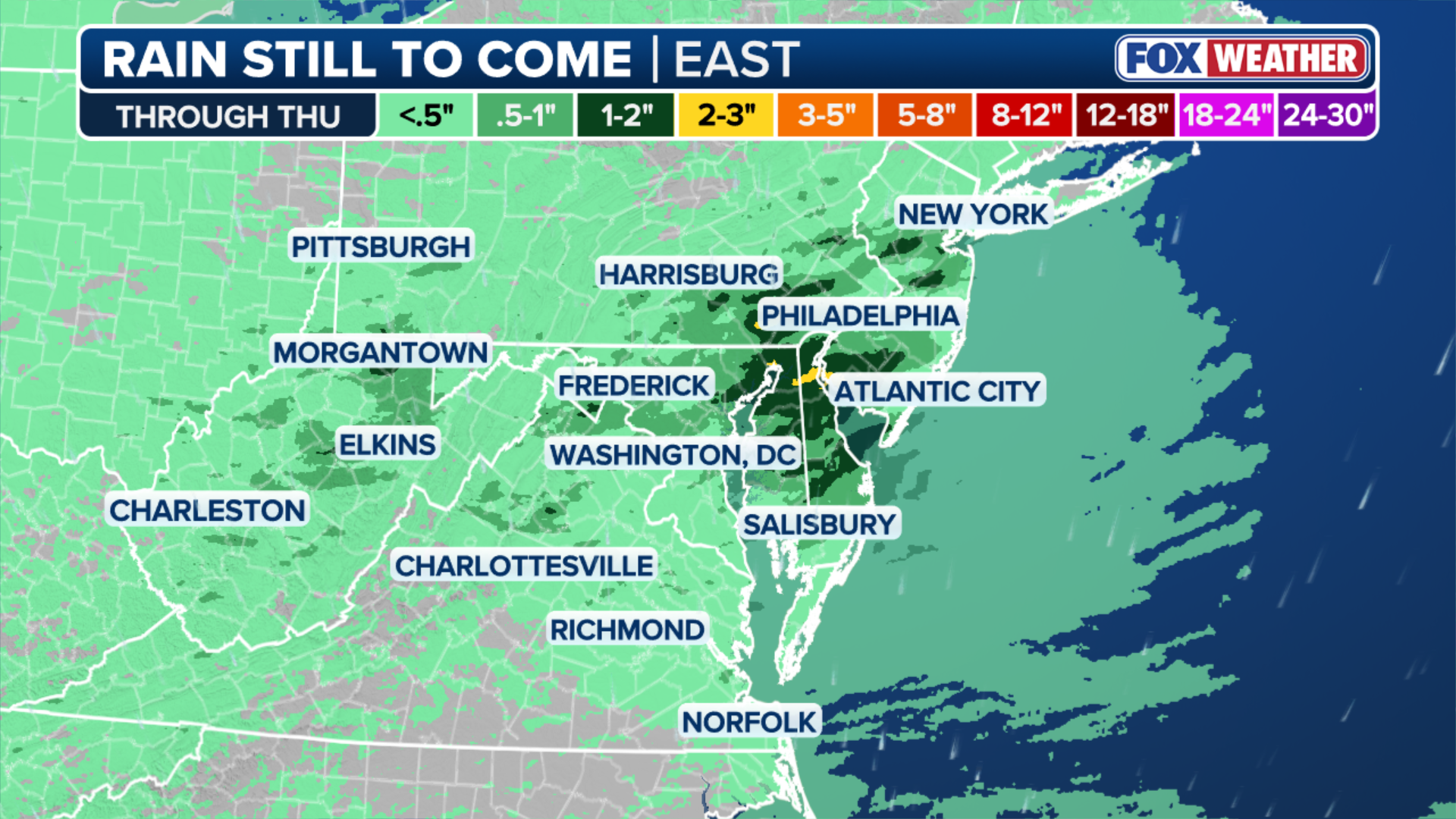
According to the FOX Forecast Center, hourly rain rates could exceed 2 inches per hour in some places.
"Localized rain totals of over 2 to 3 inches are possible within any slower-moving storms," the FOX Forecast Center said.
These storms are part of a summer weather pattern, where rounds of storms are expected to develop in the evening and afternoon through Friday.
(SOURCE GOES HERE)
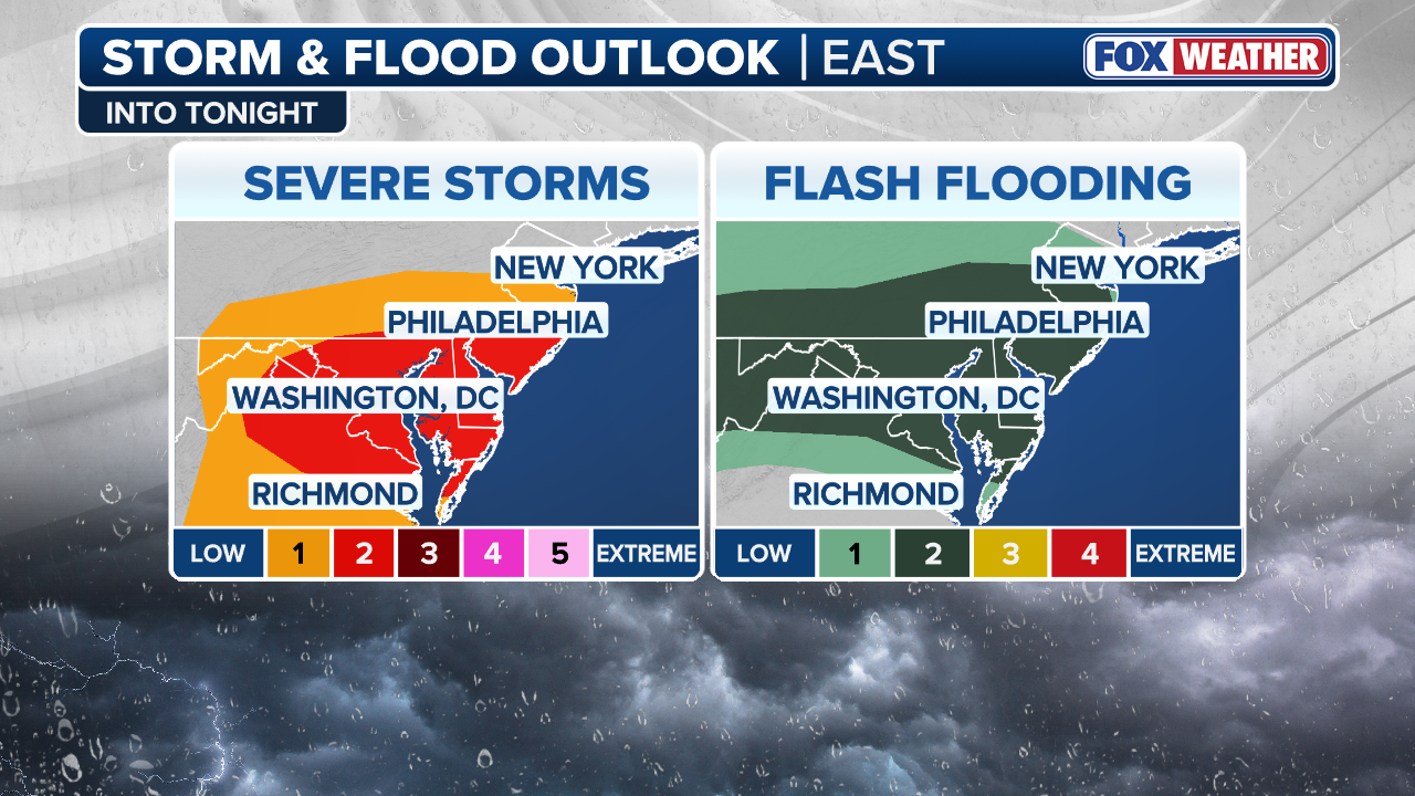
NOAA's Weather Prediction Center (WPC) has issued a Level 2 out of 4 risk of flash flooding Thursday across southern Pennsylvania, central and southern New Jersey, Delaware, Maryland, Washington, D.C. northern Virginia and eastern West Virginia.
"Locally significant urban flash flood impacts are possible if heavier cells end up over a sensitive urban location," the NWS office in Washington, D.C./Baltimore said early Thursday.
(FOX Weather)
In addition to downpours, damaging wind gusts are expected to be the main severe weather hazard.
NOAA's Storm Prediction Center (SPC) has issued a Level 2 out of 5 risk of severe storms for much of the same region, with the most damaging winds expected closer to the coast.
'WATER COMING UP TO MY FEET': FAMILY-OWNED NEW JERSEY ICE CREAM SHOP DEVASTATED BY FLOODWATERS
Thunderstorms raced across Virginia and North Carolina on Wednesday, the latest in a stretch of active weather that disrupted July 4 celebrations across the region and brought widespread flash flooding across the Northeast earlier this week.

Flooding inside BJ's Wholesale Club in Ocean Township, New Jersey, on July 6, 2026.
(Monmouth County Sheriff's Office / FOX Weather)
According to the FOX Forecast Center, more than 12,000 damaging wind reports have been recorded by the SPC across the Lower 48 this year, with the majority occurring across the Midwest and East Coast.
ROOF COLLAPSE REPORTED AT BJ'S WHOLESALE CLUB DUE TO FLOODING IN NEW JERSEY

Watch: Drone video shows flooded parts of Asbury Park, New Jersey, after torrential rainfall
Drone video shows flooded parts of Asbury Park, New Jersey, on Monday after torrential rainfall.
"That is well above the typical pace for mid-July, when the average is around 8,700 reports — more than 3,000 fewer than this year's total. In fact, July 4 was the busiest day of the year for severe weather reports across the East, with damaging winds accounting for most of those reports," the FOX Forecast Center said.
Check back for updates on this developing story.