Severe storms with damaging winds, large hail and tornadoes threaten the Plains on Tuesday
Severe storms will begin to develop late Tuesday afternoon and continue into the overnight
Potential severe weather threat in Plains on Tuesday
There is a potential severe weather threat in the Plains on Tuesday.
Severe thunderstorms will pose threats of damaging winds, large hail and tornadoes across the Plains and South through the middle of this week.
The next round of severe weather gets underway late Tuesday in the Central and Southern Plains as an upper-level disturbance punches out of the Rockies and into the central United States.
FALL IS THE SECOND SEVERE WEATHER SEASON
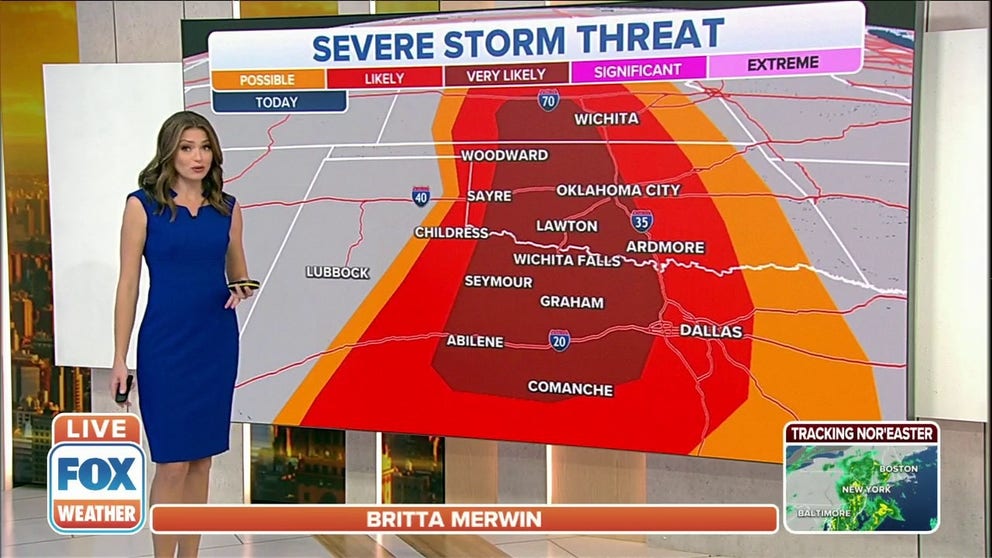
Severe storms will begin to develop late Tuesday afternoon from southern Nebraska into Kansas, Oklahoma and west-central Texas, continuing through the evening and into the overnight. Large hail and damaging wind gusts are the main threats, but isolated tornadoes are also possible in the area shaded dark red in the map below.
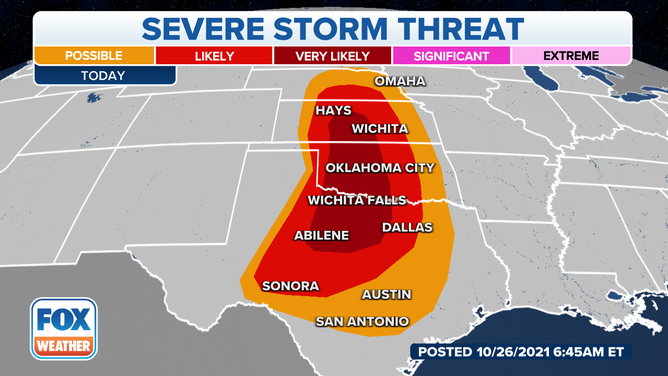
Severe thunderstorm threat on Tuesday, Oct. 26, 2021.
(FOX Weather)
On Wednesday, the risk of severe storms shifts eastward along the western and central Gulf Coast from parts of eastern and southeastern Texas to Louisiana, southern Mississippi and southern Alabama.
Damaging wind gusts and a few tornadoes are the main threats in this region Wednesday into Wednesday night.
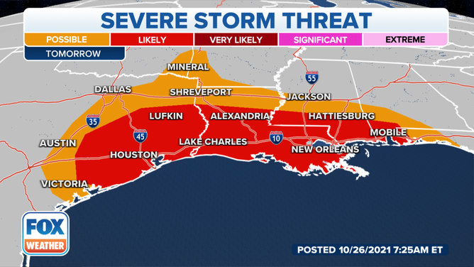
Severe thunderstorm threat on Wednesday, Oct. 27, 2021.
(FOX Weather)
Scattered severe thunderstorms are then possible Thursday into Thursday night in parts of the Southeast as this storm system continues moving eastward.
These storms will pose threats of damaging wind gusts and a few tornadoes.
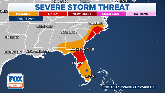
Severe thunderstorm threat on Thursday, Oct. 28, 2021.
(FOX Weather)