Fall is the second severe weather season
Fall can be notorious for an uptick in severe thunderstorms and tornadoes across parts of the South.

Severe weather risk flares back up during fall months
While spring has the most notorious reputation for severe thunderstorms and destructive tornadoes, the fall months often bring an uptick in severe weather as the transition from summer to winter takes place.
While spring has the most notorious reputation for severe thunderstorms and destructive tornadoes, the fall months often bring an uptick in severe weather as the transition from summer to winter takes place.
The Gulf Coast region, where temperatures and humidity typically remain higher than most of the U.S., can experience a secondary peak of tornadoes during the fall. Sometimes, fall twisters can even spread northward into parts of the Midwest. The general tornado risk area in October is shown below.
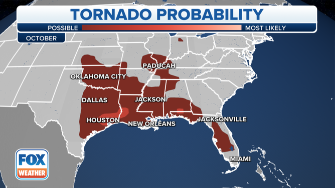
October's tornado probability.
(FOX Weather)
The fall is when the jet stream begins its southward migration toward the southern U.S. As it does so, it strengthens as the temperature contrast between cold air to the north and warm air to the south becomes more pronounced.
A stronger jet stream can fuel severe weather, adding the spin and energy needed in the atmosphere for thunderstorms to grow and intensify, possibly leading to the formation of tornadoes.
WHERE ARE TORNADOES MOST COMMON?
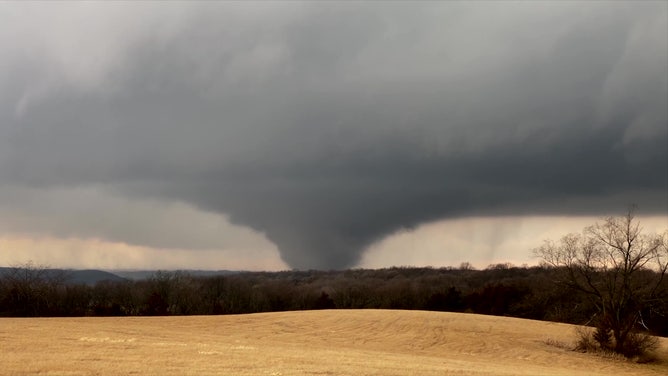
EF-4 tornado approaches Winterset, Iowa, on March 5, 2022.
(Adam O'Neil / PepperHarrow Farm)
Severe weather in the fall is often found where there’s a southward dip in the jet stream – called a trough – or a cold front moving through a region.
The map below shows that tornado risk increases in November across the lower Mississippi Valley and into parts of the Southeast compared to October. Tornadoes are also still possible farther north into parts of the Midwest in November.
HOW DO TORNADOES FORM AND HOW LONG DO THEY LAST?
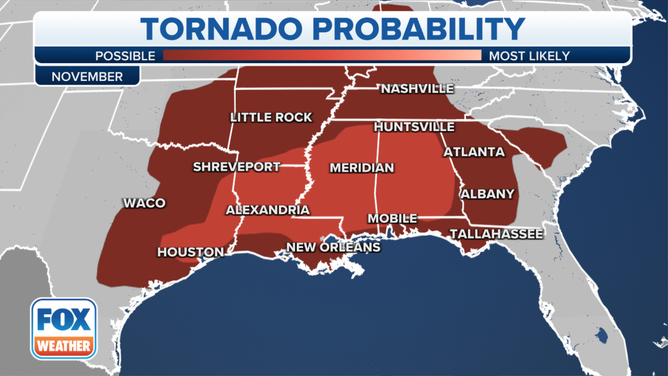
November's tornado probability.
(FOX Weather)
However, by December, the main risk for tornadoes retreats back toward the northern Gulf Coast states. That’s because most of the warmth and moisture is limited to that region as winter sets in across the U.S.
HERE'S WHERE TORNADOES ARE MOST LIKELY TO OCCUR IN EACH MONTH
Any late-season tropical activity can also provide an uptick in severe weather along the Gulf Coast in November and December.

December's tornado probability.
(FOX Weather)