Severe storms produced large hail in Texas on Sunday
Sirens blasted in downtown Dallas Sunday evening as multiple severe thunderstorms threatened the area. Two-inch-diameter hail was spotted southwest of the Dallas-Fort Worth Metroplex. Other reports of golf-ball- and quarter-sized hail were received throughout Central and North Texas.
Severe thunderstorms could bring large hail, damaging winds to Dallas metro
The FOX Forecast Center is tracking the risk of severe thunderstorms that could bring large hail and damaging winds to millions across Texas, including the Dallas metro.
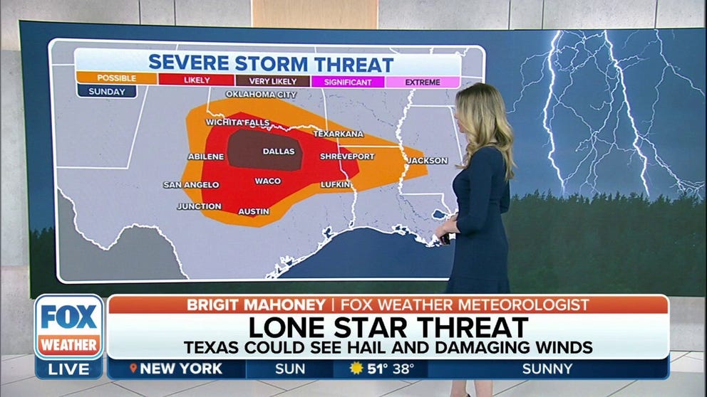
DALLAS – The Dallas-Fort Worth Metroplex was in the bull's-eye of a severe thunderstorm threat on Sunday that brought very large hail and strong winds to North and Central Texas.
As a warm front moved north and a dryline slid east across Texas, moisture from the Gulf of Mexico overlapped with these two features and triggered the development of severe storms.
NOAA's Storm Prediction Center had issued a Tornado Watch for portions of Texas, Oklahoma and Louisiana through the late-evening hours.
While the overall risk of severe weather stretched from Central and North Texas into southern Oklahoma, southern Arkansas, northern and central Louisiana and west-central Mississippi, the highest threat was focused across North Texas, including the Dallas-Fort Worth Metroplex.
Sirens blasted in downtown Dallas Sunday evening as multiple severe thunderstorms threatened the area.
Two-inch-diameter hail was spotted southwest of the Dallas-Fort Worth Metroplex. Other reports of golf-ball- and quarter-sized hail were received throughout Central and North Texas.
Isolated severe storms possible Monday
On Monday afternoon and evening, areas of isolated to widely scattered strong thunderstorms posing some risk of severe weather are possible across parts of the southern Plains, mid-Mississippi Valley and central Gulf Coast states.
Large hail and damaging wind gusts are the main threats in those regions.