Strong storms target millions in southeast after bringing hail, damaging winds to Tennessee
The most likely chance for severe weather returns on Sunday, with a level 1 out of 5 severe threat in place from Virginia to Florida along the Southeastern coast.

10 million Americans under severe storm threat this weekend
Strong storms could target the Southeastern U.S. this weekend, with a 1 out of 4 severe threat in place from Virginia down to Florida. The main threats will be damaging wind and hail.
NASHVILLE, Tenn. – As the second severe weather season gets underway, storms are threatening millions of Americans through the weekend.
More than 10 million Americans are at risk for strong storms, and while scattered storms are possible on Saturday, the main threat for storms is Sunday in the Southeast.
According to the FOX Forecast Center, most of the storms that impacted the Tenneseee Valley on Friday came to an end by Saturday morning.
FIRST TASTE OF LA NINA WINTER AHEAD WITH BIG FREEZE, SNOW

(FOX Weather)
The most likely chance for severe weather returns on Sunday, with a level 1 out of 5 severe threat in place from Virginia to Florida along the Southeastern coast.
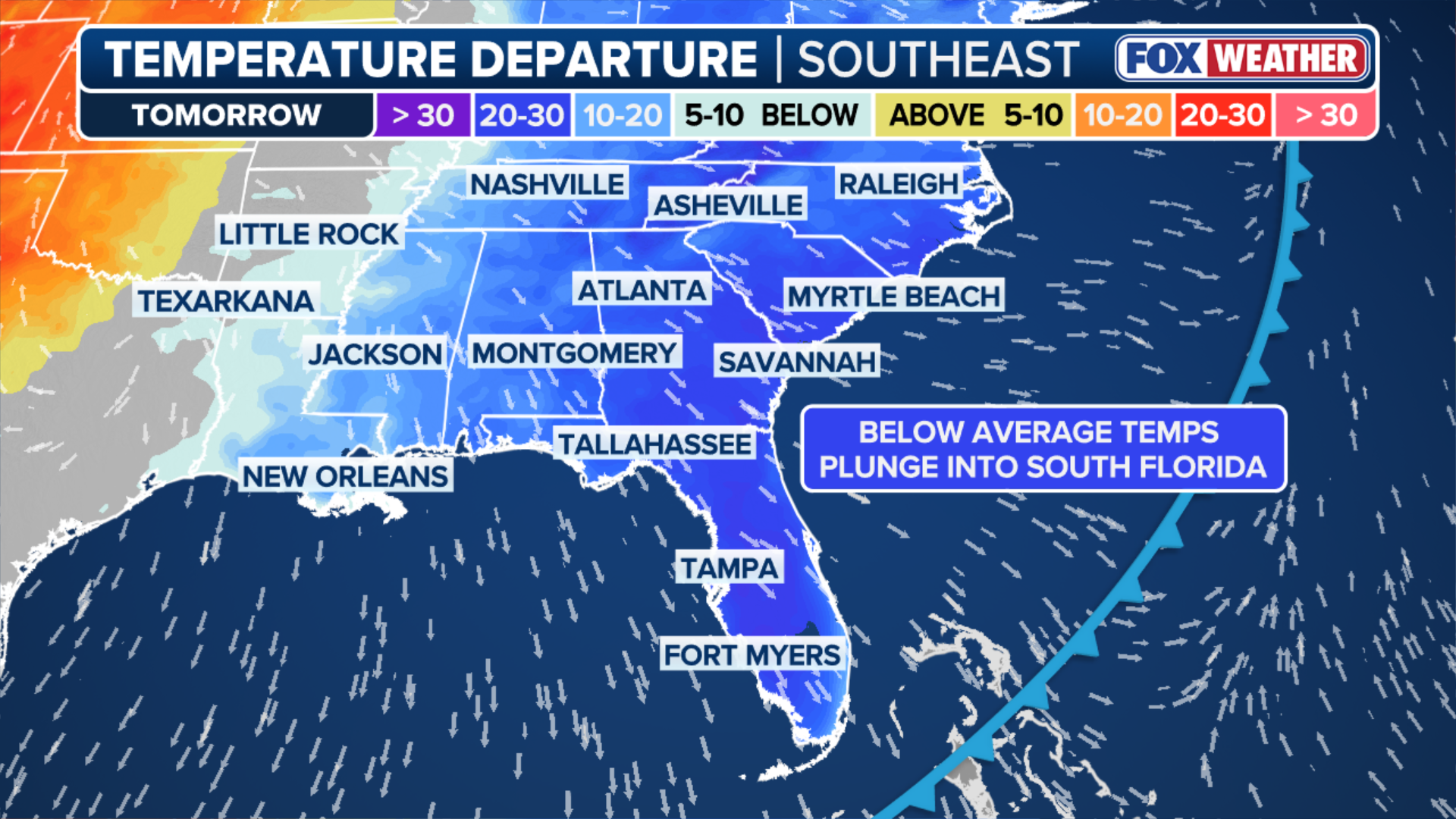
These storms will come ahead of a blast of arctic air that could break record temperatures as parts of the Southeast are expected to see a significant dip in temperatures, with projected low temperatures in the 30s on Monday for places like Atlanta and as far south as Jackson, Mississippi.
(FOX Weather)
Friday storms in Tennessee
Severe storms on Friday night in Tennessee produced a Tornado Watch, but no tornadoes, as well as hail and damaging winds.
Quarter-sized hail was reported in Williamson County.

Watch: Hailstorm rattles middle Tennessee during severe weather
Severe storms on Friday night brought heavy rain and hail to central Tennessee. Video from Williamson County shows a deluge of hail hitting the ground during the bad weather.
Video from Williamson County showed a deluge of hail hitting the ground during the storms.

Gusty winds hit Nashville during Friday night storms
Video from Friday nights shows winds knocking leaves off the trees during severe weather in Nashville.
Video from Nashville showed strong winds knocking the leaves off trees during the worst of the storms.
Storms move out of the Southeast by Monday.