Will significant plume of Saharan dust reach US this week?
NOAA says the air surrounding a dust plume has 50% less moisture than the typical atmosphere, which means the presence of the Saharan Air Layer can be detrimental to cloud formation and thunderstorm activity.
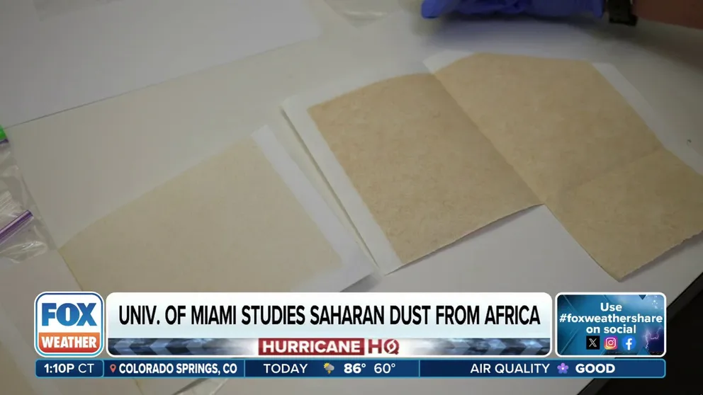
See what Saharan dust looks like to university researchers
FOX Weather's Brandy Campbell was granted access to see how university researchers are studying plumes of Saharan dust in Florida.
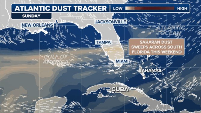
Forecasters are keeping a close eye on a significant plume of Saharan dust that is making its way off of Africa and through the Atlantic for the possibility that it could reach parts of the United States late this week.
Every year, NOAA estimates more than 180 million tons of dust leave the African continent, with the extremely dry air cutting down on thunderstorm activity and tropical cyclone formation.
(FOX Weather)
With the help of forecast models and satellites, meteorologists are tracking whether the current plume will survive its trek across the Atlantic Ocean or simply mix out of the atmosphere to be noticeable.
If it does survive the trek, it could mark the first major visible dust event of the season across Florida and the Gulf Coast, although it won’t be the first wave of dust particles in the skies over the U.S. this year.
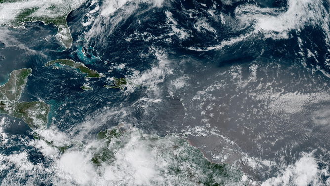
NOAA satellite image from 5/30/2025 showing a major dust plum working into the Caribbean Sea.
(NOAA)
During the final days of May, a minor invasion of the particles was detected over parts of the Gulf of America, including the Florida Keys.
The event was largely not visible to the naked eye but was confirmed using scientific data from weather balloons.
Weather balloons equipped with radiosondes, an instrument that measures atmospheric conditions, picked up signs of mid-level dry air associated with Saharan dust over the Florida Keys on Friday.
These devices provide critical data on temperature, humidity levels, and wind speeds and can help confirm the presence of fine airborne particles from Africa.
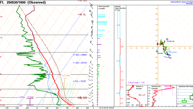
Key West, Florida sounding from 5/30/2025, with the green line showing the dew point reading. Dry layers in the atmosphere can reduce thunderstorm activity.
(NOAA)
Historically, Saharan dust outbreaks across the Atlantic peak in June and July before tapering off in late August.
In 2024, record-breaking amounts of dust affected Europe, leading to hazy skies and subdued tropical cyclone development in the Atlantic basin.
The SAL's dry, stable air acts as a suppresses tropical cyclone formation, which is one reason why early-season hurricane activity tends to be confined to the Gulf, Caribbean and western Atlantic.

(FOX Weather)
If the current plume maintains its density, it could bring hazy skies and colorful sunrises to Florida and cutdown on thunderstorm activity.
During more pronounced events, the dust can also lead to potential health concerns; however, this outcome is fairly rare in the U.S.
According to medical experts at WebMD, fine dust particles can irritate the eyes, nose and throat, particularly for individuals with respiratory illnesses.