Saildrones bound for yearlong Gulf Stream mission deployed off Rhode Island
Unmanned boats will study ocean current’s affect on weather, carbon emissions
Gulf Stream Mission aims to improve forecasting with help of saildrones
Data found will be sent via satellite in near real-time to help scientists improve their Earth system approach to forecasting, and those at the University of Rhode Island working to quantify the Gulf Stream’s role in carbon uptake.
NEWPORT, R.I. – Three saildrones that will spend a year at sea to study one of the world’s great ocean currents were deployed Thursday off the coast of Rhode Island.
The unmanned scientific vehicles sailed into Category 4 Hurricane Sam in September. In addition to providing jaw-dropping video of massive waves driven by 120 mph winds, the drone recorded valuable data from inside the storm.
Now, those drones are being given a new mission – take direct measurements of the Gulf Stream.
The powerful ocean current carries warm water from the tropical regions of the Atlantic Ocean into the Gulf of Mexico. The stream curves around Cuba and the Florida Peninsula before heading north along the East Coast of the U.S. It eventually deposits that warm water into the northern stretches of the Atlantic Ocean. The current plays a big role in the weather not only in the U.S., but also in Europe.
The goal is to collect real-time data about not only weather and water conditions, but also how the air and ocean exchange heat and carbon.
"Weather, because the Gulf Stream fuels our nor’easters and intensifies storms, and climate, because a lot of carbon dioxide is taken up by the Gulf Stream, and stops it from building up in the atmosphere, where it causes climate change," said Jamie Palter, associate professor of oceanography at the University of Rhode Island and one of the lead scientists for the mission.
Saildrones set to launch on Gulf Stream Mission
The Gulf Stream mission will last six months and the saildrones will collect critical data that will help scientists improve weather forecasts and carbon accounting.
Palter said that as the warm water being carried north by the Gulf Stream cools, it can trap larger amounts of carbon. However, scientists are not yet sure just how much carbon is captured by the current.
"We want to be able to quantify that better to help reduce uncertainty in the global carbon budget, which, right now, is preventing us from tracking our progress toward curbing our carbon emissions," Palter told FOX Weather correspondent Steve Bender.
Palter said estimates on the level of that uncertainty vary, but some are as high as 4 billion tons of CO2 each year.
"Which is about the emissions of the entire European Union," she said.
The data is also being shared with scientists in Europe, who will use it to help refine their weather forecast models.
![Saildrones Gulf Stream mission 2021]() Image 1 of 5
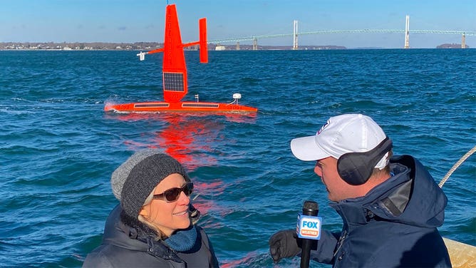
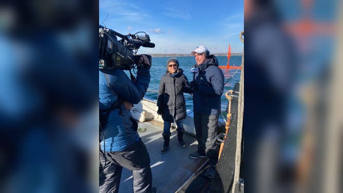
Image 1 of 5Jamie Palter, one of the lead scientists of the Saildrone Gulf Stream mission, talks to FOX Weather correspondent Steve Bender off the coast of Newport, Rhode Island, on Dec. 9, 2021. ( )
![Saildrones Gulf Stream mission 2021]() Image 2 of 5
Image 2 of 5Jamie Palter, one of the lead scientists of the Saildrone Gulf Stream mission, talks to FOX Weather correspondent Steve Bender off the coast of Newport, Rhode Island, on Dec. 9, 2021. ( )
![Saildrones Gulf Stream mission 2021]() Image 3 of 5
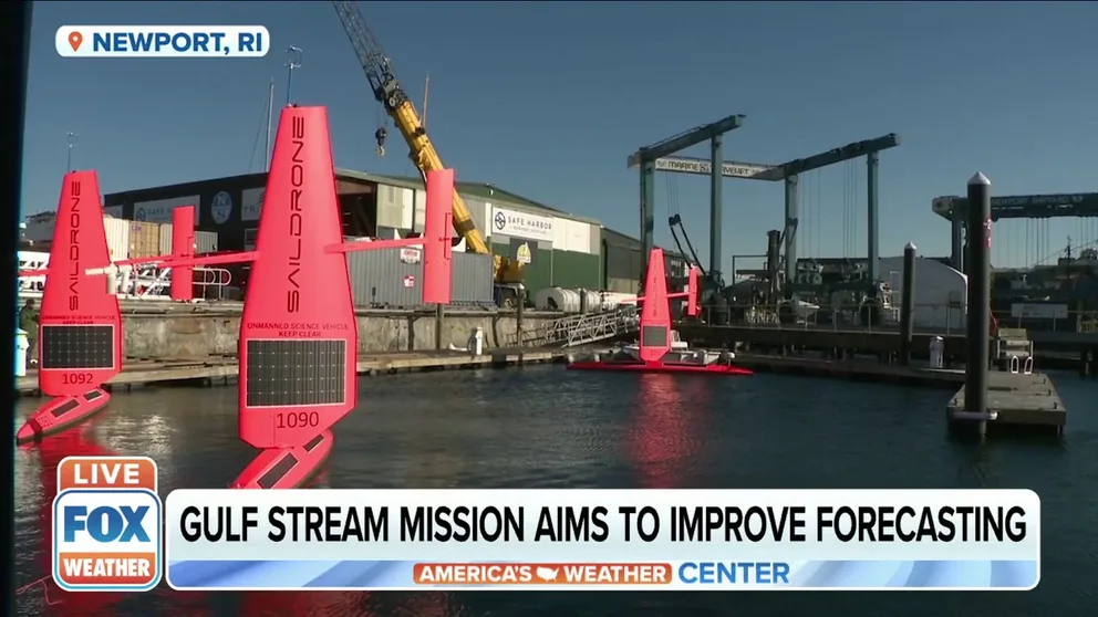
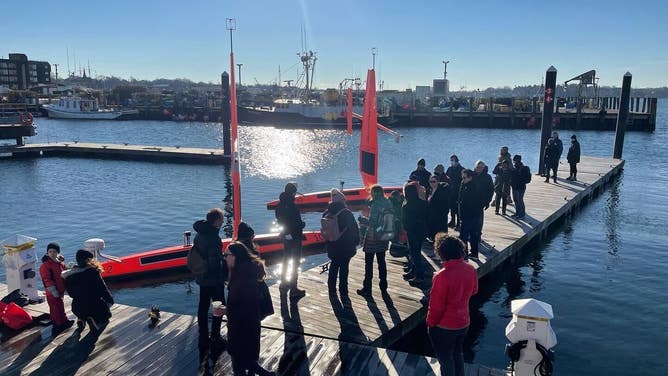
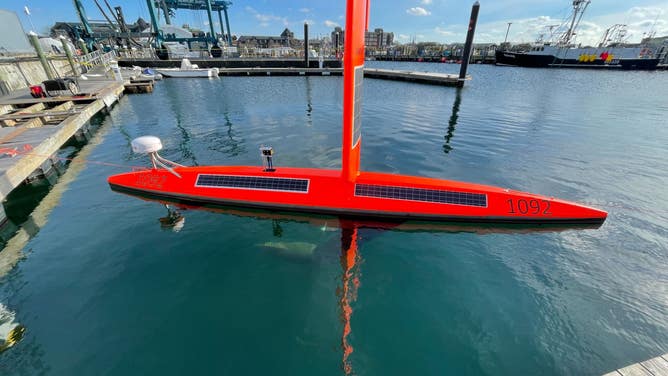
Image 3 of 5Saildrones are seen docked in Newport, Rhode Island, on Dec. 9, 2021. ( )
![Saildrones Gulf Stream mission 2021]() Image 4 of 5
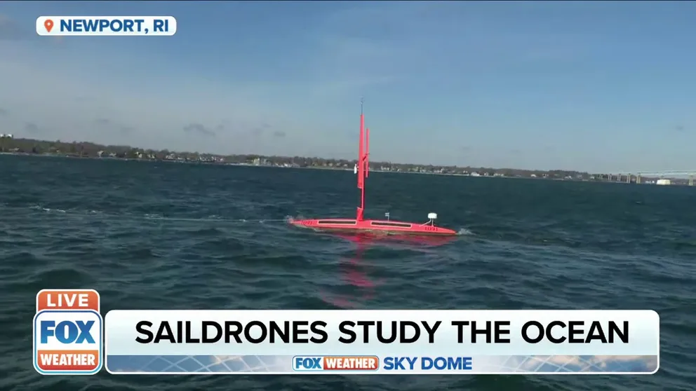
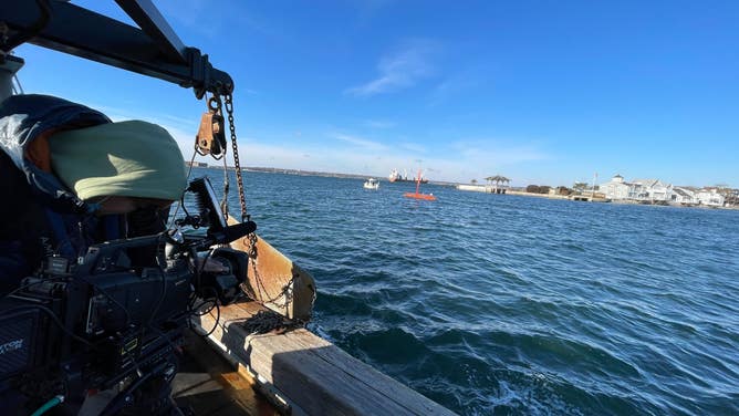
Image 4 of 5A saildrone moves through waters off the coast of Newport, Rhode Island, on Dec. 9, 2021. ( )
![Saildrones Gulf Stream mission 2021]() Image 5 of 5
Image 5 of 5Saildrones are seen docked in Newport, Rhode Island, on Dec. 9, 2021. ( )
"The location of the Gulf Stream and the sharp temperature differences on either side can have a big impact on weather forecasts and climate predictions," said Philip Browne, a research scientist at the European Centre for Medium-Range Weather Forecasts. "We are excited to be able to target saildrones to collect data from this physically and scientifically challenging region and begin exploiting the information they will provide to help improve our earth system approach to forecasting."
Analysis of the data should be complete by late summer 2023, according to Saildrone.