Saharan dust eyes muddying skies across Gulf Coast, Texas after easing in Florida
This thick plume of dust arrived during the first week of the Atlantic hurricane season, helping keep tropical development at bay – for now. The Saharan dust is forecast to linger into the weekend and move into the Southeast and parts of the Gulf Coast states through Texas.

Saharan dust spreads across the Atlantic, arriving in Florida sky
FOX Weather Correspondent Brandy Campbell reports from Miami, Florida where Saharan dust has clouded the sky. The Saharan Dust Layer also helps suppress tropical activity in the Atlantic Basin. Particles from the dust scatters sunlight in a way creating vibrant sunrises and sunsets.
MIAMI – A massive plume of Saharan dust is moving on toward the Gulf Coast and Texas this weekend, a day after turning Florida skies a milky gray and limiting some showers and thunderstorms.
Video from Cocoa Beach shows a hazy sunrise from the dust.

Watch: Saharan dust makes for hazy sunrise on Florida's Space Coast
Saharan dust is continuing to cloud skies Friday morning in Florida. The dust is set to start easing this weekend. Video from Cocoa Beach shows the dusty sunrise.
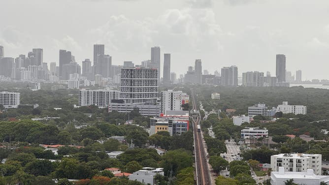
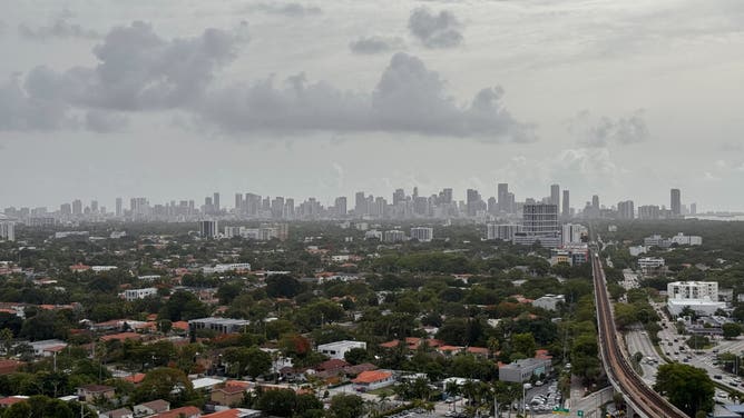
The immediate impacts in Florida of the dust were in the appearance to the sky. Cameras over Miami and South Florida showed a muddied, muted sky on Thursday morning.
5 THINGS TO KNOW ABOUT THE SAHARAN DUST PLUME
![Saharan dust clouds the sky above Miami on June 5, 2025.]() Image 1 of 5
Image 1 of 5Saharan dust clouds the sky above Miami on June 5, 2025. ( )
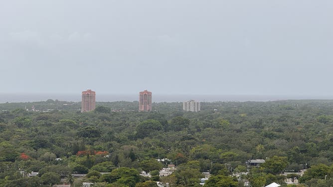
![Saharan dust clouds the sky above Miami on June 5, 2025.]() Image 2 of 5
Image 2 of 5Saharan dust clouds the sky above Miami on June 5, 2025. (FOX Weather)
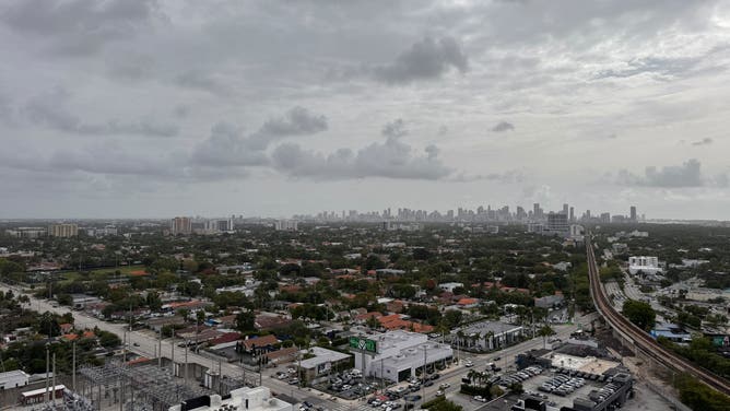
![Saharan dust clouds the sky above Miami on June 5, 2025.]() Image 3 of 5
Image 3 of 5Saharan dust clouds the sky above Miami on June 5, 2025. ( )
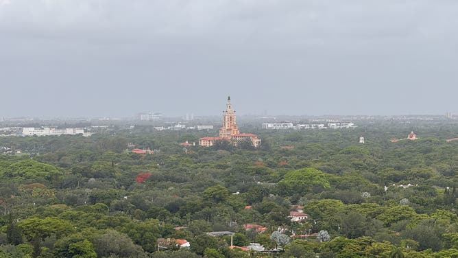
![Saharan dust clouds the sky above Miami on June 5, 2025.]() Image 4 of 5
Image 4 of 5Saharan dust clouds the sky above Miami on June 5, 2025. (FOX Weather)
![Saharan dust clouds the sky above Miami on June 5, 2025.]() Image 5 of 5
Image 5 of 5Saharan dust clouds the sky above Miami on June 5, 2025. ( )
Some areas across Florida experienced reduced air quality on Thursday and Friday while the dust spread into the Southeast.
On Friday, the Air Quality Index (AQI) was "good" throughout the panhandle and southern portion of Florida, while central Florida remained in "moderate" stage.

(FOX Weather)
Those who suffer from asthma or other respiratory issues may want to limit their time outdoors if they are in the "moderate" zone.
Saharan dust to spread along Gulf Coast into Texas
The Saharan dust is forecast to linger into the weekend and move into the Southeast and parts of the Gulf Coast states through Texas.
Those in Houston and New Orleans could see some milky or hazy skies, and perhaps some orange-tinged sunrises and sunsets.

(FOX Weather)
This thick plume of dust arrived during the first week of the Atlantic hurricane season, also working to help keep tropical development at bay – for now.
"I always think that Mother Nature has this checks and balance system and, for me, when it comes to hurricane season, the Saharan dust is the checks and balance system that we have," said FOX Weather Meteorologist Melissa Torres. "The drier air inhibits (and) helps suppresses any activity and if you get a thick enough layer, it can also maybe keep some of the temperatures of the sea surface from warming dramatically."
The NOAA’s GOES-19 satellite time lapse video below shows the 5,000-mile journey from Africa as the dust traveled thousands of miles across the Atlantic from late May to this week.
NOAA estimates that more than 180 million tons of dust leave Africa every year, and the extremely dry air reduces thunderstorm activity and tropical cyclone formation.
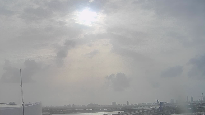
A view of the sky from FSWN Miami Dade College Wolfson Campus on Thursday, June 5, 2025 as Saharan dust fills the sky.
(Weatherstem / FOX Weather)
However, the dust particles can also create more vibrant colors for sunrise and sunset. As the larger dust particles scatter visible light, longer wavelengths like red, orange and pink will make for striking sunrises and sunsets.

This NOAA GOES satellite image produced by CSU/CIRA shows the wildfire smoke and the dust haze over the U.S. this week.
(CSU/CIRA & NOAA)