

Rounds of severe storms to ride along heat dome, bring thunderstorms to Midwest and Northeast
The FOX Forecast Center is monitoring storms that are forecast to bring large hail and damaging wind gusts to the Midwest on Friday. The storms will continue through the overnight hours to kick off the weekend through the start of next week.
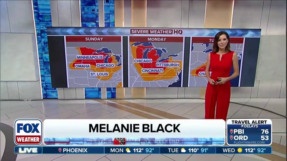
Millions face another multiday round of severe storms from Midwest to East
Millions are in the path of another multiday severe weather threat this week as storms will sweep from the Midwest toward the Northeast and Mid-Atlantic, bringing risks of destructive winds, large hail, isolated tornadoes, compounded by another flash flood risk. FOX Weather Meteorologists Melanie Black and Michael Estime have the latest:
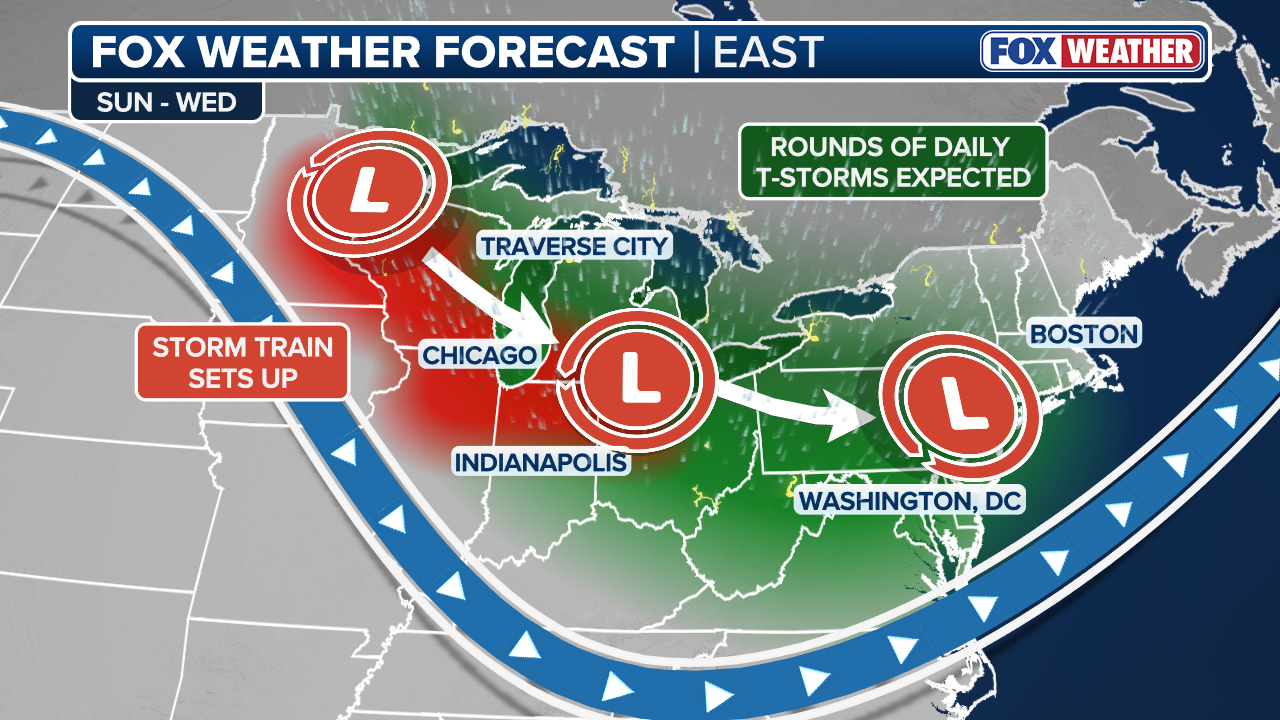
After a week full of nasty weather across portions of the U.S., ridge-riding severe storms are making a return to the Upper Midwest this weekend.
Intense heat caused by a heat dome settling over the central U.S. is fueling instability for storms heading into Sunday and the work week.
WHAT IS A HEAT DOME AND HOW CAN IT AFFECT YOU DURING THE SUMMER MONTHS?
Storms fired up again late Saturday afternoon and into the evening across parts of northern and central Minnesota, northern Wisconsin and into Michigan's Upper Peninsula.

(FOX Weather)
On Friday, storms brought hail and damaging wind gusts to the Upper Midwest, namely in Minnesota and the Dakotas. The storms continued through the overnight hours.
The FOX Forecast Center said these storms were capable of producing baseball-sized hail, damaging winds and possibly even a tornado or two.
(FOX Weather)
Hot temperatures and a very moist air mass will result in a volatile and strongly unstable atmosphere on Sunday across the Upper Midwest, capable of producing powerful thunderstorms.
However, much like on Saturday, a strong cap will keep storms at bay for much of the day, leading to low confidence in exactly how the storms will develop, the FOX Forecast Center said.
2 DEAD IN WEST VIRGINIA AFTER CATASTROPHIC FLOODING SLAMMED THE STATE, TRIGGERING STATE OF EMERGENCY
As a result, a Level 3 out of 5 severe storm risk is in place for Sunday across Minnesota, northern Iowa and western Wisconsin.
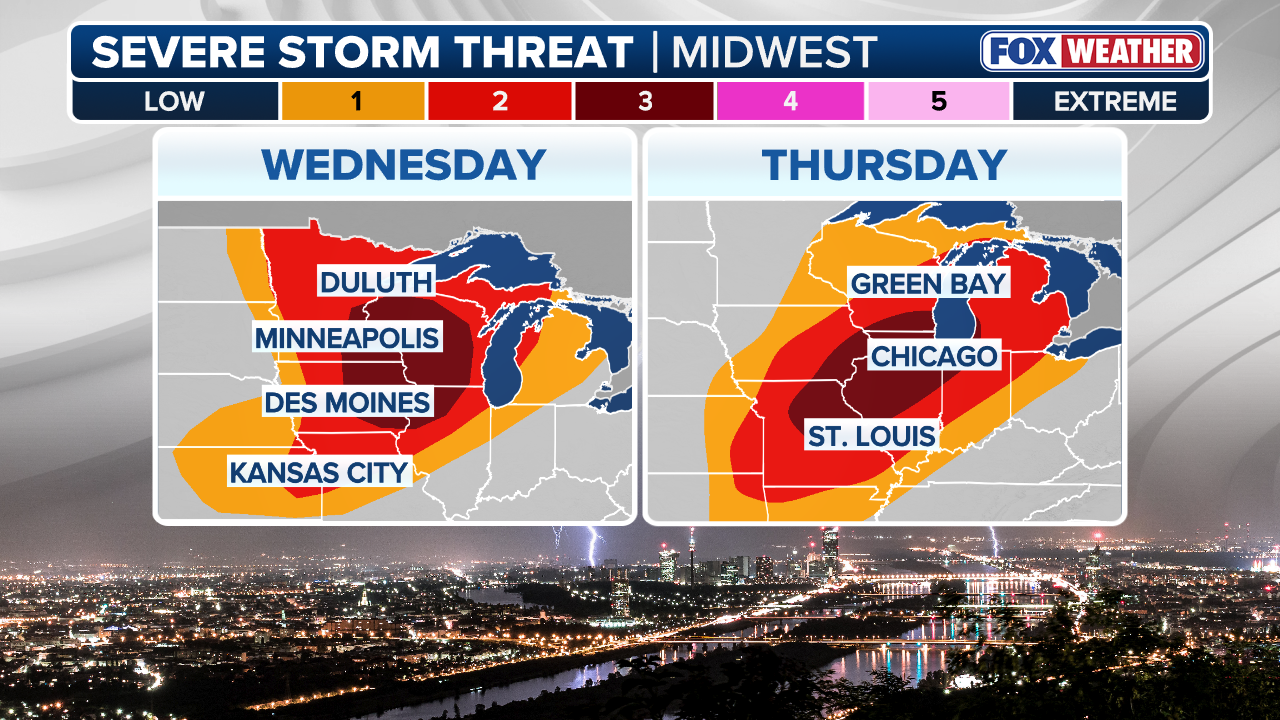
(FOX Weather)
The storm risk will continue through Monday, as another round of storms is expected to develop East across major cities, including Chicago, Detroit, Indianapolis and Cleveland.
This will be the transition day to more widespread thunderstorm activity, and by Monday afternoon, thunderstorms will be found from Illinois to New York.
OVER 20 MILLION AMERICANS FACE DANGEROUS FLOOD THREAT AS HEAVY RAINS BATTER CAROLINAS, MID-ATLANTIC
If the severe storms weren’t enough, there is also a risk of flash flooding across the Great Lakes and Northeast.

(FOX Weather)
On Tuesday, a compact but potent upper-level disturbance dropping out of Canada will promote widespread downpours and soaking rain across the Northeast.
Rain totals will generally be around 1 to 2 inches, with localized heavier amounts where storms repeatedly hang out over the same areas.
While it seems like it has rained every weekend along the immediate East Coast, much of the region remains under ongoing drought conditions.
Be sure to check with FOX Weather all weekend long as we monitor the developing weather conditions.