

Record-warm Gulf waters could fuel late-season tropical activity despite El Niño suppression
The Gulf's record warmth could fuel late-season October tropical activity—or, if the Atlantic stays quiet, set the stage for a highly severe fall and winter storm season.
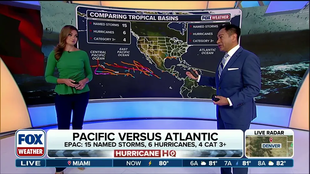
Pacific tropics remain active as Atlantic nears historic territory
A roaring Pacific. A snoozing Atlantic. The culprit? A brewing super El Niño. FOX Weather meteorologists Britta Merwin and Craig Herrera break down the tale of two seasons:
THE TAKEAWAY
- Much of the Florida and Gulf waters have reached record-warm territory.
- An October tropical system could rapidly fuel up on the untapped ocean heat.
- Alternatively, ongoing El Niño-driven inactivity could prime the Florida Peninsula for a severe fall and winter weather season.
FLORIDA- Record-warm waters around Florida and the Gulf are creating an unusual setup as El Niño continues to suppress tropical activity in the Atlantic, according to our affiliate, FOX 35 Orlando meteorologist Noah Bergren.
"A good majority of the water around Florida and in the Gulf is now at record territory for the surface temp," Bergren said.
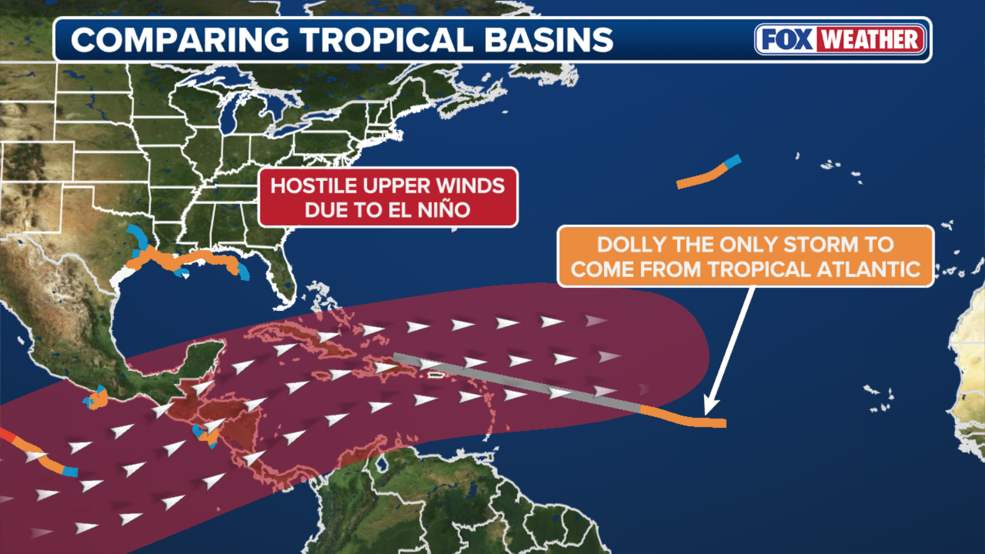
Despite ocean conditions that can easily support tropical development, no hurricanes have formed in the Atlantic so far this year. In fact, the basin is nearing historic territory for the latest first hurricane of the season.
(FOX Weather)
Since the beginning of the satellite era in 1966, the latest date for a season's first Atlantic hurricane is September 11—a record set by Hurricane Gustav in 2002 and tied by Hurricane Humberto in 2013.
Without a storm in sight, 2026 is poised to break that record.
For perspective, the atmosphere and ocean are locked in a massive tug-of-war across Florida and Gulf waters.
While the record warm water is present, hostile atmospheric conditions brought on by El Niño—such as strong wind shear—are actively tearing developing systems apart. Meanwhile, El Niño is having the exact opposite effect in the Pacific, producing a massive surge of tropical activity.

(FOX Weather)
This atmospheric battle could become particularly important later in the Atlantic season.
BREWING SUPER EL NIÑO EXPECTED TO BE STRONGEST ANYONE ALIVE ON THE PLANET HAS EVER EXPERIENCED
If a tropical system manages to develop in October as a cold front pushes south, the Gulf’s untapped ocean heat could provide ample fuel for a storm moving relatively close to Florida, Bergren warned.
There is also another potential outcome if the Atlantic remains quiet.
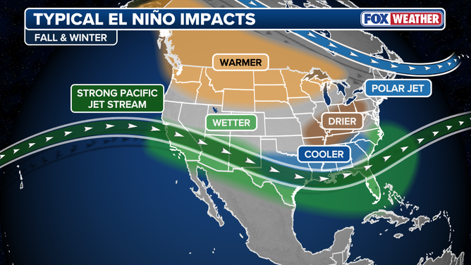
Typical El Niño winter impacts.
(FOX Weather / FOX Weather)
Bergren notes that the combination of an inactive hurricane season and a strong El Niño pattern could set the stage for a highly active fall and winter severe weather season across the Florida Peninsula, raising the threat level for heavy thunderstorms and tornadoes.
"A much warmer than average Gulf helps to keep instability up for thunderstorm risks in the winter-time on the Florida Peninsula," he explained.
This unprecedented ocean warmth is a direct reflection of what has already been a top-10 hottest summer on record for the Sunshine State.