Scattered damaging winds possible across parts of Florida peninsula Saturday evening
Gusty winds and heavy rain are the main concern in any storms that develop
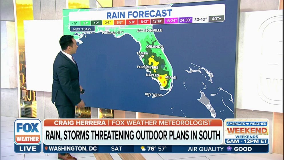
Rains, storms threaten outdoor plans Saturday in South
Gusty winds and large hail are the biggest concerns with the strongest storms. The tornado threat is very low.
A soggy weekend is in store for parts of the Southeast and Florida as an out ridge of high-pressure shifts back to the West.
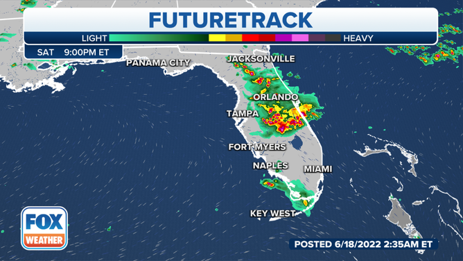
The National Weather Service in Melbourne, Flordia, said showers and storms are beginning to push into far northern portions of the local area as of around noon. This activity will spread southward through the day, reaching areas along the I-4 corridor by 3 p.m. and areas to the south in the mid to late afternoon.
HOW TO WATCH FOX WEATHER ON TV
Gusty winds and heavy rain are the main concern in any storms that develop.
(FOX Weather)
A few storms could be strong to severe, especially those enhanced by the sea breeze, and will be capable of producing strong to damaging winds of 50 to 60 mph, frequent lightning, heavy downpours of 1 to 3 inches and small hail.
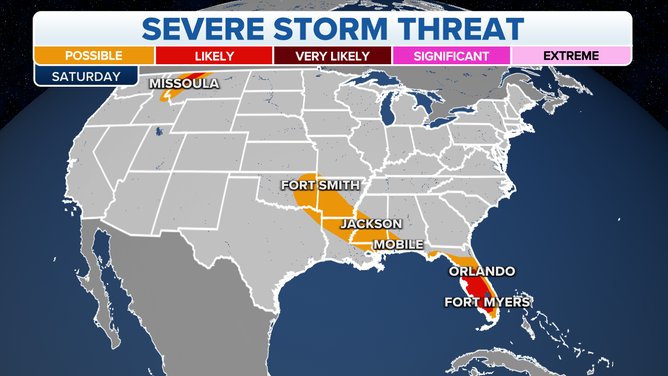
Scattered damaging winds are possible across parts of the Florida peninsula through early evening.
(FOX Weather)
Rain amounts will generally be around 1 inch but up to 3 inches could fall in parts of Southwestern Florida prompting marginal risks for excessive rainfall to be issued in parts of The Sunshine State each day this weekend, the National Weather Service said.
THE 5-POINT SEVERE THUNDERSTORM RISK CATEGORY SCALE EXPLAINED
Localized flooding is possible across parts of Florida through Saturday evening.
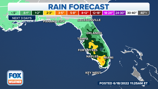
Rain amounts will generally be around 1 inch but up to 3 inches could fall in parts of Southwestern Florida.
(FOX Weather)
Along with the chance for thunderstorms, it will also still be very hot across the Southeast. Heat alerts remain in effect through Saturday, highs will be in the 90s with heat index values in the 90s and 100s.
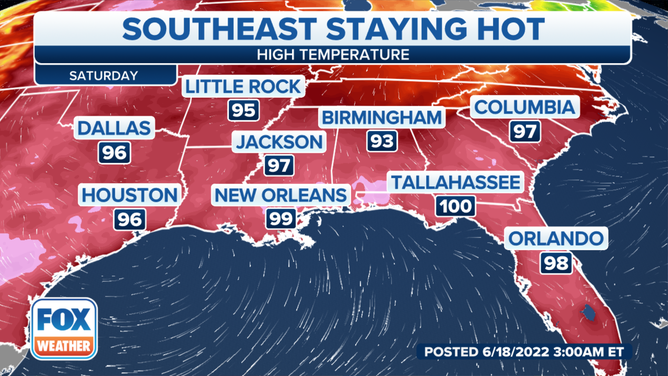
Heat alerts remain in effect through Saturday, highs will be in the 90s with heat index values in the 90s and 100s.
(FOX Weather)
CLICK HERE TO GET THE FOX WEATHER UPDATE PODCAST
Be sure to download the FOX Weather app to track any storms in your area and receive potentially life-saving weather alerts issued by the National Weather Service. The free FOX Weather livestream is also available 24/7 on the website and app and on your favorite streaming platform. The FOX Weather Update podcast also provides weather information for the entire country.