Quick-moving system making for a messy Monday across the Great Lakes region
Travel is expected to be slow in areas where heavier rain and snow falls
Quick-hitting system brings rain, snow to Great Lakes, Northeast
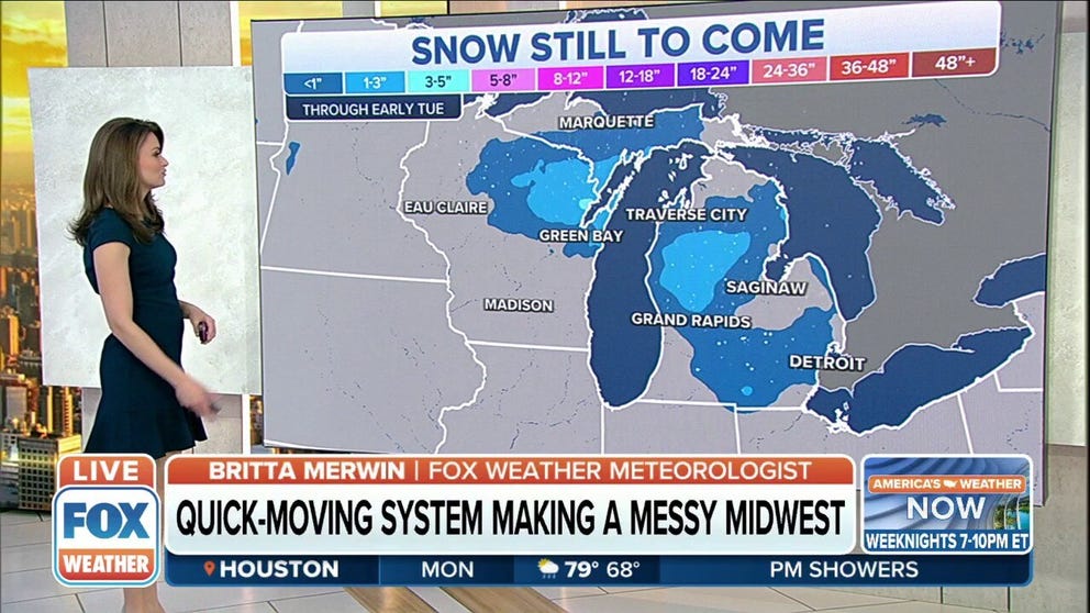
It will be a quick moving system with little snow accumulation, but still could make for a messy Monday AM commute across Northern Wisconsin and Michigan.
Anyone hitting the road in the Great Lakes region on Monday will need to take it slow as a fast-moving storm system is bringing rain and snow to the area through Tuesday.
Rain has been falling in the Chicago area since early Monday morning, and the line of showers extends southward through Illinois and into the Mississippi and Ohio valleys.
But with colder temperatures to the north, snow has been reported across northern Wisconsin and in the Upper Peninsula of Michigan.
HOW TO WATCH FOX WEATHER ON TV

In general, most areas will see less than a half-inch of rain while the system moves through the region. But up to an inch of rain could fall in some areas where bands of heavier showers set up.
7 THINGS YOU NEED TO KNOW ABOUT WINTER DRIVING

And while this will by no means be a blockbuster snow event, travel could be slow across central and northern Wisconsin to interior Michigan.
Less than an inch of snow is expected from areas around Detroit, Grand Rapids and Saginaw, but interior parts of the state could see 1 to 3 inches through early Tuesday, with some locally higher amounts between 3 and 5 inches.
The same holds true across central and northern Wisconsin, where most areas will see less than an inch of snow. Green Bay and surrounding areas could see higher totals between 3 and 5 inches.