Rain, mountain snow will make for another messy day in the Pacific Northwest
Mountain-pass-level snow and several inches of rain will be possible through Wednesday as a weak atmospheric river affects the region
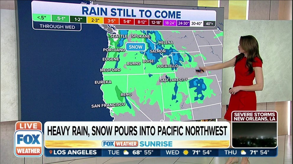
Heavy rain and snow continue to pour into the Pacific Northwest
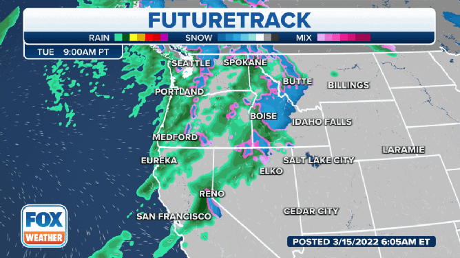
A pair of storm systems will bring more rain and mountain snow to the Pacific Northwest to start and end the workweek.
SEATTLE – More rain and mountain snow will make for a messy day on Tuesday in the Pacific Northwest.
It will be another rainy day across the Pacific Northwest on Tuesday.
Rain has been pushing onshore along the Pacific coast from Northern California into Oregon and Washington, with the heaviest precipitation falling across the Olympic Peninsula.
Heavy rain has been falling across the region since Monday and will continue through Wednesday before a second storm system moves into the area to end the week.
On Monday, the National Weather Service said Seattle picked up more than a half-inch of rain. That brings the monthly total so far to just under 2 inches of rain, which is less than average.
HOW TO WATCH FOX WEATHER ON TV

In terms of rain totals through Wednesday, most areas will likely see less than an inch. However, the heaviest rain is expected to fall from the Olympic Peninsula and along the Pacific coast into Oregon.
Those areas could see an additional 1 to 2 inches of rain through Wednesday.

And while rain will fall in the lower elevations, snow will fall in the mountains.
The Cascades could pick up a foot of additional snow through the middle of the week, with some peaks receiving more than a foot.
Anyone traveling through the mountain passes will need to monitor and prepare for winter travel conditions.
The Olympic Mountains should also see a few more inches of snow through the middle of the week.