Northeast wakes up to flash freeze, just after coast-to-coast storm sparks travel chaos
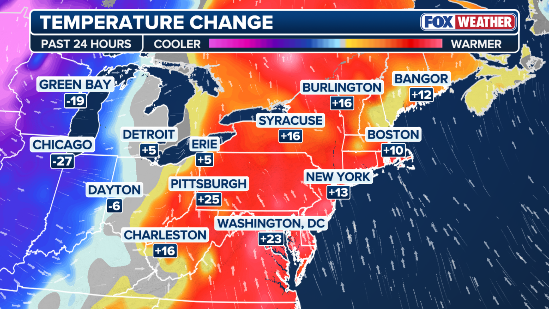
Ahead of the flash freeze, record high temperatures were recorded in more than 10 locations, mainly across New England. Both Burlington, Vermont and Albany, New York broke their 130-year-old record high temperatures.

Century-old record warmths followed by potential flash freeze in parts of the Northeast and New England
As a powerful, coast-to-coast storm surges towards the Northeast, packing heavy winds and funneling in record warm temperatures. Combined with heavy rain, the conditions heighten the potential for a flash freeze.
Northeasterners on Saturday woke up to cold temperatures once again after a week of record warmth caused by a coast-to-coast storm that impacted the continental U.S.
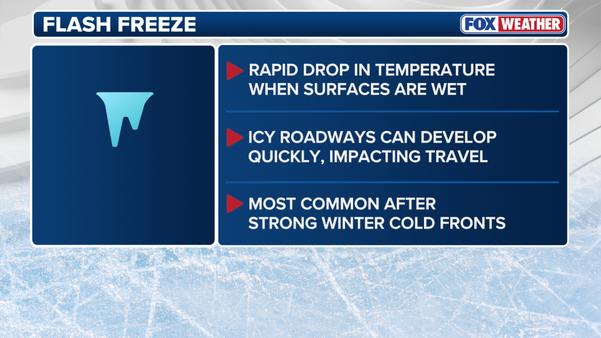
A flash freeze plunged temperatures back down into the teens and 20s by Friday night across the interior Northeast.
(FOX Weather)
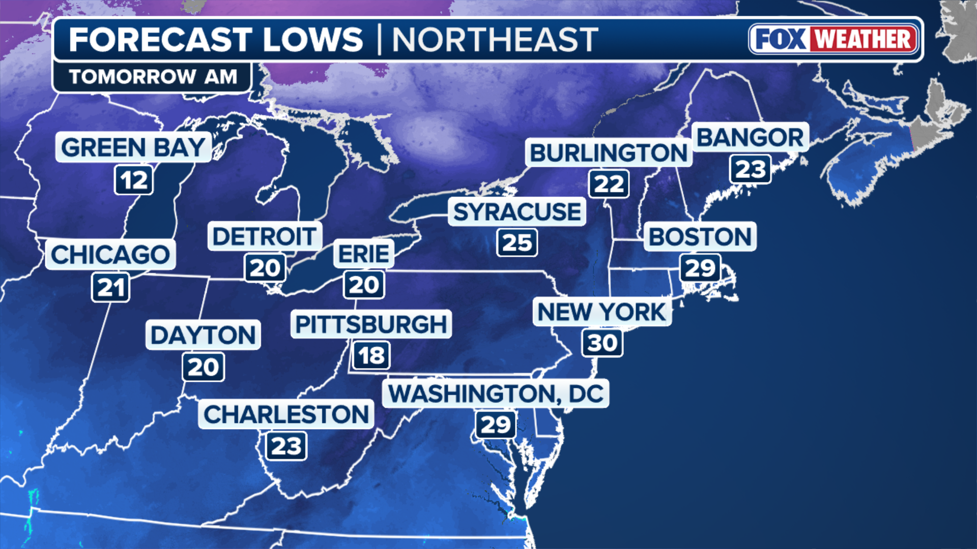
By Saturday morning's sunrise, temperatures in New York City and Boston were hovering at freezing.
TRAVEL NIGHTMARE UNFOLDS AT MAJOR EAST COAST AIRPORTS AS POWERFUL STORM UNLEASES VICIOUS WIND, RAIN
It has been a bitterly cold start to December, with nearly the entire eastern third of the U.S. running at least a few degrees below average month-to-date.
(FOX Weather)
Ahead of the flash freeze, record high temperatures were recorded in more than 10 locations, mainly across New England. Both Burlington, Vermont and Albany, New York broke their 130-year-old record high temperatures.
A flash freeze occurs when a rapid drop in temperature combines with wet surfaces, leading to icy roadways that can impact travel.
OUTLOOK: WHAT ARE THE CHANCES OF A WHITE CHRISTMAS AROUND THE COUNTRY?
(FOX Weather)
Wind chill values will dip into the single digits for many across New England and interior portions of the Northeast early Saturday. Fortunately, temperatures will rebound Saturday afternoon, with highs climbing back into the 30s.