

Developing nor’easter to slam millions in New England with first significant snow, lash I-95 with rain
Before the system reaches the Northeast, it is forecast to bring an initial round of severe weather to parts of the Great Lakes and Ohio Valley beginning Wednesday.
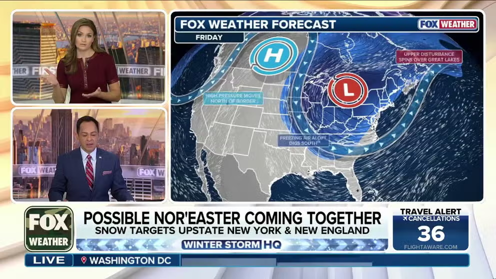
Developing nor'easter expected to spread first significant snow to New England, lash I-95 with rain
A storm system is expected to race through the Ohio Valley Wednesday before moving off the coast and strengthening into a nor'easter toward the end of the week, which would lash the Interstate 95 corridor with widespread rain, while delivering the first significant snow to northern New England and Upstate New York into the weekend.
THE TAKEAWAY:
- Storm system to race through the eastern U.S. and move off the coast and develop into a nor'easter by Friday.
- Nor'easter to lash the Interstate 95 corridor with rain and wind, while delivering the first significant snow to northern Pennsylvania, Upstate New York and northern New England.
- Up to a foot of snow is possible across the White and Green mountains and in the Great Lakes.
- System to threaten Ohio and Tennessee valleys with severe weather Wednesday.
A storm system is expected to race through the Ohio Valley Wednesday before moving off the coast and strengthening into a nor'easter toward the end of the week, which will lash the Interstate 95 corridor with widespread rain, while delivering the first significant snow to northern New England and Upstate New York into the weekend.

(FOX Weather)
Before the system reaches the Northeast, it is forecast to bring an initial round of severe weather to parts of the Great Lakes and Ohio Valley beginning Wednesday.
From there, the developing storm will track toward the East Coast, bringing periods of rain, gusty winds and snow to parts of the region.
POLAR VORTEX DISRUPTED AT THE EARLIEST POINT IN CALENDAR YEAR ON RECORD - WHAT HAPPENS NEXT?
The driving force behind this pattern change is a strong ridge of high pressure building over the western U.S.
This will help colder Canadian air push south into the Northeast while warmer air remains across the West.
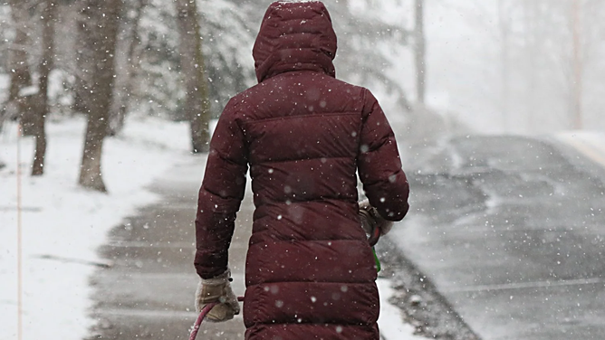
FILE - A woman walks a dog as the snow begins to fall.
(Suzanne Kreiter / The Boston Globe / Getty Images)
The contrasting air masses will help provide the atmospheric lift and upper-level energy needed to support a strengthening area of low pressure, setting the stage for the late-week storm.
Rather than a typical El Niño-driven weather pattern, this setup is being influenced by the polar jet stream.
(FOX Weather)
A pronounced dip in the jet stream will allow colder air to plunge southward, helping an area of low pressure develop somewhere between the Great Lakes and Ohio Valley before moving toward the East Coast.
Wednesday: Storm begins to take shape
The first stage of the developing system will unfold across the Great Lakes and Ohio Valley on Wednesday, bringing a threat of severe weather to parts of the region.

Damage left from an EF-2 tornado that swept through Tennessee's Morgan County on the night of Feb. 6, 2025.
(NOAA)
The greatest threat is expected across the lower Ohio and western Tennessee valleys, where scattered thunderstorms could develop late Wednesday afternoon and peak during the early evening as a cold front pushes through.
A Level 1 out of 5 severe weather threat is currently in place for parts of Kentucky, western Tennessee, southern Illinois and southern Indiana.

(FOX Weather)
The storms could produce strong, damaging wind gusts, along with the possibility of an isolated tornado or two.
Thursday: System advances toward the Northeast
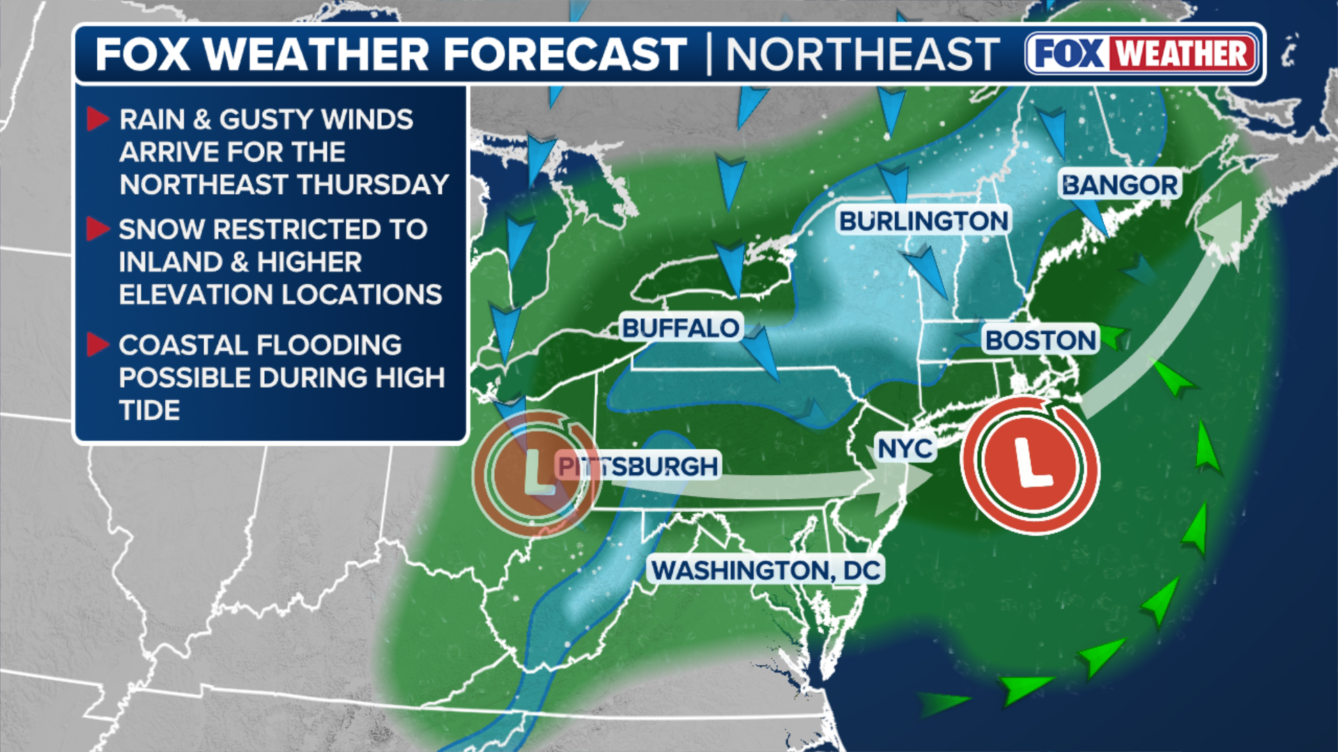
By Thursday, the area of low pressure will begin moving toward the Northeast.
Showers are expected to graze parts of the I-95 corridor, while Vermont, New Hampshire and portions of upstate New York begin to see snow.
By Thursday night, the area of low pressure is expected to approach the New Jersey coast, bringing periods of heavy rain to Philadelphia and New York City.

(FOX Weather)
The rain will then spread farther inland across Pennsylvania and into upstate New York.
It is expected that travel impacts could escalate late Thursday into Friday as the winds pick up, and the rain becomes heavier.
Friday: Nor'easter strengthens along the coast
By Friday, the area of low pressure is expected to track northward, roughly parallel to the East Coast, with the center of the storm positioned south or near Long Island.

A winter snow storm threatened Boston and much of New England with wet, heavy snow, but in Coolidge Corner only rain fell in the morning.
(Lane Turner/The Boston Globe / Getty Images)
As pressure falls, winds will increase, helping the system take on the characteristics of a more traditional nor'easter.
While this is not expected to become an especially powerful storm, strengthening northeasterly winds could bring periods of unsettled weather to coastal areas.
As the developing storm moves northward, brisk northerly winds will also pull colder air across the relatively warm waters of the Great Lakes.
The sharp contrast between the cold air and warmer lake waters will help trigger a notable lake-effect snow event beginning Friday and potentially lasting into the start of the weekend.
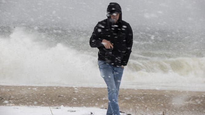
Nantucket, MA - February 13: At Sconset Beach, onlookers watch the erosion.
(Stan Grossfeld/The Boston Globe / Getty Images)
Across the Northeast, snow will spread across portions of upstate New York, southern Vermont and New Hampshire. However, temperatures are expected to hover near freezing in some locations, which could result in wetter, heavier snow and lower-than-average snow ratios.
WHEN IS THE EARLIEST SNOWFALL ON RECORD FOR PARTS OF THE NORTHEAST?
Precipitation will vary depending on elevation and location, with some areas seeing a mix of rain and snow, while higher elevations are more likely to experience periods of accumulating, heavy, wet snow.
The storm is expected to reach its peak intensity Friday night as colder air funnels into the region.

(FOX Weather)
According to FOX Forecast Center, the storm's impacts will largely depend on how quickly the system moves offshore and how much colder air can filter into the region.
If the nor'easter is close enough to the coast, it could boost snow totals higher than expected. If the nor'easter moves farther away from the coast, the snow will end quicker.
However, New York City is expected to dry out by late Friday, while Boston could see periods of rain and gusty winds throughout much of the evening.
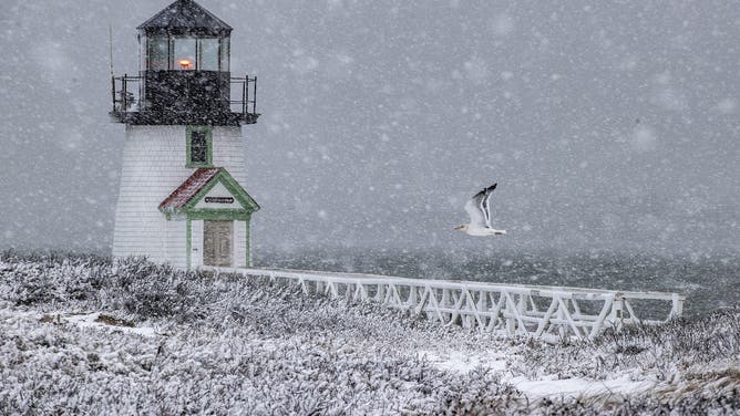
Nantucket, MA - February 13: Brant Point Light during the height of the snowstorm gets a flyby from a gull.
(Stan Grossfeld/The Boston Globe / Getty Images)
Wind gusts of 20 to 30 mph are possible.
Snowflakes could begin mixing in closer to the coast, but no significant accumulation is expected.
HOW DOES THE POLAR VORTEX INFLUENCE WEATHER?
Where could the heaviest snow fall?
The highest snow totals are expected across climatologically favored higher elevations, including the White Mountains of New Hampshire and Maine, the Green Mountains of Vermont, the Adirondacks in New York and parts of the Appalachians in West Virginia and Massachusetts. These areas could see 5 to 8 inches of snow.
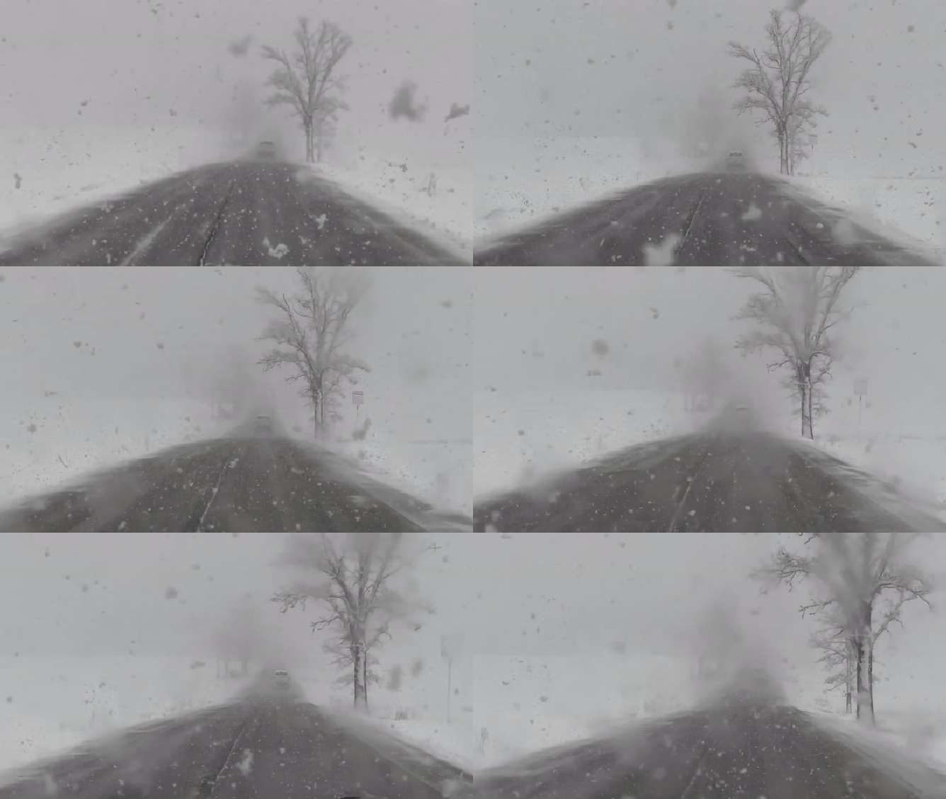
This image shows heavy snow falling on Route 22 outside Burlington, Vermont, as a powerful nor'easter blasts through the Northeast and New England.
(Scott Alexander / FOX Weather)
Meanwhile, widespread accumulations of 1 to 3 inches are possible across the Allegheny Plateau in New York and Pennsylvania.
Outside higher elevations, snowfall totals will generally remain below 3 inches, with amounts decreasing farther south.
Some snow is expected across valley cities. This includes cities such as Albany and Binghamton, New York, Burlington, Vermont, Manchester, New Hampshire, and Augusta, Maine.

(FOX Weather)
No snow accumulation is expected across major population centers along the I-95 corridor south of Maine.
COULD SUPER EL NIÑO PUT A DAMPER ON LAKE-EFFECT SNOW THIS WINTER?
The Great Lakes could see additional lake-effect snow
Beyond the Northeast, portions of the Great Lakes region could also see significant snowfall as persistent winds blow colder air across the warmer lake waters.
According to FOX Weather, Michigan's Upper Peninsula, such as Lake Superior, could see the most substantial accumulations.

(FOX Weather)
Persistent northwest winds off the lake will help generate several inches of snow, with totals potentially exceeding half a foot in some locations.
Farther south, across extreme northern Indiana near Lake Michigan, northerly to north-northwesterly winds could direct a long band of rain and snow into extreme northern Indiana.
THE RIPPLE EFFECT OF EL NIÑO: WHAT DOES IT MEAN AND HOW DOES IT IMPACT THE WORLD'S ECONOMY?
This includes South Bend, Indiana, where 1 to 3 inches of snow may accumulate.
Along Michigan's Lake Michigan shoreline, bands of snow pushing inland could bring periods of accumulating snowfall.
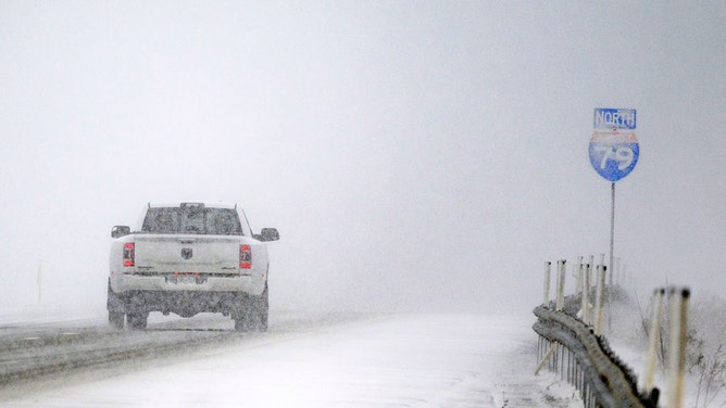
Cars drive in near whiteout lake-effect snow on Interstate 79 on December 12, 2024 in Erie, Pennsylvania.
(Jeff Swensen/Getty Images / Getty Images)
Most areas could see 1 to 3 inches, although more concentrated bands north of Grand Rapids could produce 3 to 5 inches.
Saturday: Lingering snow showers as storm pulls away
By Saturday, the storm is expected to pull away toward the Canadian Maritimes.
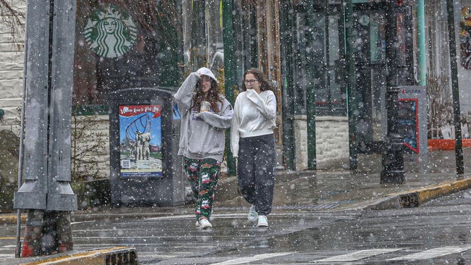
Pedestrians walk along Main Street, in Port Jefferson, New York, as a mixture of snow and rain fell from the Nor'easter.
(John Paraskevas/Newsday RM via Getty Images / Getty Images)
However, lingering moisture wrapping around the system, combined with colder northwest winds, could keep snow showers going across parts of the Northeast.
Snow showers could stretch from Maine southward through the Appalachians, including portions of upstate New York and central Pennsylvania. Most of the precipitation is expected to taper off by Saturday morning as the system continues moving farther away.