Clipper system spreading snow, wintry mix from Great Lakes to Northeast through New Year's Day
On Monday (New Year's Day), the clipper system will bring snow to interior sections of the Northeast and mid-Atlantic.
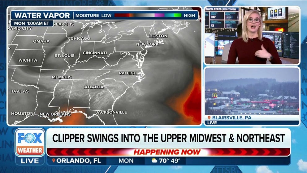
Clipper swings into upper Midwest, Northeast on Monday
A fast-moving clipper will be swinging through the Upper Midwest and Great Lakes into early next week.
CHICAGO – A fast-moving clipper system that brought light snow and a wintry mix to parts of the Great Lakes on Sunday continues to impact communities across the interior Northeast before moving offshore late on New Year's Day.
The system initially produced areas of freezing drizzle across the Upper Midwest, leading to slick roads that triggered several crashes as drivers were caught off-guard by the patches of ice.

(FOX Weather)
How much snow is expected?
Less than an inch of snow with a light glaze of ice is expected for most areas through New Year's Day.
Some of the higher elevations of the central Appalachians could pick up locally higher snowfall amounts, ranging from 2 to 4 inches.
DRIVING IN LIGHT SNOW IS JUST AS DANGEROUS AS A MAJOR SNOWSTORM, RESEARCHERS SAY

(FOX Weather)
While the snow won't amount to much, gusty winds could blow some of that snow around, leading to areas of blowing and drifting snow that reduces visibility.
"Associated with this clipper, we also see those higher wind gusts coming through," Lewis said. "So we are going to be watching wind gusts anywhere between 10 to 20 (mph), 20 to even 30 mph as this continues to move off from west to east."

(FOX Weather)