Atmospheric river storms threaten Pacific Northwest with heavy rain, flooding this week
While this first storm moved out on Saturday, more atmospheric river-type storms are lurking through the first full week of November amid an active weather pattern in the Pacific Ocean.

Atmospheric river storms to slam Pacific Northwest with heavy rain, flooding this week
A series of powerful atmospheric river-type storms are set to slam the Pacific Northwest this week. FOX Weather Meteorologist Michael Estime has the latest on Nov. 2, 2025.
SEATTLE – November is typically the wettest month of the season in the Pacific Northwest, and right on schedule multiple atmospheric river-type storms are on the docket to kick off the first full week of the month.
One storm slammed the region on Saturday, with steady rain lingering from the system that began soaking trick-or-treaters on Halloween night, causing the area’s mountain-fed rivers to rise.
More than two inches of rain fell in the mountains, and another inch or so was expected on Saturday. Flood Watches that had been in effect have since been canceled.
(FOX Weather)
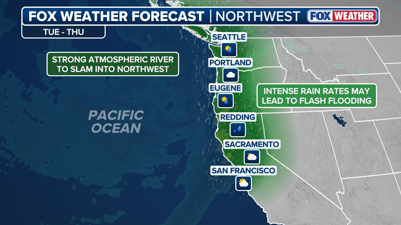
While that first storm moved out on Saturday, more atmospheric river-type storms are lurking through the first full week of November amid an active weather pattern in the Pacific Ocean.
By early this week, a strong area of low pressure will continue to spin in the Bay of Alaska before gradually shifting eastward into Canada. This system will once again draw moisture northward from the Pacific Ocean, directing it toward the Pacific Northwest through late Tuesday.
WHAT DOES A 'CATEGORY 5' ATMOSPHERIC RIVER MEAN? SCALE AIMS TO RATE NATURE'S LARGEST SOAKERS

(FOX Weather)
This atmospheric river is forecast to be very strong as it hits the Pacific Coast, though with the heaviest rains more focused on the Oregon coast this time. Right now, forecasts from the Center for Western Water and Weather Extremes are projecting this event to be a level 5/5 on their atmospheric river scale for locations in Oregon.
The heaviest rainfall will likely arrive along the coastal regions of Washington and Oregon by Wednesday. Between Tuesday and Thursday, widespread rainfall totals of 3 to 5 inches are expected along the coasts, with locally higher amounts of 5 to 8 inches possible across the Olympic Mountains.

(FOX Weather)
Farther south, from southern Oregon into northern California, lighter totals of 1 to 2 inches are anticipated. Flash flooding will be possible, especially into Wednesday afternoon, as the heaviest rain moves slowly down the Northwest coastline.
Long-range forecasts suggest yet another atmospheric river-type storm lurks later in the week or over next weekend, and no sign of a drier weather pattern in the days beyond.