Hikers rescued along Pacific Crest Trail as McKinney Fire rages in Northern California
The McKinney Fire has burned more than 50,000 acres and has destroyed several structures
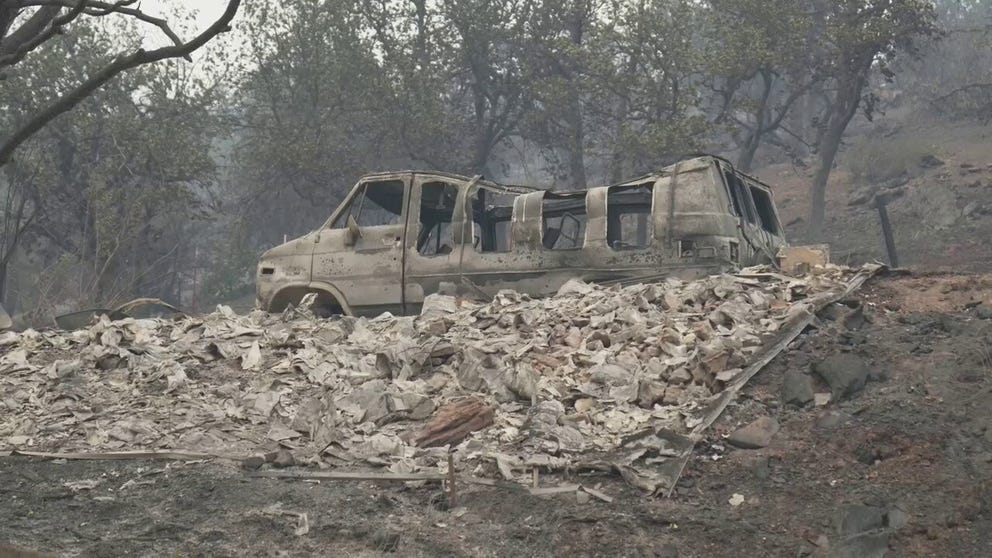
California's McKinney Fire scorching inside Klamath National Forest
The McKinney Fire has burned over 52,000 acres and is currently 0% contained.
SISKIYOU COUNTY, Calif. – The rapidly growing McKinney Fire in Northern California is not only threatening homes and businesses, hikers and campers are also in the path of the flames, forcing crews to perform evacuation operations.
The Jackson County Sheriff’s Office said they found at least 60 hikers along the Pacific Crest Trail in Red Buttes Wilderness Saturday afternoon and safely transported all to an area away from the fire’s front lines.
A spokesperson for the fire incident response team said there is likely little to no cell service in the longer stretches of the trail, so hikers may not know how close they are to the fire, especially on days the flames burn erratically.
![McKinney Fire rescue]() Image 1 of 5
Image 1 of 5Pacific Crest Trail hikers evacuated from the McKinney Fire (Jackson County Sheriff’s Office)
![McKinney Fire rescue]() Image 2 of 5
Image 2 of 5Pacific Crest Trail hikers evacuated from the McKinney Fire (Jackson County Sheriff’s Office)
![McKinney Fire rescue]() Image 3 of 5
Image 3 of 5Pacific Crest Trail hikers evacuated from the McKinney Fire (Jackson County Sheriff’s Office )
![McKinney Fire rescue]() Image 4 of 5
Image 4 of 5Pacific Crest Trail hikers evacuated from the McKinney Fire (Jackson County Sheriff’s Office)
![]() Image 5 of 5
Image 5 of 5Pacific Crest Trail hikers evacuated from the McKinney Fire (Pacific Crest Trail Association)


The Klamath National Forest consists of more than 1.7 million acres, and the Pacific Crest Trail runs through a significant part of the wilderness considered threatened by flames.
HOW TO WATCH FOX WEATHER ON TV
Local agencies and search and rescue volunteers make up the teams looking through evacuation zones for hikers and campers.
The spokesperson did not know how many people how many other groups had been evacuated but said work continues around the clock to ensure everyone is out of harm’s way.
South of the fire in the town of Etna, police arranged for busses to transport hikers Sunday around the evacuation zone to Oregon.
Pacific Crest Trail impacted by fires
The historic path is only one of eleven National Scenic Trails in the United States and runs from the Mexican border through California, Oregon and Washington before reaching the country’s northern border with Canada.
The Pacific Crest Trail Association manages the 2,653-mile national treasure, one of the first National Scenic Trails designated by President Lyndon Johnson’s signing of the National Trails System Act on October 2, 1968.
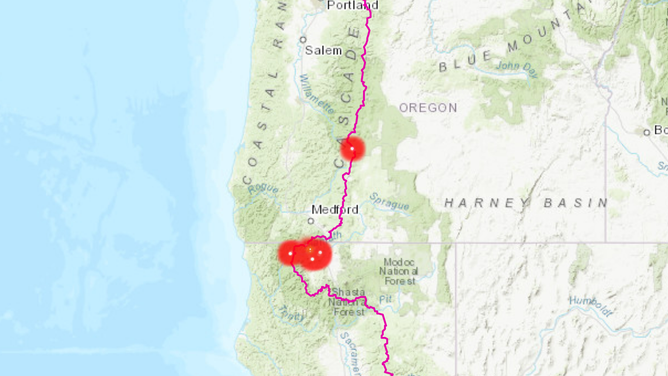
Hundreds of acres of the famed Pacific Crest Trail are closed in California and Oregon due to wildfires.
(Pacific Crest Trail Association)
Due to the West’s on-going drought, the majority of the trail runs through vegetation that is in desperate need of rain and is prone to wildfires.
Several large wildfires have forced the closure of hundreds of miles of the trial.
Closures:
- California: Etna Summit (mile 1600) in Northern California to Mt. Ashland Campground (mile 1710) in Southern Oregon due to the McKinney & China 2 fires
- Oregon: Around Windigo Pass (mile 1848 to mile 1908) between Crater Lake and Bend, Oregon, due to the Windigo & Tolo Mountain fires
- Oregon: Closed from near Pamelia Lake (mile 2027) on the Willamette National Forest to near Triangle Lake north of Olallie Lake (mile 2048) due to damage from the Lionshead Fire
The U.S. Forest Service recommends if hikers are near any of the active fires to evacuate and find safety in the nearest town.
If a fire is spotted outside any of the closed areas, the Pacific Crest Trail Association recommends calling 911 and relaying the mile marker location to authorities.