

Powerful storms to unleash torrential rain and dangerous, potentially deadly waves across Pacific Northwest
The latest atmospheric river is currently scraping western Washington, bringing rain to the Olympic Peninsula and Washington Cascades.
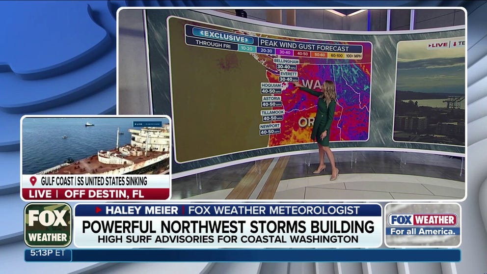
Powerful atmospheric rivers cause heavy rain and dangerous surf to Pacific Northwest
Rounds of atmospheric rivers are targeting the Pacific Northwest, bringing torrential rainfall, massive ocean swells, gusty winds and snow to higher elevations. Conditions are expected to intensify this weekend, with wind gusts reaching 50 to 60 mph along the coast. Meanwhile, 20 to 25 foot waves could pound the coastline.
THE TAKEAWAY:
- Strong atmosphere rivers continue to impact the Pacific Northwest with heavy rain, gusty winds and snow.
- Over the weekend, the storm will intensify, triggering wind gusts that could reach 50 to 60 mph along the coast.
- Massive 20 to 25 foot waves and offshore seas exceeding 30 feet are expected to slam the shoreline.
- "The large wave runup may dislodge logs on area beaches and result in them rolling up and down area beaches, which have historically killed or seriously injured unsuspecting people," the NWS said.
Powerful atmospheric rivers continue to target the Pacific Northwest this week, bringing rounds of heavy rain, strong winds and snow to higher elevations.
But the greatest threat may be along the coastline, where massive ocean swells are expected to generate destructive surf and life-threatening sneaker waves.
Sneaker waves are hazardous waves that can surpass normal surf activity and become deadly and destructive.

(FOX Weather)
The latest atmospheric river is currently scraping western Washington, bringing rain to the Olympic Peninsula and Washington Cascades.
Conditions along the Oregon and Washington coasts have been hazardous all week, with 15- to 20-foot westerly swells dominating the waters.
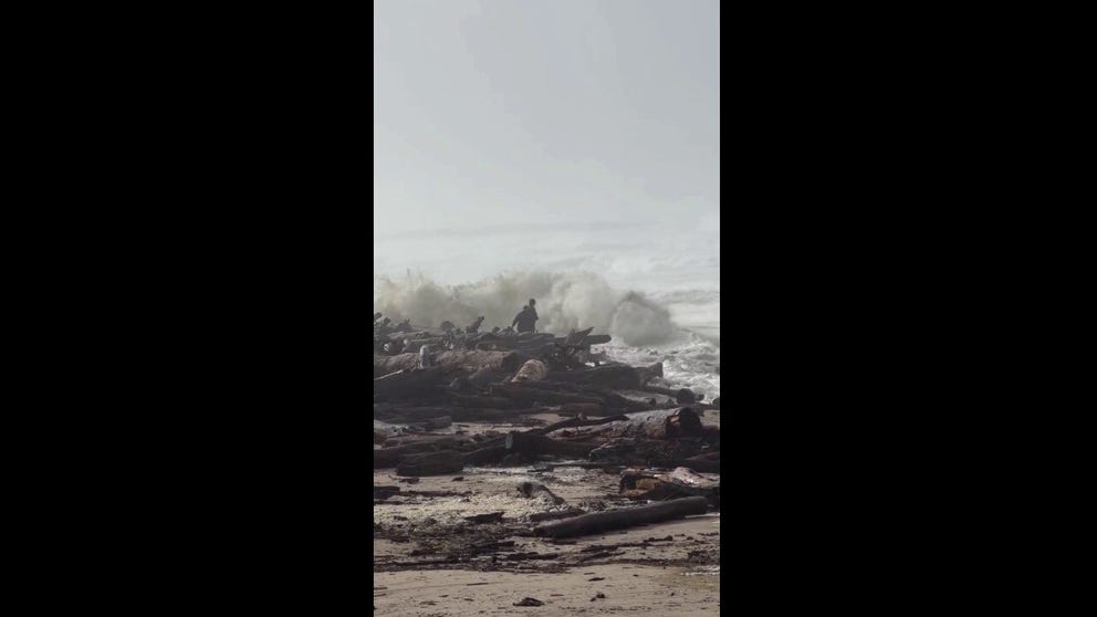
Two people come dangerously close to sneaker waves in Oregon
POWERFUL WAVES NEARLY SWALLOW BEACHGOERS: A scary scene unfolded in Winchester Bay, Oregon, where strong sneaker waves nearly swallowed two people and a dog along the beach. Thankfully, the dog was rescued and is safe with his owners.
These long-period swells can generate sudden sneaker waves that surge significantly farther up beaches than normal, sweeping over rocks and jetties with enough force to roll heavy drift logs.
"Destructive waves may wash over beaches, jetties, and other structures unexpectedly," the National Weather Service (NWS) said. "Extreme caution should be used if you plan to visit beaches this week."
(FOX Weather)
The combination of high astronomical tides and persistent onshore wave energy is also expected to produce minor tidal overflow and significant beach erosion.
High Surf Advisories are now in place along the Washington coast.
POLAR VORTEX DISRUPTION COULD BE EARLIEST ON RECORD, BUT EL NIÑO IMPACT MAY KEEP US WARM
However, according to FOX Weather, this event is relatively minor compared to the more powerful system expected to arrive over the weekend.
SECONDS FROM DISASTER: A dangerous sneaker wave dragged a child through rough surf at Cannon Beach, Oregon, on Sunday before an adult pulled the child to safety. https://t.co/fg5yedbawn
— FOX Weather (@foxweather) November 11, 2026
Beginning Friday, a stronger storm system will push a pair of fronts onshore, bringing soaking rain and gusty winds.
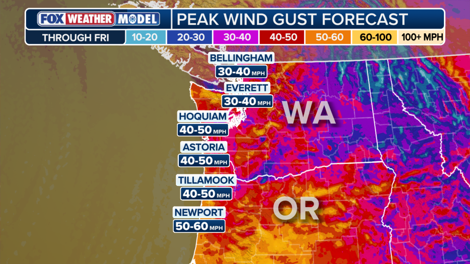
Wind gusts could reach 50 to 60 mph along the coast and 40 mph across the Interstate 5 corridor.
WHEN IS THE EARLIEST SNOWFALL ON RECORD FOR PARTS OF THE NORTHEAST?
Colder air is expected to arrive late Sunday into Monday, dropping snow levels to around 3,500 to 4,000 feet and bringing another round of snow to the Cascade passes.
(FOX Weather)
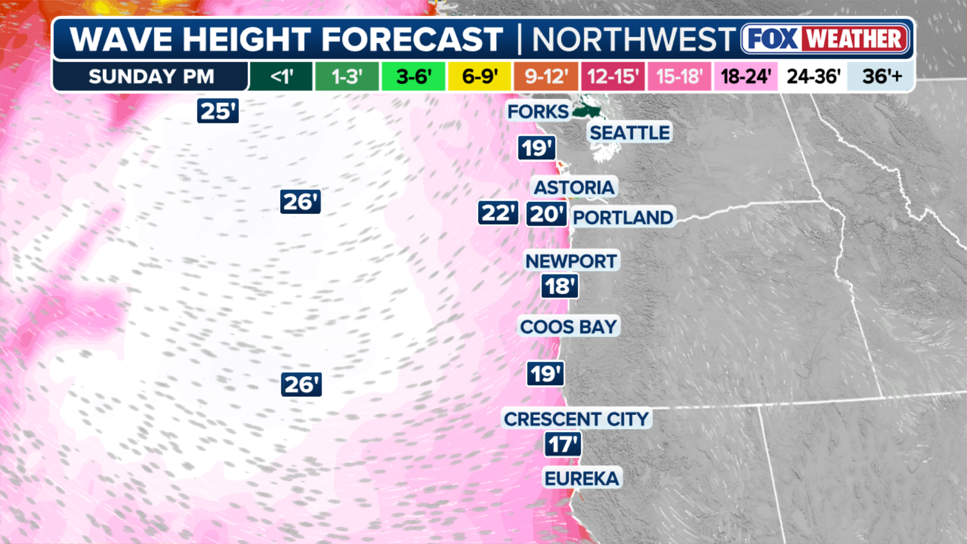
Along the coast, massive 20- to 25-foot waves and offshore seas exceeding 30 feet are expected to slam the shoreline.
These conditions could produce destructive, crashing surf capable of surging over coastal structures and temporarily submerging beaches.
"The large wave runup may dislodge logs on area beaches and result in them rolling up and down area beaches, which have historically killed or seriously injured unsuspecting people, so there will be much more of a threat than just getting wet from a rogue wave," the NWS said.
PARADE OF STORMS DUMP RAIN ON PACIFIC NORTHWEST: States like Oregon and Washington are dealing with heavy amounts of rain coming down on the area due to a parade of storms. This video captures just a portion of the soaking rain slamming the region. https://t.co/ECBXM6lpZq
— FOX Weather (@foxweather) November 9, 2026
The series of storms expected over the weekend is part of a larger weather pattern that will cause atmospheric pressure to drop between systems. In some cases, pressure is forecast to fall as low as 950 to 960 millibars.
These powerful low-pressure systems will help generate even stronger winds over the Pacific, fueling massive ocean swells that will push toward the coastline.